Midnitemapper
Senior Member
Having dinner at the fabulous Jamal Hazid Pakistan restaurant last night, a friend posed the question,
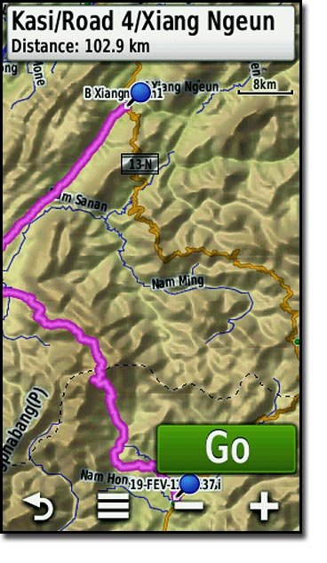
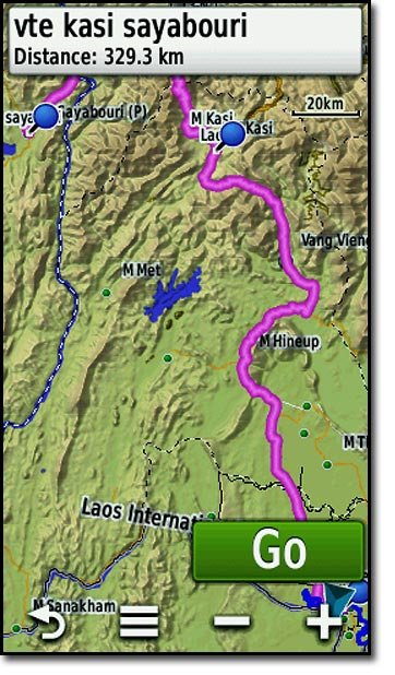
Which route is shorter Vientiane Paklay Sayaburi or via Kasi and the under construction (4 years now) road that goes over the big mountain, with the air America landing site LS 25 PHOU CHAI.
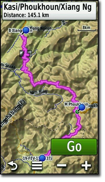
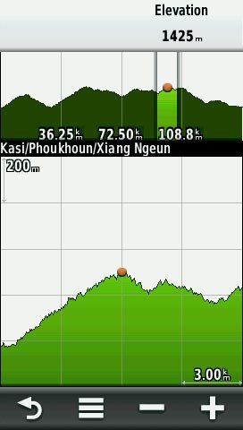
Wow the Mekong river valley road is 73 kms shorter and the elevation profile is very sedate.
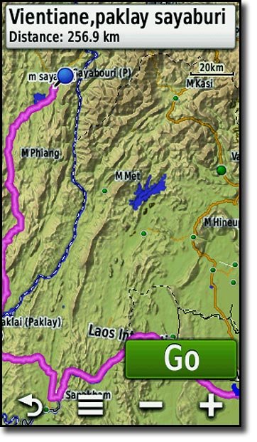
A quick route calculation on the Montana revealed these results.
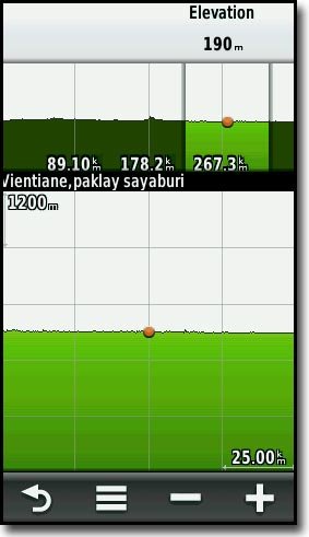
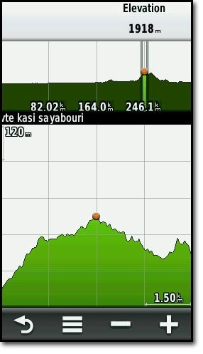
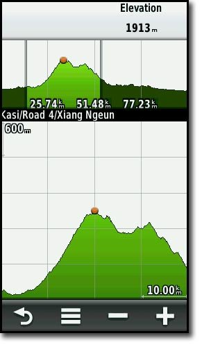
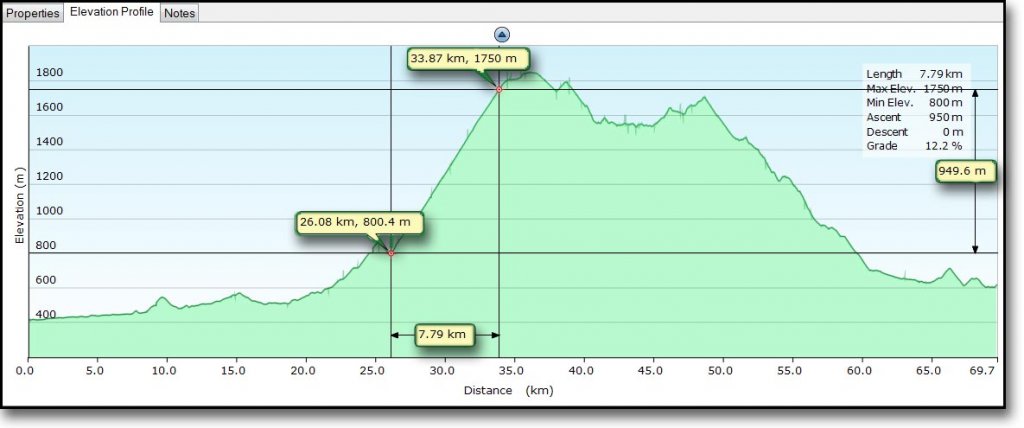
This new amazing cut road, has some very dangerous grades as you can see from this elevation profile. There are grades exceeding 12percent !
http://en.wikipedia.org/wiki/Grade_%28slope%29
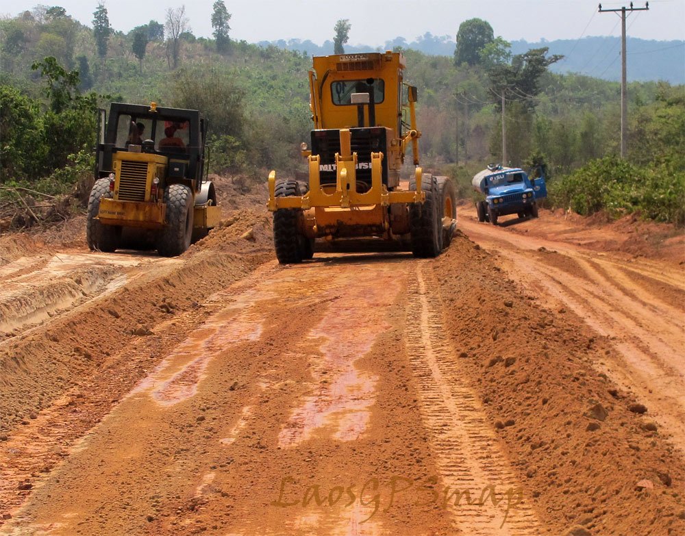
Looking back on some of my recorded tracks for this area the first time I went to the top was late 2009 the fog was so thick at this altitude I had to turn around. Then early 2010 I made it to the top but the track was still not passable. I slept in the construction camp that night, on the top of the mountain, the skeleton work crew promising to clear the rocks to allow passage all the way through, the following day. Over the camp fire, stories came out about workers being killed when rocks fell and crushed the jackhammer crew and destroyed a new Caterpillar tracked digger.
This dangerous grade will likely see more carnage when this road opens to traffic. The views on the top are fantastic but keep er in low gear and use engine braking on those downhills, or you will overheat your brakes, when you lift your foot from the pedal, the next braking action may just not be there!
Which route is shorter Vientiane Paklay Sayaburi or via Kasi and the under construction (4 years now) road that goes over the big mountain, with the air America landing site LS 25 PHOU CHAI.
Wow the Mekong river valley road is 73 kms shorter and the elevation profile is very sedate.
A quick route calculation on the Montana revealed these results.


This new amazing cut road, has some very dangerous grades as you can see from this elevation profile. There are grades exceeding 12percent !
http://en.wikipedia.org/wiki/Grade_%28slope%29

Looking back on some of my recorded tracks for this area the first time I went to the top was late 2009 the fog was so thick at this altitude I had to turn around. Then early 2010 I made it to the top but the track was still not passable. I slept in the construction camp that night, on the top of the mountain, the skeleton work crew promising to clear the rocks to allow passage all the way through, the following day. Over the camp fire, stories came out about workers being killed when rocks fell and crushed the jackhammer crew and destroyed a new Caterpillar tracked digger.
This dangerous grade will likely see more carnage when this road opens to traffic. The views on the top are fantastic but keep er in low gear and use engine braking on those downhills, or you will overheat your brakes, when you lift your foot from the pedal, the next braking action may just not be there!


