KTMphil
Senior member
With more and more people using their smart phones & tablet devices for navigation, we wanted to be able to get the "North Thailand On & Off-Road GPS Map" to run on an android operating system.
Well, we've finally achieved it last night. A friend who's pretty good with IT played around with it and has managed to get it to run on the OruxMaps application for android OS. This application is currently a free download from the play store.
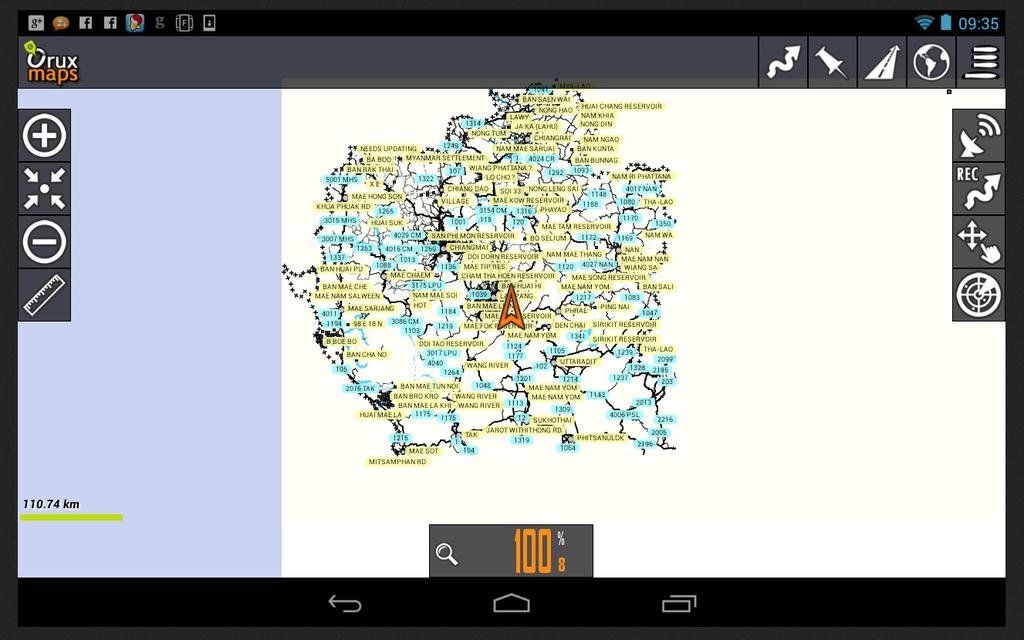
It was pretty exciting opening it for the first time last night, we had no idea whether this was going to work. Below is the first image we saw in the OruxMaps application, with the "North Thailand On & Off-Road GPS Map" data showing on the screen, this meant there was a fairly good chance it had worked! This is the whole of north Thailand in the image below (ie zoomed out)
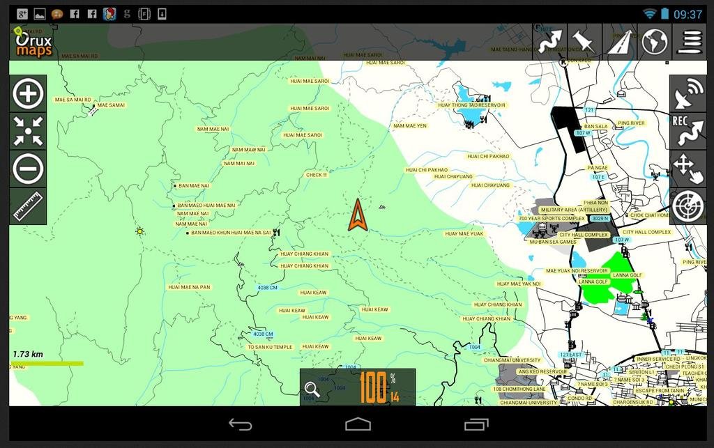
What was highly important, as road data is available from many sources on the internet, was that the unique off-road/ trail data contained on the "North Thailand On & Off-Road GPS Map" showed correctly and was usable. It was, take a look at the zoomed image of Doi Suthep mountain, which is just west of Chiang Mai city, all the trail data was there and in a usable form. This can be used for trail riding, routes can be planned using the OruxMaps software and it will auto route - This is fantastic.
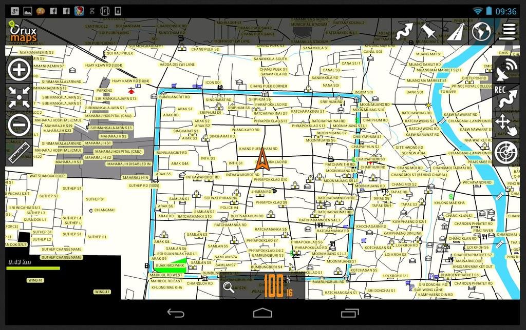
We then did a check of the city data, to see how usable it would be. Below is a zoom on Chiang Mai city moat square, again all very usable as a navigation tool, this is all very impressive.
Well, we've finally achieved it last night. A friend who's pretty good with IT played around with it and has managed to get it to run on the OruxMaps application for android OS. This application is currently a free download from the play store.
It was pretty exciting opening it for the first time last night, we had no idea whether this was going to work. Below is the first image we saw in the OruxMaps application, with the "North Thailand On & Off-Road GPS Map" data showing on the screen, this meant there was a fairly good chance it had worked! This is the whole of north Thailand in the image below (ie zoomed out)

What was highly important, as road data is available from many sources on the internet, was that the unique off-road/ trail data contained on the "North Thailand On & Off-Road GPS Map" showed correctly and was usable. It was, take a look at the zoomed image of Doi Suthep mountain, which is just west of Chiang Mai city, all the trail data was there and in a usable form. This can be used for trail riding, routes can be planned using the OruxMaps software and it will auto route - This is fantastic.

We then did a check of the city data, to see how usable it would be. Below is a zoom on Chiang Mai city moat square, again all very usable as a navigation tool, this is all very impressive.


