Scanned maps of south east asia

KTMphil

Senior member
Joined
Jan 11, 2011
Location
Chiang Mai, Thailand
Bikes
2007 KTM 990 Adventure Suzuki DRZ 400
Mac, a long time resident in Laos, sent me this great link to some war era south east Asia maps that have been scanned.

An American fellow called Jim has scanned maps of south east Asia he calls them:

South East Asian War - Area Of Operations

1965 - 1975

(The Vietnam War)


Link to all the scanned maps is here:

http://www.nexus.net/~911gfx/sea-ao.html

Link to the Laos map he has scanned is below, looks pretty cool:

(click on the individual "square" of the area you're interested in to zoom in, keep clicking to zoom)

http://www.nexus.net/~911gfx/laos.html

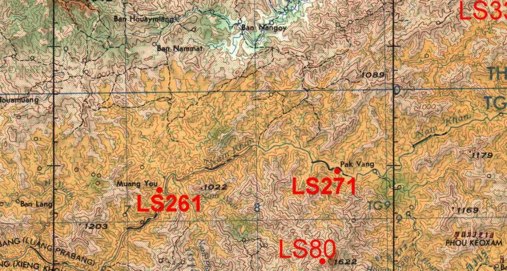
Once zoomed right in, this is a cropped area of a piece of the map he has scanned for Laos, great detail, lots of trails etc.. The LS refers to the "Lima Sites" which were U.S military sites during the Vietnam war.

laos scanned map from mac.jpg
 
Very slight correction of terminology here.

The Lima Sites were NOT U.S. "military" airfields and airstrips, they were just numbered for convenience of use by anyone, which as it usually was back then, was CASI and Air America planes, and largely Lao of various ethnicities and Americans of various stripes on the ground.

The convenient thing about numbering the airfields was that language could be ignored as most of the farangs didn't speak Lao, or even if they did, it was easy to mix up the tones. Solution, just carry along a pen and write down the LS number, as in "go to Site 261." Little in the way of linguistic expertise needed by anyone this way.

BTW, airfields in Thailand were also numbered, also for convenience. Chiang Mai is T-11, Tango 11; Bangkok (Don Muang) is Tango 09.

Airfields in Cambodia and Vietnam were also similarly numbered.

Mac, former USAID
 
Yep, real handy! I more often refer to these online maps than to my old hard copies I have here on the shelf. FYI, a few of the scanned maps have my hen scratches from 40+ years ago.

Mac
 
Very interesting and thanks for the post. During the Vietnam war effort were additional Airfields plowed into Thailand and now since abondoned or did the war effort Thailand side just utilize existing airfields; ie Chiang Mai and Don Muang?

Mac would love to see your Chicken scratch comments on the maps if you feel like posting them. At 46 I'm too young to remember much about the Vietnam War but always find the trivia quite fascinating. Sadly finding people with much first hand experiences is getting more difficult as time passes.

Does anyone know how the original maps were obtained and who penned them, and how info was obtained for mapping roads (what little there were) and tracks back then?
 
Well, during, and before, a whole lot of small airstrips were built all over Thailand and Laos. There were 100+ strips in both countries. The immediate Chiang Khong area, for example, had three or four within 10 km of town, altho almost none of them were used after the flood of 1966. The major airports in Thailand were numbered but there were also a host of real wee strips, too. Korat had three, T-13, 13A, and 13B. Somewhat understandably, the bulk of the airstrips were in the boarder areas. Nong Khai had two, one of which, T-22, was long enough for the Thai Airways DC-3s which flew in and out of the place. They stopped when TA went to turbo prop planes, they picked up gravel and dinged the props too much there. This probably about 1979. Some of the strips were pretty short. You watched that stupid, but fun, movie Mel Gibson did, Air America? At least some of the flying was realistic, like the run in and out of that short strip. So far I've not been able to ID exactly which strip that is.

Getting over to the Lao side, the strips became even more fun. Like LS-261 noted above. It was all of 525 ft long, good enough for a Porter or Helio, even better for a helicopter.... Other places had two or even more airstrips. Xieng Lom/Hon, there in far western Sayaboury had three, the old Japanese airport left over from WW II, built when the province was part of Thailand, a nice long one that could take a C-123 built in the early 1960s, then a short Porter/Twin Otter strip right "downtown," built about 1968. Hong Sa had two, the short one is now part of the E-W road right down near the market area, the long one looks like it could still take a good sized plane, just to the south of town.

Might add that while chasing down old runways is kind of interesting, best to BE CAREFUL as some of them do have UXO scattered around. Depending on location, when a runway changed management it might become a target.... Ask the locals, follow the well worn pathways, do not wander out into the bush!

As to hen scratches, check Lao sheet NE48-13, lower right corner, there's some notes that survived the scanning. Jim had some of his own maps, another friend and I loaned him our collections so he could complete the project. He chose "clean" copies if available for the scanning, makes sense, altho the marked up ones are more "fun." I still have mine here.

Re how the maps were made, laborious I reckon, back in the 1940s-'50s, but got easier in the '60s. The U.S. Army Map Service was the main mapping agency of the USG early on. They used locally available maps, improved on them over the years, made lots of on site surveys, aerial surveys, then when satellites popped up in the sky, things got easier and more accurate. Some history here: http://en.wikipedia.org/wiki/National_G ... nce_Agency

If anyone's passing by Future Park Rangsit, just north of Don Muang Airport, I can usually make it down for lunch, I live 25 km east of there. can haul along my box of 1:250,000s.

Mac
 
Mac- Thanks heaps for the post, very informative!!

I'll make sure I watch my step poking around the airfields. I think those old airfields will make for some great fodder to put on the to do list when traipsing about Laos on the bike next time. One thing I'm not clear on is US bombing missions that targeted Laos, did some of them also originate in Laos? If so I can only imagine how interesting a big city like Vientiene was housing both the Air America staff and also the French air crews that were backing the communist movement. The tensions in the air must have been thick enough to cut with a knife.

I've read some of the Air America and Ravens books and all I can say what a ride that must have been to be a young gent signed up for duty during those times. A glorious, crazy, hell bent for leather fun time I'm sure.

I never saw the movie Air America as I thought it would be nothing but horseshit but if there was even anything interesting I guess I'll track it down. A 525 foot runway sounds enough to tighten the sphincter. Absolutely diabolical that people would land a plane on it. The most aggressive take off I've ever done was in a twin Otter and I thought that was short, but whats the minimum take off distance for a twin otter?

Next time I'm in BKK lunch is on me Mac if you're bored?
 
Ban Nakang LS 36
Stopover strip to LS 85
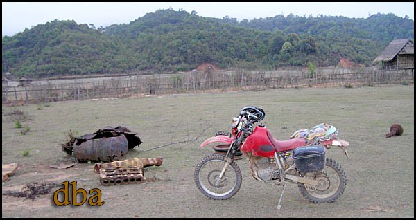
There is still a Howitzer, lots of fuel drums, airplane parts and excavator brought in by plane.
ls36.jpg
 
BignTall, notes below

Mac- Thanks heaps for the post, very informative!!

I'll make sure I watch my step poking around the airfields. I think those old airfields will make for some great fodder to put on the to do list when traipsing about Laos on the bike next time. One thing I'm not clear on is US bombing missions that targeted Laos, did some of them also originate in Laos? If so I can only imagine how interesting a big city like Vientiene was housing both the Air America staff and also the French air crews that were backing the communist movement. The tensions in the air must have been thick enough to cut with a knife.

Mac says: Few USAF air strikes originated in Laos altho there were some FACs there, notably the RAVENS (by Chris Robbins, available at Asia Books, as is his book Air America). There just weren’t any USAF “strike" aircraft in Laos. The bulk of the air strikes originated from bases in Thailand, with some from the USN offshore and a few from Guam. There also weren’t many French aircrews around in the late ‘60s and on to 1975 and they weren’t supporting the other guys. I think the MMF may have had a C-47 and perhaps an Beaver, that’s about it. “Tensions?” Not so you’d notice, too much cheap beer available !!
xxxxxxxx

I've read some of the Air America and Ravens books and all I can say what a ride that must have been to be a young gent signed up for duty during those times. A glorious, crazy, hell bent for leather fun time I'm sure.

Mac says: Yep, spent many an hour over four years in AirAm & CASI Porters and AirAm H-34s milling around the skies in the north from Houei Sai in the west over to just east of LS-85 area. Only picked up 10 holes, nine in an AirAm H-34 and one in a CASI Porter. [edit: should be "just WEST of LS-85 area."]
xxxxxxxxx

I never saw the movie Air America as I thought it would be nothing but horseshit but if there was even anything interesting I guess I'll track it down. A 525 foot runway sounds enough to tighten the sphincter. Absolutely diabolical that people would land a plane on it. The most aggressive take off I've ever done was in a twin Otter and I thought that was short, but whats the minimum take off distance for a twin otter?

Mac says: Well, the “narco” aspect of the movie is BS but much of the flying is great, particularly the Porter landing at the real short strip up in the C. Mai or Mae Hong Son area. There’s a film that AirAm did on themselves back in about 1970 that you can view or download here, it’s a good one: http://www.vietnam.ttu.edu/AirAmerica/FMFM/index.htm
xxxxxxxxxxxxxxxx

Next time I'm in BKK lunch is on me Mac if you're bored?

Mac says: Rarely bored, too busy in retirement, but yes, out at Future Park Rangsit, only 25 km from home, 45 minutes given the way the friggin’ traffic has built up in the last 15 year since we moved out here!
 
Mac....

I'm wondering if you have more tales to tell, very interesting.......

Whilst at work yesterday I started printing the maps out and have got them up on the wall in
my office.....

I love a map..they enable dreams...

thanks for taking the time... :D
 
Back
Top Bottom