You are using an out of date browser. It may not display this or other websites correctly.
You should upgrade or use an alternative browser.
You should upgrade or use an alternative browser.
Koh Kong or Hat Lek border to Siem Reap
- Thread starter Tanarthur
- Start date
alexuk
Senior Member
- Joined
- Jan 30, 2011
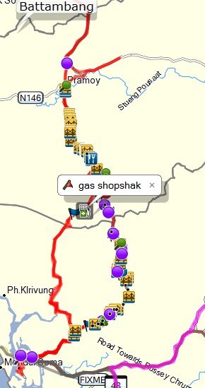
I did half of the new chinese road from Ko kong over the cardamom mountains this year.Anyone done this route before? Direct from Hat Lek border to Siem reap without going to Phnom Penh first.
Let's just ride....
Wasnt far from there up to Veal Vang then Pursat, and on to Battambang, quite easy if the weather is ok,
Nightrider70
Senior Member
- Joined
- Apr 25, 2011
- Bikes
- DRZ400SM
If you are talking about Koh Kong -> Pra Moy -> Battambang I have been there.
Pailin to Koh Kong
Battambang Cambodia
Pailin to Koh Kong
Battambang Cambodia
Tanarthur
Member
- Joined
- Nov 26, 2013
- Bikes
- Current ride. Kawasaki Versys 650 2012
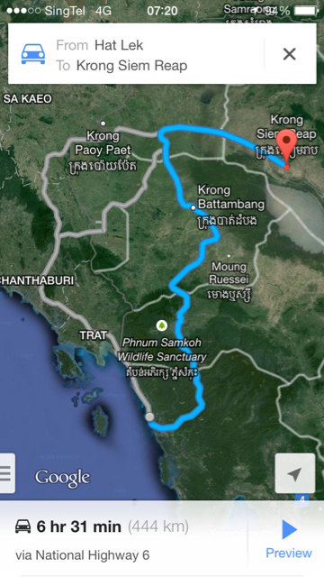
Night rider, this is very precious information for me. Thank you. You mentioned in your blog that time will not be save. Means that although distance are shorter, it will take ask much time to reached. Am I correct? This is what I found on Google map of the route they plot for me to take.
Let's just ride....

Let's just ride....
Nightrider70
Senior Member
- Joined
- Apr 25, 2011
- Bikes
- DRZ400SM
You mentioned in your blog that time will not be save. Means that although distance are shorter, it will take ask much time to reached. Am I correct? This is what I found on Google map of the route they plot for me to take.
Correct. Part of the way are dirt tracks so your average speed will be low compared to the main roads via Phnom Penh. The conditions can have changed alot since I was there however. Google map does not have the new roads, use OSM if you can.
monsterman
Senior Member
- Joined
- Jan 13, 2011
when u cross the border make sure your bikes green book has recent stamp in it for tax/insurance or your bike will not be allowed out by the Thais and fill up on thai side with fuel as sometimes they are closed or out of fuel on cambo side
Tanarthur
Member
- Joined
- Nov 26, 2013
- Bikes
- Current ride. Kawasaki Versys 650 2012
Nightrider70
Senior Member
- Joined
- Apr 25, 2011
- Bikes
- DRZ400SM
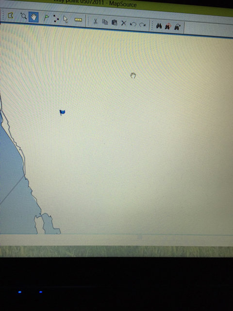
Nightrider, can you direct me to the OSM? Mine also give me a blank "look". If you all don't mind.
You can get my bike version of OSM for Garmin at www.nightrider.info/map/ You also got Lambertus world wide maps.
A listing of OSM based GPS map: http://wiki.openstreetmap.org/wiki/OSM_Map_On_Garmin/Download
Alexuk, care to share your Maps for the GPS? Mine shows lots of blanks space.
Nightrider, can you direct me to the OSM? Mine also give me a blank "look". If you all don't mind.
Maybe try this OSM link. Just select the tiles you'd like and they'll email them to you. As a gmapsupp and a map to load in Mapsourse or Basecamp, Windows or Mac.
I would suggest using the Routable Bicycle [Openfietsmap Lite] option.
Free worldwide Garmin maps from OpenStreetMap
I'd like to send in my local tracks to add to OSM but every time I try to it's rejected. Maybe some one could start a thread on how to do this. I failed.
Nightrider70
Senior Member
- Joined
- Apr 25, 2011
- Bikes
- DRZ400SM
I'd like to send in my local tracks to add to OSM but every time I try to it's rejected. Maybe some one could start a thread on how to do this. I failed.
Post a failing track here and I will try to upload it.
Nightrider70
Senior Member
- Joined
- Apr 25, 2011
- Bikes
- DRZ400SM
Fantic, I did that. Shows the blank area.
You can set the amount of data shown in Basecamp/Mapsource. You might have it set so low nothing shows when zoomed out.
Tanarthur
Member
- Joined
- Nov 26, 2013
- Bikes
- Current ride. Kawasaki Versys 650 2012
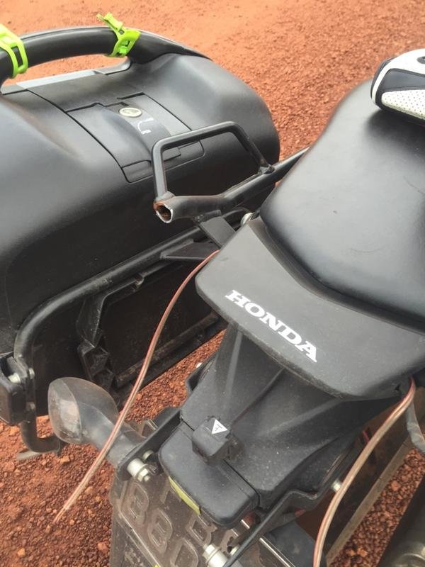
Mine dropped on the road so still can recover. I still got my panniers on so just re pack everything. Lucky the top box got nothing much.
I really wonder how you guys can go by that way??? Really a case of over estimating oneself and under estimating the road...
Everyone I talked to was amaze how is it possible that I came by that way... I am still feeling shocked that I survive that road...
Let's just ride....
I really wonder how you guys can go by that way??? Really a case of over estimating oneself and under estimating the road...
Everyone I talked to was amaze how is it possible that I came by that way... I am still feeling shocked that I survive that road...
Let's just ride....
Nightrider70
Senior Member
- Joined
- Apr 25, 2011
- Bikes
- DRZ400SM
Mine dropped on the road so still can recover. I still got my panniers on so just re pack everything. Lucky the top box got nothing much.
I really wonder how you guys can go by that way??? Really a case of over estimating oneself and under estimating the road...
Everyone I talked to was amaze how is it possible that I came by that way... I am still feeling shocked that I survive that road...
Let's just ride....
Google's estimated 6.5 hours from Koh Kong to Siem Reap was a bit optimistic, wasn't it?
Tanarthur
Member
- Joined
- Nov 26, 2013
- Bikes
- Current ride. Kawasaki Versys 650 2012
I am a weak rider... I took 12 hours to reached Pursat... I will never ever try this again... Never!!!!!
I have change my traveling plans too. Suppose to go to Laos via Strung Treng border but decide that it will be too "risky" for me. So now I will just exit to Thailand via Poipet then make my way up to Huay xia to Boten... I don't think I can take another "surprise"... Moral is low now and guts busted!!
Let's just ride....
Nightrider70
Senior Member
- Joined
- Apr 25, 2011
- Bikes
- DRZ400SM
So you skipped short cuts from Pramaoy to Battambang?
If you take 65 and 64 to Preah Vihear city you have a nice paved road the whole way without any surprises. You will pass Beoung Mealea and also Cambodia's "pyramid" on the way. Stay over night in Preah Vihear City, a boring place but with many guesthouses. Next day you ride to Laos via Stung Treng. I do not know if the bridge is open over Mekong but if it isn't there is a ferry. The road from Preah Vihear City to Stung Treng should be paved by now, if parts are unpaved it is good dirt ready to be paved, Stung Treng is a dirty place so aviod staying there over night, better to push on and cross the border into Laos and stay in a guesthouse there.
If you take 65 and 64 to Preah Vihear city you have a nice paved road the whole way without any surprises. You will pass Beoung Mealea and also Cambodia's "pyramid" on the way. Stay over night in Preah Vihear City, a boring place but with many guesthouses. Next day you ride to Laos via Stung Treng. I do not know if the bridge is open over Mekong but if it isn't there is a ferry. The road from Preah Vihear City to Stung Treng should be paved by now, if parts are unpaved it is good dirt ready to be paved, Stung Treng is a dirty place so aviod staying there over night, better to push on and cross the border into Laos and stay in a guesthouse there.
Nightrider70
Senior Member
- Joined
- Apr 25, 2011
- Bikes
- DRZ400SM
You are actualy a pretty strong rider if you made it from Koh Kong to Pursat via Pramoy in one day on a road bike.
You will like the 65 and 64 to Preah Vihear City.
You will like the 65 and 64 to Preah Vihear City.
Tanarthur
Member
- Joined
- Nov 26, 2013
- Bikes
- Current ride. Kawasaki Versys 650 2012
NR... I got no choice. There's no turning back... 12 hours covering less than 300km is a big shock to me. When I went from Mae Sot to Mae Hong Son. 14 hours but at least I covered 500km with 1 hour lunch break in between. This time round is all the way straight to Pursat. Stopping to ask direction and refuel only... Keep telling myself to push on... Keep praying that there are no oncoming traffic... I was planning to go to Laos via Veun Kham from Siem Reap straight. But I don't want to experience the surprise over at Laos side. Moreover, I am riding alone. Don't want to experience the helplessness feeling I had previously again. Just say I chicken out.... Maybe the next time when I have company but I know the next time will never come.. Cause I riding pals are not so willing to sacrifice so much of their time on riding like me...
I vow to myself, that I will try to travel with company if I were to go to any unfamiliar area in future...
Let's just ride....
I vow to myself, that I will try to travel with company if I were to go to any unfamiliar area in future...
Let's just ride....
Nightrider70
Senior Member
- Joined
- Apr 25, 2011
- Bikes
- DRZ400SM
The road is paved and good in Laos all the way to China as long as you stick to the main road.
Don't bail out.
Don't bail out.
Tanarthur
Member
- Joined
- Nov 26, 2013
- Bikes
- Current ride. Kawasaki Versys 650 2012
NR, too late. I chicken out... Now at Lop Buri... Maybe if I find company then I will try again. Which means 1 year of being a good boy to save all my leaves...
Btw, met 1 caucasian riding on a XR on the way to Au Sen. All thanks to him for guiding me in the right direction. Without him I will not be able to reached Pursat before dusk. If you happened to be here.. Thank you fellow rider..
Alexuk, I think is 15km from Koh Kong the hell started for me all the way for 200km... You might want to travel the more common route which is from Koh Kong to Phnom Penh... Then to Laos. The rest might be able to advise you better...
Let's just ride....
Tanarthur
Member
- Joined
- Nov 26, 2013
- Bikes
- Current ride. Kawasaki Versys 650 2012
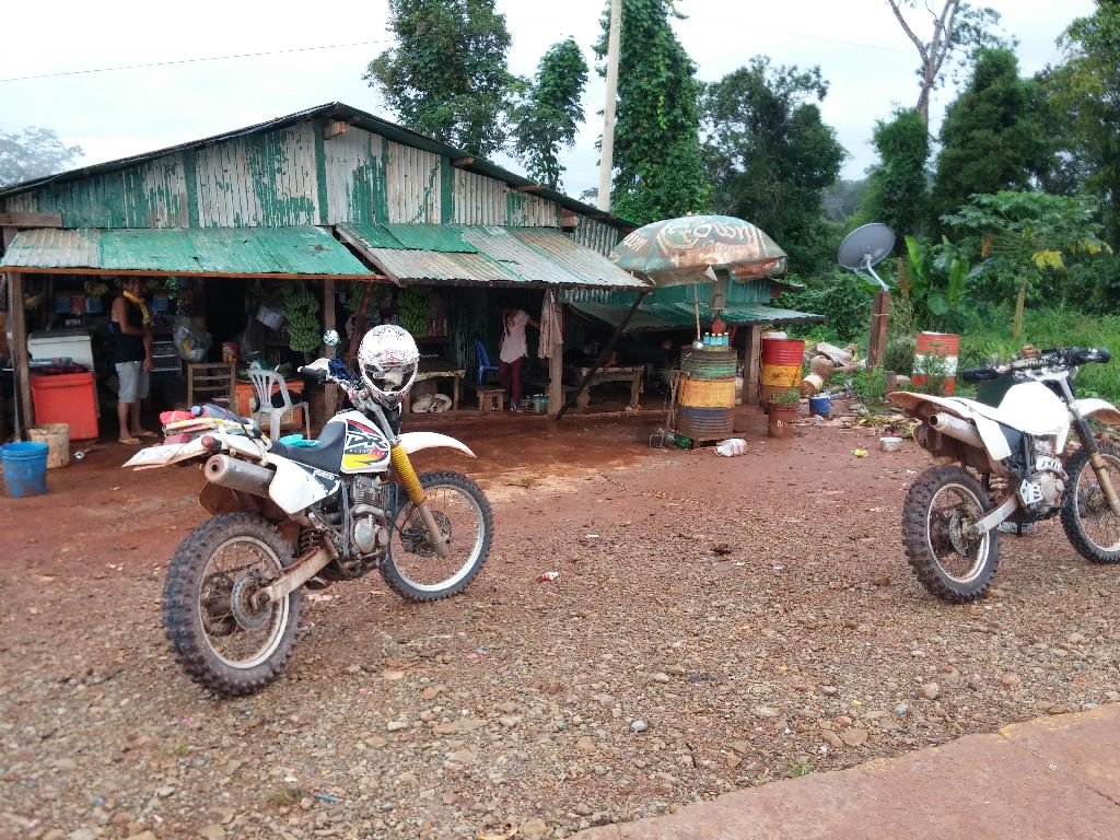
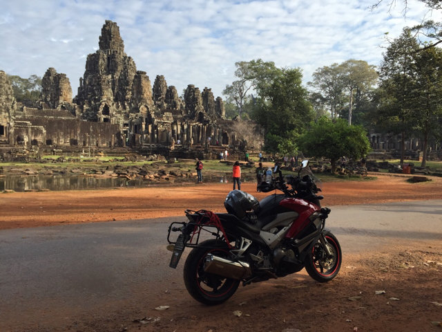
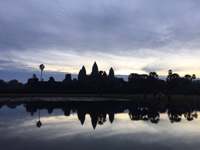
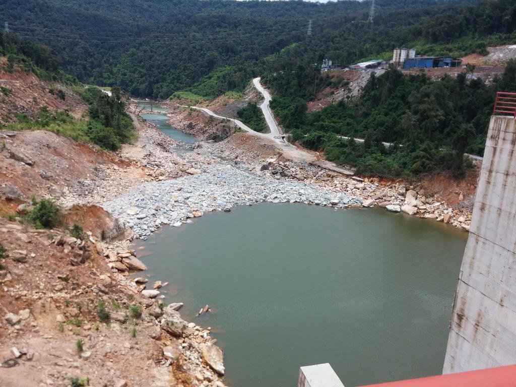
Some on this phone.. Others in the cam.. Not yet uploaded... Currently on the way to Laos... These photo you should have seen or passed by the place... Further up after the dam, if it rains... Good game....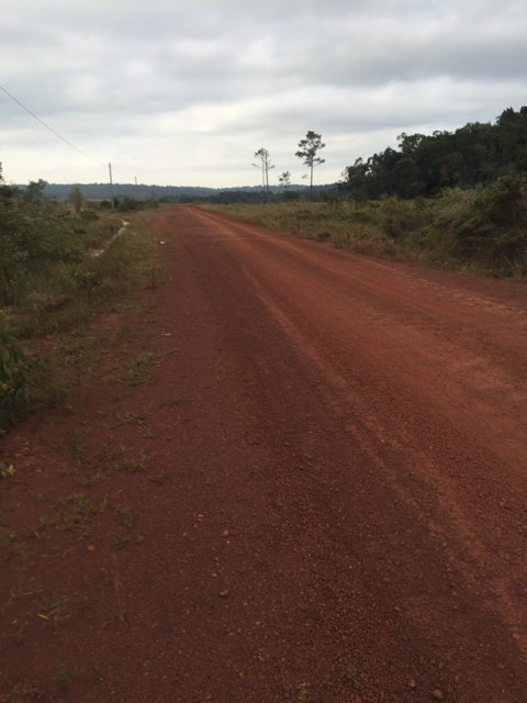
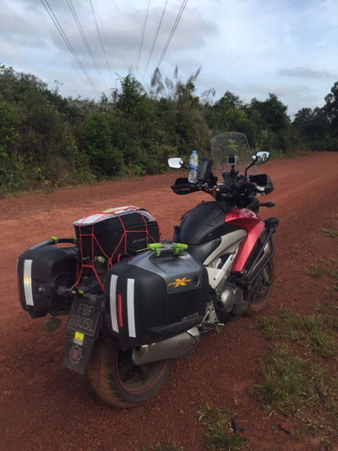
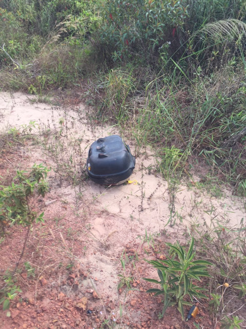
The last picture is my box. Should still be around these few days...
The rest of the journey I have no time to take any photos as I am really concentrating of maneuvering my bike... Other photos mostly shows my bike when it is dropped. That's when I "have time" to take photos...
Just be really careful when you go by this route. There is a home stay at Ou Sen. So you might want to consider. Thought I don't think will stay there... So I pushed on. If you are on a lighter bike then should not be an issue. The XR rider I met, started the journey later than me. He had time for lunch.. Stop to chit chat and still able to go ahead of me. So I guess the kind of bike plays a big part in that region...
Let's just ride....
Nightrider70
Senior Member
- Joined
- Apr 25, 2011
- Bikes
- DRZ400SM
Russ McDermid
Member
- Joined
- Jan 30, 2011
- Location
- Chiang Mai & Hereford, UK.
- Bikes
- Honda Transalp XL700VA in the UK, and a CRF250L & V-strom in Thai.
Hi Fantic,
I intend going to Siam Reap from CM, via Trat, in a few months. And I will be using OSM, so if you have any tracks that are not on the OSM now, I will be happy to add them for you.
The exercise will also increase my knowledge of the area.
Russ.
I intend going to Siam Reap from CM, via Trat, in a few months. And I will be using OSM, so if you have any tracks that are not on the OSM now, I will be happy to add them for you.
The exercise will also increase my knowledge of the area.
Russ.
Thank's Nightrider70Post a failing track here and I will try to upload it.
Attachments
Nightrider70
Senior Member
- Joined
- Apr 25, 2011
- Bikes
- DRZ400SM
OSM only accepts GPX format. If you use BaseCamp you can export the track in GPX format and then upload it to OSM.
| Thread starter | Similar threads | Forum | Replies | Date |
|---|---|---|---|---|
|
|
Koh Kong info | Cambodia Information | 3 |
| Similar threads |
|---|
| Koh Kong info |


