Forest
Senior Member
- Joined
- Feb 28, 2014
- Bikes
- Vstrom650,CRF250 , Ducati 900ss ,Yamaha YZ250, Virago 400 etc..
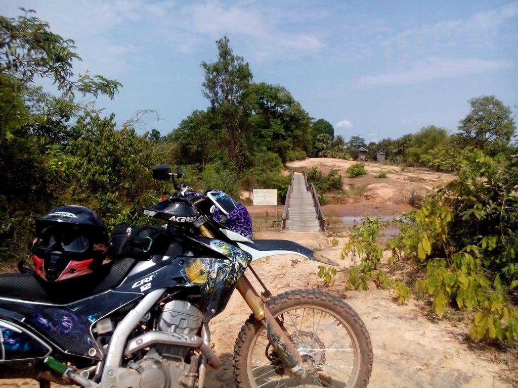
good ride down to Cambo over Songkran ,for about 13-14 days-
All went well with the mighty CRF .Crossed the border at Ban Pakkard /Pailing with no particular problems ,i arrived there quiet late 8-9pm ,as i posted in another thread.Went to Siem Reap and from there took the route 66 to Ta Seng ,Which was quiet an adventure going solo.The first 30 40 km are a snap .on unpaved well levelled road,where any bike could drive,but from Baeng Malea is where some fun starts.You must be a mud lover to take it.the rain as started alteady and the ox carts dig deep into the road .there is ophten a way to drive around the muddy areas but in many cases you will have to cross it sometime for 30-50 meters !no choice .just go. At the end of the day actually the bike got stuck since i was a bit heavy, had camel bags and a small pack on the rack.with a forestry/military guy (complete of a machine gun!)that came by after a while we got it out quickly. solo rides are nice but with company is definetly more fun and in this cases might help") I slept in Ta Seng at a simple home stay, there was also a magic shop that for $2 dollars washed the bike and you could see it again when all the mud was gone ! I gave him the boots too..hehe. the 62 down to the 6 was unpaved with lots of holes/rocks etc but ok,not much traffic.while the 6 to Phnom Penh was one of the worst! meaning trucks/buses/cars overtakin very careless u exist ,unpaved n superdusty for sometimes a long way ,visibility 30-50meters!I started to think ,will they ever finish the 'road work'??anyway there was about anything on this road,and driving badly!here I see one of the most odd things ever seen carried on a honda dream..the coffins delivery man! he was driving one hand and with the other trying to keep the badly tied up coffin on the rear !!
I slept in Ta Seng at a simple home stay, there was also a magic shop that for $2 dollars washed the bike and you could see it again when all the mud was gone ! I gave him the boots too..hehe. the 62 down to the 6 was unpaved with lots of holes/rocks etc but ok,not much traffic.while the 6 to Phnom Penh was one of the worst! meaning trucks/buses/cars overtakin very careless u exist ,unpaved n superdusty for sometimes a long way ,visibility 30-50meters!I started to think ,will they ever finish the 'road work'??anyway there was about anything on this road,and driving badly!here I see one of the most odd things ever seen carried on a honda dream..the coffins delivery man! he was driving one hand and with the other trying to keep the badly tied up coffin on the rear !! (i even tought to follow him to take a pic ,but too bad I didn't..).
then I went down to Sianoukville to rest and avoid the Songkran 'madness'. Chilled out at Otres beach which is one of the most relaxed and out of town.Nice.Then started my way back .Exit at Ko kong, parked right in front of customs regardless had not papers for Cambo,stamped out ,not a word about the bike ,I fired it up and easily entered Thailand..Honestly was a kind of a nice feeling to be 'back'. Well here follow some pics i took,hope some of this info is useful :RO
All went well with the mighty CRF .Crossed the border at Ban Pakkard /Pailing with no particular problems ,i arrived there quiet late 8-9pm ,as i posted in another thread.Went to Siem Reap and from there took the route 66 to Ta Seng ,Which was quiet an adventure going solo.The first 30 40 km are a snap .on unpaved well levelled road,where any bike could drive,but from Baeng Malea is where some fun starts.You must be a mud lover to take it.the rain as started alteady and the ox carts dig deep into the road .there is ophten a way to drive around the muddy areas but in many cases you will have to cross it sometime for 30-50 meters !no choice .just go. At the end of the day actually the bike got stuck since i was a bit heavy, had camel bags and a small pack on the rack.with a forestry/military guy (complete of a machine gun!)that came by after a while we got it out quickly. solo rides are nice but with company is definetly more fun and in this cases might help
I slept in Ta Seng at a simple home stay, there was also a magic shop that for $2 dollars washed the bike and you could see it again when all the mud was gone ! I gave him the boots too..hehe. the 62 down to the 6 was unpaved with lots of holes/rocks etc but ok,not much traffic.while the 6 to Phnom Penh was one of the worst! meaning trucks/buses/cars overtakin very careless u exist ,unpaved n superdusty for sometimes a long way ,visibility 30-50meters!I started to think ,will they ever finish the 'road work'??anyway there was about anything on this road,and driving badly!here I see one of the most odd things ever seen carried on a honda dream..the coffins delivery man! he was driving one hand and with the other trying to keep the badly tied up coffin on the rear !! (i even tought to follow him to take a pic ,but too bad I didn't..).then I went down to Sianoukville to rest and avoid the Songkran 'madness'. Chilled out at Otres beach which is one of the most relaxed and out of town.Nice.Then started my way back .Exit at Ko kong, parked right in front of customs regardless had not papers for Cambo,stamped out ,not a word about the bike ,I fired it up and easily entered Thailand..Honestly was a kind of a nice feeling to be 'back'. Well here follow some pics i took,hope some of this info is useful :RO


![DSC_0026[1].jpg](https://www.rideasia.net/motorcycle-forum/data/attachments/22/22492-c30360525f2b8bbcb9392b3be304733d.jpg "DSC_0026[1].jpg")
![DSC_0156[1].jpg](https://www.rideasia.net/motorcycle-forum/data/attachments/22/22495-d5bcb1f73387d35308f2a85f86c2b187.jpg "DSC_0156[1].jpg")
![DSC_0181[1].jpg](https://www.rideasia.net/motorcycle-forum/data/attachments/22/22496-d90189f28a729d184e30203722f43de3.jpg "DSC_0181[1].jpg")