Ally
Well-known member
Having been to a couple of spots where I have thought "do you think I could join up this track with that road", I have been on the wrong bike and to be honest out of my depth.
1 - Mae Thea
The road towards the waterfall has a track up to the right at the main entrance. It's a cabbage truck route and does go on through to towards the 105 area.


See a bit more here ... ( That was before I found gps!)
2 - Mae Wang National Park - towards Doi Inthanon
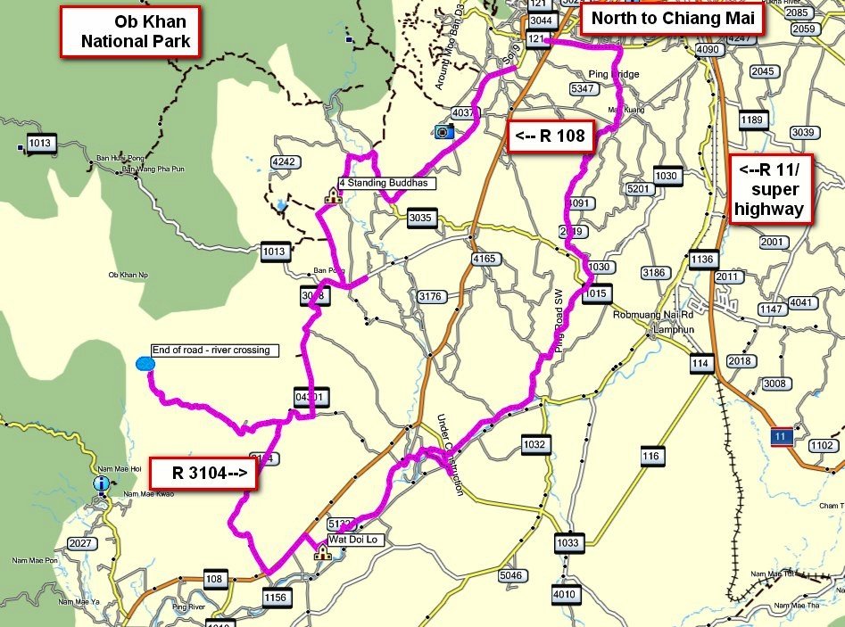
Approached from 1013 or the 108, this National Park is vast.

This road eventually brings you to a river crossing...

Here is where you end up.

on the map it shows a track but on the same side, that just cannot be true - the natural course of the track leading here points straight over this river.

You can see the gps, get the gdb and see what I am on about here...
3 - Out the back of MaeOn
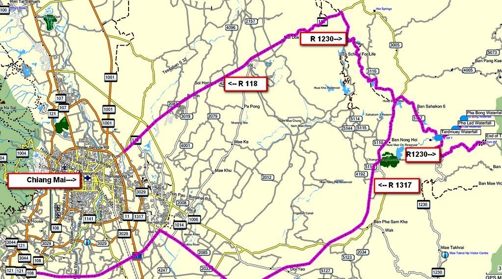
Coming down the 1230 from Haui Kaeo end you get to the park & walk waterfall 'attraction' just before the bridge and you have a left turn.

The road goes on a bit but peters out into wild track. It must !! It must !!! link up with something beyond to the north.

Back on the 1230 travelling south, there is another left turn.

It dissapointingly ends (for me) here, I walked on a bit and it gets pretty tricky going up into the forest.

I am convinced this one connects somehow to the Haui Kaeo through Chaeson road, just after one of those lovely river crossings in the middle of the park.
You can also see more pics & grab the gdb here ...
Why am I posting these, with no intention of doing them myself, 'cos I would love to know what they are like but too much of a whuss to do it! :RE
Hope some finds them of use.
Ally
1 - Mae Thea
The road towards the waterfall has a track up to the right at the main entrance. It's a cabbage truck route and does go on through to towards the 105 area.


See a bit more here ... ( That was before I found gps!)
2 - Mae Wang National Park - towards Doi Inthanon
Approached from 1013 or the 108, this National Park is vast.
This road eventually brings you to a river crossing...
Here is where you end up.
on the map it shows a track but on the same side, that just cannot be true - the natural course of the track leading here points straight over this river.
You can see the gps, get the gdb and see what I am on about here...
3 - Out the back of MaeOn
Coming down the 1230 from Haui Kaeo end you get to the park & walk waterfall 'attraction' just before the bridge and you have a left turn.

The road goes on a bit but peters out into wild track. It must !! It must !!! link up with something beyond to the north.

Back on the 1230 travelling south, there is another left turn.

It dissapointingly ends (for me) here, I walked on a bit and it gets pretty tricky going up into the forest.

I am convinced this one connects somehow to the Haui Kaeo through Chaeson road, just after one of those lovely river crossings in the middle of the park.
You can also see more pics & grab the gdb here ...
Why am I posting these, with no intention of doing them myself, 'cos I would love to know what they are like but too much of a whuss to do it! :RE
Hope some finds them of use.
Ally


