Lone Rider
Blokes Who Can
The Pak Ou Ferry route aka Offroad from Oudomxay to Luang Prabang
A bit more on the Pak Ou Ferry route also known as Offroad from Oudomxay to Luang Prabang. In the past this route could only be done using offroad bikes as part of the track was single trail and it involved a boat trip as road 1801 from road 2W via Mueang Nga stopped at Ban Lathan on the Mekong. Pounce did this trip in 2011 and you can find part (Day 6) of his report below - the full trip report is here: http://www.rideasia.net/motorcycle-forum/threads/1237-Northern-Laos-December-2011-Been-there.
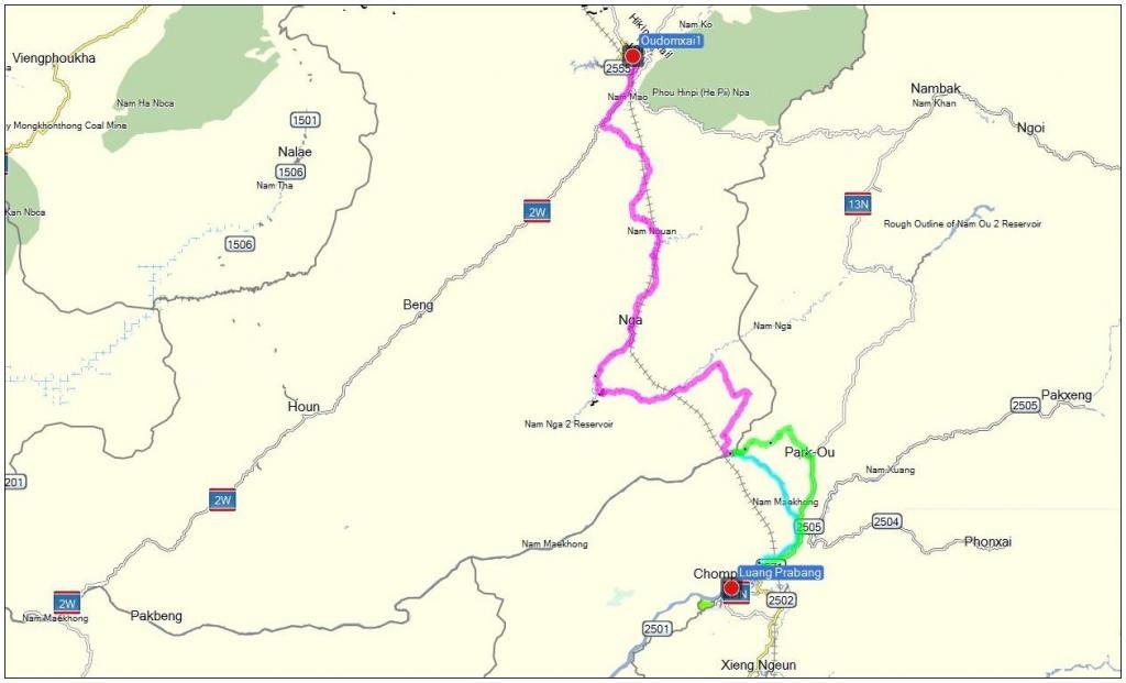
The map shows the route along Rd. 1802 and shows the location of the railway which runs more or less parallel with Rd. 1801 - the part in Magenta is the original track from Oudomxay to Ban Lathan, the part in Cyan is the part which in the past needed to be done by boat and the part in Green is the new track which links Ban Lathan to Rd. 13N.
Fast forward to 2017/2018 and things have changed considerable. At the moment this trip can be done completely using roads and tracks as a new track has been made running from Rd. 13N to Ban Lathan on the Mekong. In addition, the trip can now also be done by car although you probably would need a 4WD as the track is being used by the contractors who are building the Laos-China Railway which runs more or less parallel with Rd. 1801 and as a result the tracks has been damaged quite a bit.
The damaged bridge just south of Mueang Nga has been replaced by a new bridge and there is a lot of tunneling goin on for the railway which is under construction.
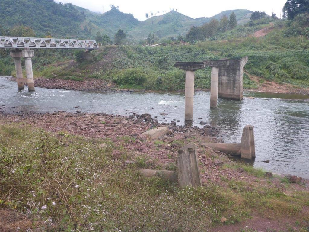
The old and the new bridge
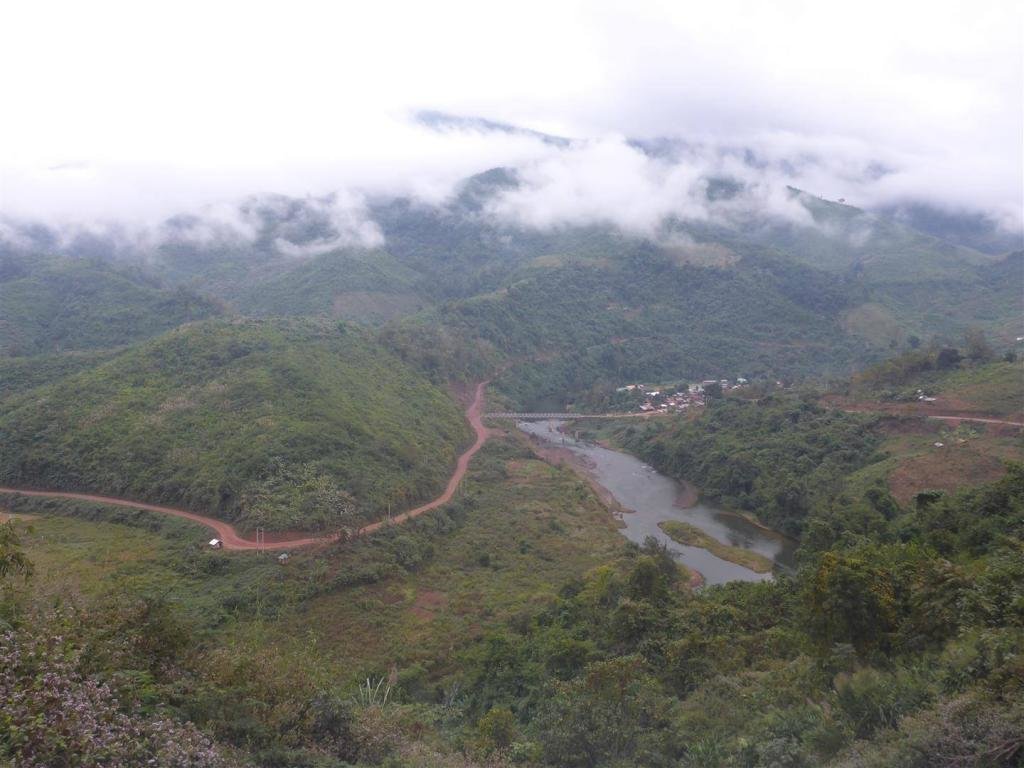
The new brisge with the upgraded tracks
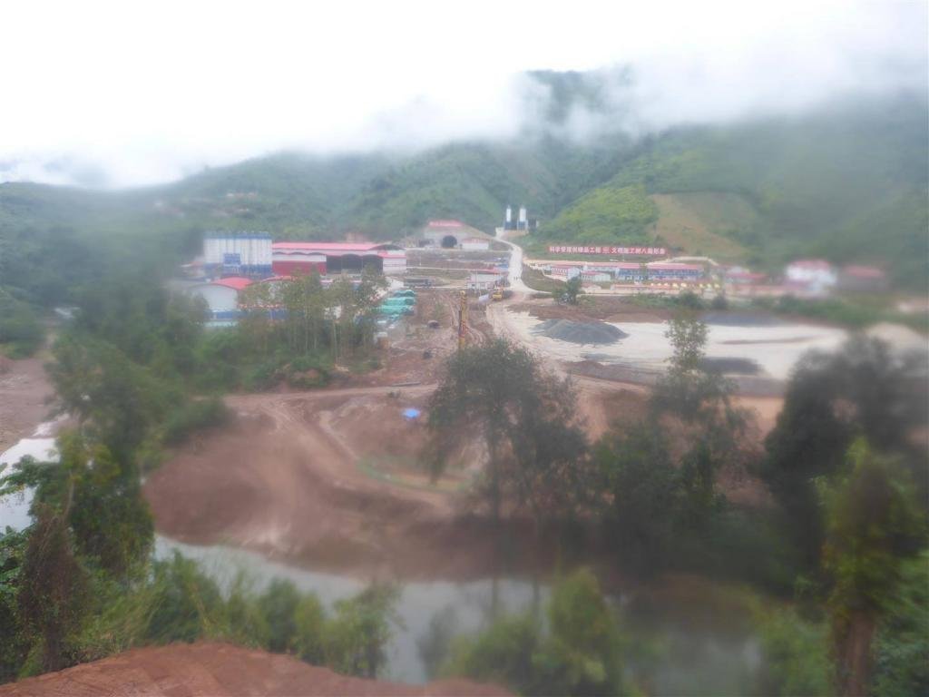
One of the many Lao - China railway construction sites - apologies for the bad quality as the pictures was taken while it was raining.
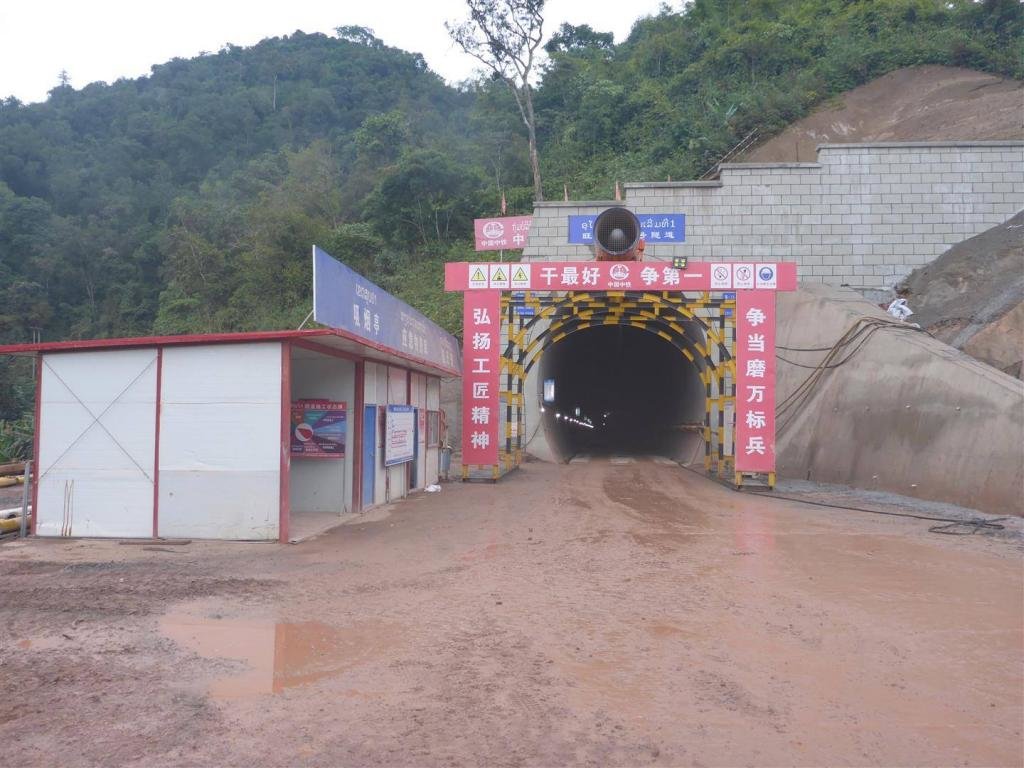
One of the tunnels for the railway
Anyway, check it out as it still is a beautiful offroad ride through one of the remote parts of Laos
A bit more on the Pak Ou Ferry route also known as Offroad from Oudomxay to Luang Prabang. In the past this route could only be done using offroad bikes as part of the track was single trail and it involved a boat trip as road 1801 from road 2W via Mueang Nga stopped at Ban Lathan on the Mekong. Pounce did this trip in 2011 and you can find part (Day 6) of his report below - the full trip report is here: http://www.rideasia.net/motorcycle-forum/threads/1237-Northern-Laos-December-2011-Been-there.
The map shows the route along Rd. 1802 and shows the location of the railway which runs more or less parallel with Rd. 1801 - the part in Magenta is the original track from Oudomxay to Ban Lathan, the part in Cyan is the part which in the past needed to be done by boat and the part in Green is the new track which links Ban Lathan to Rd. 13N.

Day 6 - 23/12/2011
Oudom Xai - Luang Probang
186klm - 6h 28' moving - 2h 30' stopped - 28.7kph moving average


I might take it easy today & follow a well marked road on the GPS. I'm on my way to Luang Probang south via the 2W then head south east onto the 1801. Well I think I'm heading to the village of Pak Ou as the GPS is hard to read & the map I have is a bit confusing.. This is where a companion paper map of the GPS tracks would come in handy.
Now the 1801 is a good road with only minor ruts & potholes all the way to Muang Nga.


From there it gets a bit worse but is still a good road until I get to the village of Ban Keo where there's another toll bridge. This one is quite impressive though.

I pay my 5,000 kip & over I go.

There are some stunning views along this road but it's starting to get a bit narrower.

I keep following it until I notice on the GPS as I get to the village of Ban Senchot that in very small writing it says "Start Big Road" Great I think, it's going to get easier. Wrong!, it seems I'm going the other way & the road turns into single trail immediately.
No worries, it carries onto what I think is Ban Pak Ou, I'll keep going.
The road has washed away? Well this is the only track on the GPS so I decide to get across the creek.


Well, it can't get any worse, right? I pull this down, get the bike through then rebuild it.

Then this… The track is impassable. Shit bollocking bastard!

What to do now? I don't want to have to backtrack all the way I've come today. I channel Bear Grylls, stay calm, get back through the fence & across the creek then ride back to a small village I passed (on video). In stunted hand signals with a forlorn look on my face & pointing at the map asking to get to the Mekong, this lovely lady gestures I go back a short way & take the fork to the right (look on video again, you'll see I passed 2 just before the village)
Woohoo, there's a way through (I hope)
In a straight line, I'm only 13klm's from where I want to be.
I'll let the video & pics show you what comes next.


OMG, I made it! What was 13klm's in a straight line ended up be 35klm's of single trail. One section of which I rode for 9 minutes & dropped a height of 420 odd metres in altitude.
Now remember I think I'm in Pak Ou when actually I'm in Ban Lathane, a village 10klm's further up river.


It's about 4pm I think by now & I want to get to Luang Probang tonight. I make a deal with a boat owner who agrees to take me there along the Mekong for about $80-$90. As there's no roads it's my only choice & I'm not going to haggle with him as he'll need to spend the night on his boat after he drops me off.


This is Pak Ou, where I thought I was headed.


As the sun is setting the boat man drops me of about 5 klm's out of Luang Probang. It's a short ride into town where I find a great guest house with secure parking for the bike as tomorrow will be an arse resting day. You wouldn't believe how sore it gets bouncing around the Laos roads.
Fast forward to 2017/2018 and things have changed considerable. At the moment this trip can be done completely using roads and tracks as a new track has been made running from Rd. 13N to Ban Lathan on the Mekong. In addition, the trip can now also be done by car although you probably would need a 4WD as the track is being used by the contractors who are building the Laos-China Railway which runs more or less parallel with Rd. 1801 and as a result the tracks has been damaged quite a bit.
The damaged bridge just south of Mueang Nga has been replaced by a new bridge and there is a lot of tunneling goin on for the railway which is under construction.

The old and the new bridge

The new brisge with the upgraded tracks

One of the many Lao - China railway construction sites - apologies for the bad quality as the pictures was taken while it was raining.

One of the tunnels for the railway
Anyway, check it out as it still is a beautiful offroad ride through one of the remote parts of Laos

