Shane
Active member
Long day’s ride in Phongsali Province Laos ??: from Muang Khoa - Samphan - Boun Tai - Udomxai
Lovely ride along the Nam Ou river. Passed dam number 4 outside Muang Khoa and it’s big brother dam number 5 at Samphan. From there it was a boat crossing to the trail leading to Boun Tai. It’s a very remote area and there were some very surprised villagers seeing me rock up. The look on their faces was as if a spaceship had landed! Lol The boat driver told me that there’s only about 2 falangs on bikes per week through that area.
Absolutely lovely ride from Boun Tai to Udomxai on the tarmac road. Nice chilled out way to finish the day.

I arrived in Muang Khoa Having taken the off road trail from Nong Khiaw. I arrived early so rode around for a bit checking out the town. It’s nicely situated along the Nam Ou river.


This is the view of Muang Khoa from the road leading to Samphan (which I would take the following day)

A beautiful sunset.... with a view of the Nam Ou hydroelectric plant 4.


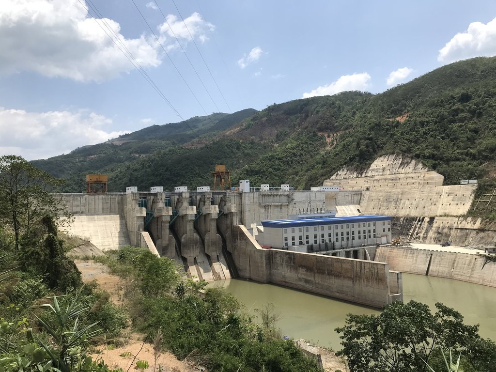
The next morning I set off early on the trail following the Nam Ou river to the town of Samphan. First stop off was at the Dam for a few more pics. It looks like it’s almost ready for operations.


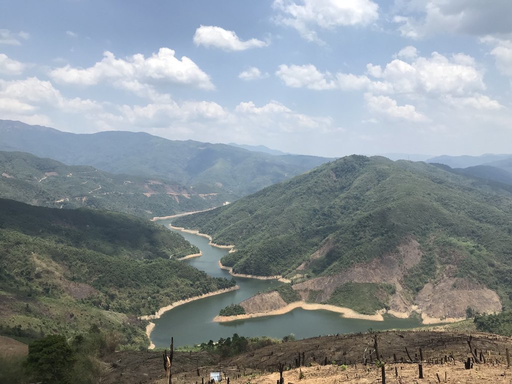
After the dam there are some lovely views of the river surrounded by the mountains. The trail is well graded and pretty easy.
I did also note a trail that appeared to be freshly cut on the opposite bank. I didn’t see this marked on any map so perhaps it’s new. It appeared to go most of the way to Samphan but there was a few places that I couldn’t see it. I guess that can be explored another time.


A bridge that looks like it’s been under construction for a while but never been finished.


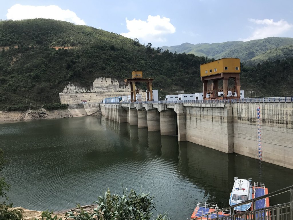
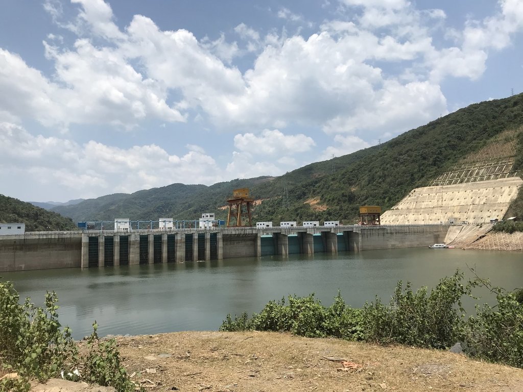
After the town of Samphan I came accriss the big brother of the previous dam. This one is the Nam Ou hydroelectric Dam 5. This is where the road ends.... kind of


The nice graded road ended and the boat crossing begins.
The boat driver wasn’t exactly a master photographer. It took him a few attempts and the below pic was the best he could do. His finger is only blocking out the dam anyway.
At least he was a better boat driver than photographer. I got to the other side with no problems.


Once at the other side, I was really in the middle of nowhere. The trail was still nice as it was dry.

Some cool views of the reservoir from up in the hills on the other side of the dam.


It certainly is a very remote region. There were only a few very primitive villages in the region. I only came across a handful of locals on bikes in the several hours that I spent on the trail.


This one village seemed to be hacked right out of the mountain. Pretty cool.


 E
E
I spent several hours getting from the far side of the dam to Boun Tai. I pretty much had the trail all to myself. There was stunning scenery and some very surprised villagers.
Once I popped out on the main road I headed for Oudomxai. I still had a couple of hours left to go but it was nice to finish up the day cruising along on some easy tarmac. The views along this road were really nice going over the mountains and following the river to the town of Oudomxai.
Overall it was a very long day but well worth it in terms of the ride and the scenery.
Lovely ride along the Nam Ou river. Passed dam number 4 outside Muang Khoa and it’s big brother dam number 5 at Samphan. From there it was a boat crossing to the trail leading to Boun Tai. It’s a very remote area and there were some very surprised villagers seeing me rock up. The look on their faces was as if a spaceship had landed! Lol The boat driver told me that there’s only about 2 falangs on bikes per week through that area.
Absolutely lovely ride from Boun Tai to Udomxai on the tarmac road. Nice chilled out way to finish the day.
I arrived in Muang Khoa Having taken the off road trail from Nong Khiaw. I arrived early so rode around for a bit checking out the town. It’s nicely situated along the Nam Ou river.
This is the view of Muang Khoa from the road leading to Samphan (which I would take the following day)
A beautiful sunset.... with a view of the Nam Ou hydroelectric plant 4.
The next morning I set off early on the trail following the Nam Ou river to the town of Samphan. First stop off was at the Dam for a few more pics. It looks like it’s almost ready for operations.
After the dam there are some lovely views of the river surrounded by the mountains. The trail is well graded and pretty easy.
I did also note a trail that appeared to be freshly cut on the opposite bank. I didn’t see this marked on any map so perhaps it’s new. It appeared to go most of the way to Samphan but there was a few places that I couldn’t see it. I guess that can be explored another time.
A bridge that looks like it’s been under construction for a while but never been finished.
After the town of Samphan I came accriss the big brother of the previous dam. This one is the Nam Ou hydroelectric Dam 5. This is where the road ends.... kind of
The nice graded road ended and the boat crossing begins.
The boat driver wasn’t exactly a master photographer. It took him a few attempts and the below pic was the best he could do. His finger is only blocking out the dam anyway.
At least he was a better boat driver than photographer. I got to the other side with no problems.
Once at the other side, I was really in the middle of nowhere. The trail was still nice as it was dry.
Some cool views of the reservoir from up in the hills on the other side of the dam.
It certainly is a very remote region. There were only a few very primitive villages in the region. I only came across a handful of locals on bikes in the several hours that I spent on the trail.
This one village seemed to be hacked right out of the mountain. Pretty cool.
EI spent several hours getting from the far side of the dam to Boun Tai. I pretty much had the trail all to myself. There was stunning scenery and some very surprised villagers.
Once I popped out on the main road I headed for Oudomxai. I still had a couple of hours left to go but it was nice to finish up the day cruising along on some easy tarmac. The views along this road were really nice going over the mountains and following the river to the town of Oudomxai.
Overall it was a very long day but well worth it in terms of the ride and the scenery.
")