You are using an out of date browser. It may not display this or other websites correctly.
You should upgrade or use an alternative browser.
You should upgrade or use an alternative browser.
Off-road to Doi Inthanon with Midnight Mapper & Harry
- Thread starter KTMphil
- Start date
KTMphil
Senior member
KTMphil
Senior member
As we entered the Ob Kahn National Park, it was interesting to see how swollen the rivers were from the first big rains of the season, a week ago you could have ridden in this river bed

A local lady very curious as to why we would be heading in this direction .... we'd find out why soon enough


A local lady very curious as to why we would be heading in this direction .... we'd find out why soon enough

KTMphil
Senior member
Last Karen house before the nasty steep stuff starts\


From the rain the night before, we weren't sure if we were going to be able to get up this section and may have to turn back


From the rain the night before, we weren't sure if we were going to be able to get up this section and may have to turn back

KTMphil
Senior member
Around the next bend some Karen locals hunting birds with dogs and a rifle

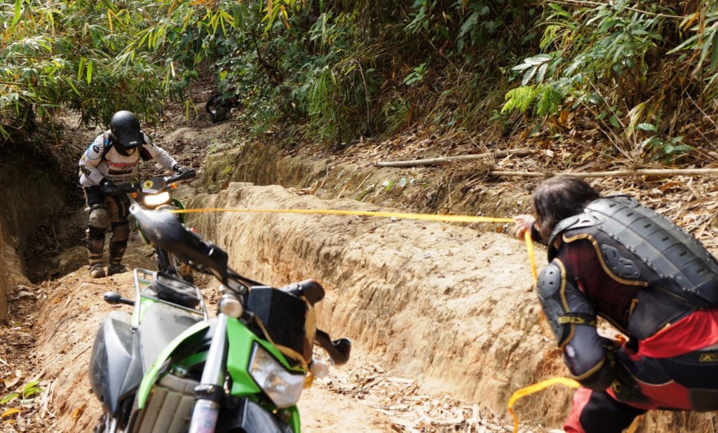
Then some really nasty stuff -- with the rain the clay was greasy, took 3 of us to get each bike up here


Then some really nasty stuff -- with the rain the clay was greasy, took 3 of us to get each bike up here


KTMphil
Senior member
More nasty steep rutted trails-- Max, Alex, LUFC and Jon would love it


A Karen lady on the trail who told us she was off to pick fragrant leaves


A Karen lady on the trail who told us she was off to pick fragrant leaves

KTMphil
Senior member
Harry getting a refreshing drink from a bamboo water faucet

Then more hell trails, here moving rocks to try make things a little easier


On this route there are about 5 very steep sections all in the first third of the trails

This is really steep but as usual doesn't show in the photo too well


Then more hell trails, here moving rocks to try make things a little easier


On this route there are about 5 very steep sections all in the first third of the trails

This is really steep but as usual doesn't show in the photo too well

KTMphil
Senior member
KTMphil
Senior member
Wat Luang is one of the most beautiful Wat's i've seen in Thailand, This is what you see as you approach it, first views through the trees

And then this as you get closer


Being in the middle of no where it was amazing how well maintained it was


And then this as you get closer


Being in the middle of no where it was amazing how well maintained it was


Ally
Well-known member
I like that temple very much. There is a feeling of solitude there you don't find in many places.
Great pics & report so far, you have still to reach Inthanon!

Ally
Great pics & report so far, you have still to reach Inthanon!

Ally
KTMphil
Senior member
Harry's done many tours on this route and I can see why

There were giant wooden Buddha's in the both buildings


& a beautiful old teak building


There were giant wooden Buddha's in the both buildings


& a beautiful old teak building


KTMphil
Senior member
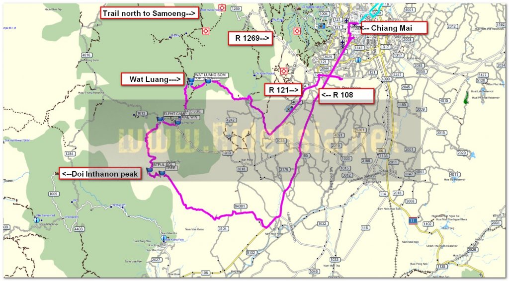
A map of where we are in relation to Wat Luang!


KTMphil
Senior member
Would be interested to see the route you take to get there Ally. The way we went was hell, would be interested in easier route SW to take people
Ally said:I like that temple very much. There is a feeling of solitude there you don't find in many places.
Great pics & report so far, you have still to reach Inthanon!

Ally
johnnysneds
Senior Member
- Joined
- May 14, 2011
- Location
- Chiang Mai
- Bikes
- Multistrada 1200S Touring, WR450F, KTM200EXC, Gas Gas 280, PCX
This looks remarkably like the death valley trails, is it not? i recognize the rutts

Here's the Death Valley trail, is it the same?


Here's the Death Valley trail, is it the same?

KTMphil
Senior member
Leaving Wat Luang, Don realizes he a front flat, we try pumping it but it doesn't stay up

We had tools and tubes with us, so we found a bit of shade and got the tube changed


Interesting tip from MM:
When you've got the old tube out of the tire, run a rag around the inside of the tire in case whatever caused the puncture is still imbedded in the tire (thorn, nail etc...), this way you dont risk cutting your fingers.

We had tools and tubes with us, so we found a bit of shade and got the tube changed


Interesting tip from MM:
When you've got the old tube out of the tire, run a rag around the inside of the tire in case whatever caused the puncture is still imbedded in the tire (thorn, nail etc...), this way you dont risk cutting your fingers.
KTMphil
Senior member
All fixed and off through some great forest single track trails


The rain had cleared all the smoke and humidity, giving us great clear views in the Doi Inthanon area, a real treat.


The rain had cleared all the smoke and humidity, giving us great clear views in the Doi Inthanon area, a real treat.

KTMphil
Senior member
Jonny -- yes, the SE part of your trail is the same one....it was wet, greasy and nasty.
johnnysneds said:This looks remarkably like the death valley trails, is it not? i recognize the rutts

Here's the Death Valley trail, is it the same?

KTMphil
Senior member
KTMphil
Senior member
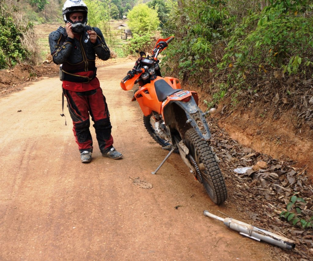
Wire tied the fixing holes and rode off, the wire ties and then wire didn't hold and ended up putting a nut and bolt in it which held.
Elephant camps in the Ban Huai Pong area, there are a few of them


Elephant camps in the Ban Huai Pong area, there are a few of them


KTMphil
Senior member
this was a close top Doi Inthanon as we'd get, time to turn left and start heading east

A newly de-forested area


A newly de-forested area


KTMphil
Senior member
Back into the jungle and trying to see if there's a way around this huge fallen tree

No way around it, the only way is through the river and to limbo with the bike under it

No problems

Then another huge tree, this one we found a way around

MM in the river bed with some very friendly dogs accompanying some fisherman


No way around it, the only way is through the river and to limbo with the bike under it

No problems

Then another huge tree, this one we found a way around

MM in the river bed with some very friendly dogs accompanying some fisherman

KTMphil
Senior member
The route SE away from Doi Inthanon involves following the river bed, not sure if this route would be possible in rainy season

Cool tree along the way

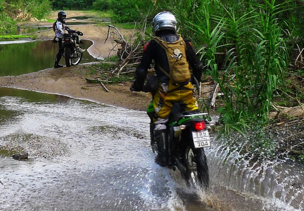
There were some beautiful, river bed sand trails towards the end as we approached the paved section, after the rain the greenery had returned


Cool tree along the way

There were some beautiful, river bed sand trails towards the end as we approached the paved section, after the rain the greenery had returned

LivinLOS
Senior Member
- Joined
- Feb 10, 2011
- Bikes
- Gas Gas 250 (Trials), YZ250 (enduro), DRZ440 (Supermoto) CBR900 Streetfighter (scary !!)
johnnysneds said:This looks remarkably like the death valley trails, is it not? i recognize the rutts

Here's the Death Valley trail, is it the same?

I thought the same when I saw the pic..It looks identical..
I would like to give death valley a go.. but that technical bit looked intimidating..
KTMphil
Senior member
A fantastic days riding apart from a river crossing that was way too deep..... lots of water in the motor
only option was to turn the bike upside down with the spark plug out, rotate the back wheel in second gear and get the 8 liters of water out of the 2 stroke crank case.
worked surprisingly well
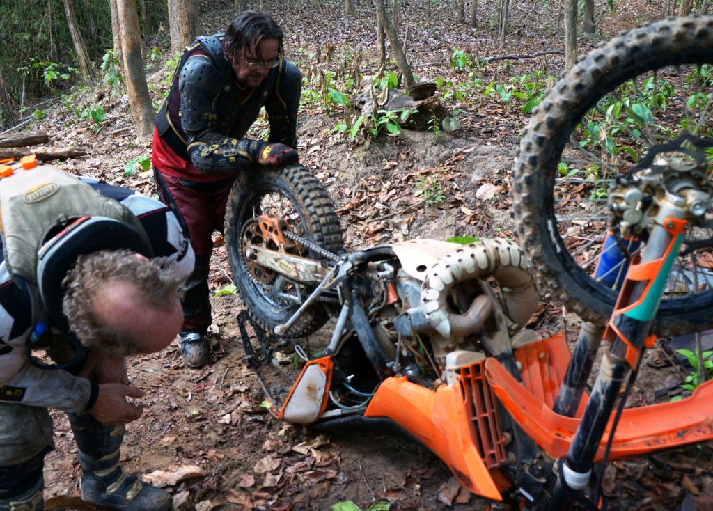
photo: midnight mapper
only option was to turn the bike upside down with the spark plug out, rotate the back wheel in second gear and get the 8 liters of water out of the 2 stroke crank case.
worked surprisingly well

photo: midnight mapper
KTMphil
Senior member
jb2112 said:Wow! Fantastic stuff. Great post and terrific photos. Did the bike make it out?
JB-- we had it all going again in 20 minutes ...love 2 strokes!
KTMphil
Senior member
KTMphil
Senior member
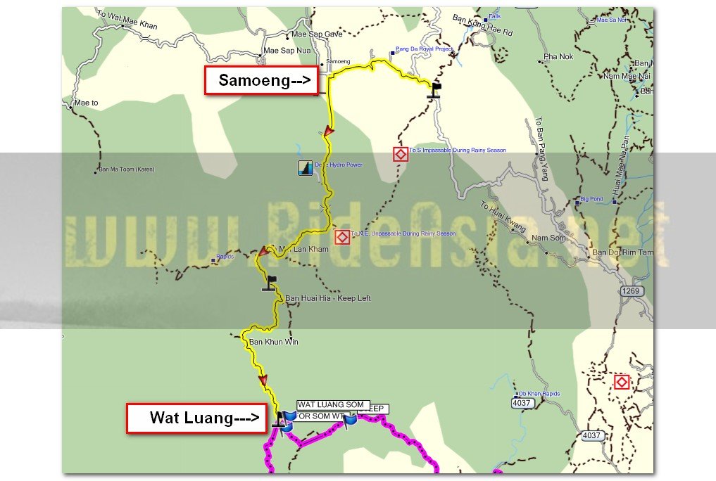
At Wat Luang - this route the went S/SW towards Doi Inthanon, not north to Samoeng
LivinLOS said:johnnysneds said:This looks remarkably like the death valley trails, is it not? i recognize the rutts

Here's the Death Valley trail, is it the same?

I thought the same when I saw the pic..It looks identical..
I would like to give death valley a go.. but that technical bit looked intimidating..
Ally
Well-known member
KTMphil said:Would be interested to see the route you take to get there Ally. The way we went was hell, would be interested in easier route SW to take people
Ally said:I like that temple very much. There is a feeling of solitude there you don't find in many places.
Great pics & report so far, you have still to reach Inthanon!

Ally
Phil, indeed there is an easier route, from Mae Win or as Slash did it recently, from the north via Samoeng.
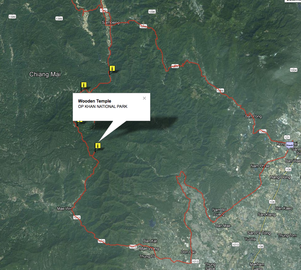
Here is my trip Jan 2010.
I guess having 2 skilled guys along with you made for a tremendous journey.
Ally
Ally
Well-known member
KTMphil said:A map of where we are in relation to Wat Luang!

Who needs a map when you have local knowledge, some flattened earth & a few bits of stick!
Love it !
Ally
KTMphil
Senior member
Harry & Don in the river bed

Harry's custom/ purpose made truck for bikes, with built-in loading ramps


Harry's custom/ purpose made truck for bikes, with built-in loading ramps


Good job getting the KTM going again so quickly. Had this happen before and as you said, its pretty easy on a 2T.
One thing I would recommend Phil is to increase the amount of premix on your next ride, maybe double concentration to say, 32:1 just to make sure the bearings have plenty of oil on them after their little swim. It will smoke a hell of a lot but worth it for more peace of mind.
My (your) poor bike!
One thing I would recommend Phil is to increase the amount of premix on your next ride, maybe double concentration to say, 32:1 just to make sure the bearings have plenty of oil on them after their little swim. It will smoke a hell of a lot but worth it for more peace of mind.
My (your) poor bike!
KTMphil
Senior member
The Karen Eco Lodge about 1km NE of Mae Win looks a very interesting place to stay. Reasonably fancy, near the Elephant parks, rooms im told are about 1,000 bht a night.

They have a pretty cool bamboo bridge across the river


Karen Hill Tribe lodge
Sprawling rice fields, deep green valleys, lush jungle and meandering rivers: the view from the balcony of the Karen Hill Tribe Lodge is unforgettable. Set to a dramatic mountain backdrop, from here you'll see no buildings, roads or power lines. Don't forget your camera.
Built in the traditional Karen Hill tribe style using local pine and bamboo, the lodge interiors have been kitted out with European-style home comforts to make your stay as relaxing as possible. Unlike some of the other accommodation in the area, here you can enjoy your incredibly peaceful location while relaxing in the knowledge that hot water, electricity, comfortable beds and built-in mosquito nets await you after a long day on elephant back.
Keren Hill Tribe Lodge Features
7 twin rooms
3 double rooms
Every room is equipped with comfortable bedding, electric lighting, fans and mosquito nets.
Every room has a private bathroom with a hot shower
Atmospheric dining area, using fresh local produce as well as supplies from Chiang Mai
Lodge bar
Log camp fire every evening
Outstanding natural scenery
The Mae Win area is all set up for elephant safari's, see the link below
http://www.asianelephantsafari.com/home
GPS co-ords of the Karen Eco Lodge near Mae Win
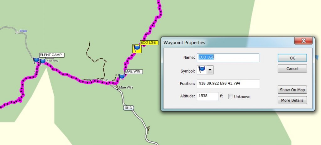

They have a pretty cool bamboo bridge across the river


Karen Hill Tribe lodge
Sprawling rice fields, deep green valleys, lush jungle and meandering rivers: the view from the balcony of the Karen Hill Tribe Lodge is unforgettable. Set to a dramatic mountain backdrop, from here you'll see no buildings, roads or power lines. Don't forget your camera.
Built in the traditional Karen Hill tribe style using local pine and bamboo, the lodge interiors have been kitted out with European-style home comforts to make your stay as relaxing as possible. Unlike some of the other accommodation in the area, here you can enjoy your incredibly peaceful location while relaxing in the knowledge that hot water, electricity, comfortable beds and built-in mosquito nets await you after a long day on elephant back.
Keren Hill Tribe Lodge Features
7 twin rooms
3 double rooms
Every room is equipped with comfortable bedding, electric lighting, fans and mosquito nets.
Every room has a private bathroom with a hot shower
Atmospheric dining area, using fresh local produce as well as supplies from Chiang Mai
Lodge bar
Log camp fire every evening
Outstanding natural scenery
The Mae Win area is all set up for elephant safari's, see the link below
http://www.asianelephantsafari.com/home
GPS co-ords of the Karen Eco Lodge near Mae Win

johnnysneds
Senior Member
- Joined
- May 14, 2011
- Location
- Chiang Mai
- Bikes
- Multistrada 1200S Touring, WR450F, KTM200EXC, Gas Gas 280, PCX
Vorsprung durch Technik! Awesome. Whats the three prongs down the right hand side for?
Love the cut-out on the roof

Love the cut-out on the roof

KTMphil
Senior member
KTMphil
Senior member
I think he told me its some kind of set up especially for Songkran to attach water hoses - serious!
johnnysneds said:Vorsprung durch Technik! Awesome. Whats the three prongs down the right hand side for?
Love the cut-out on the roof

Captain_Slash
Community Manager
- Joined
- Jun 28, 2011
- Bikes
- BMW 310GS Honda Wave 125 Honda MSX 125
Thats a good trip to that wooden temple Phil, heres my trip there from november but the map of my route isnt showing
captain-slash-thailand/the-klx-gets-wet-off-road-from-samoeng-to-mae-win-t1072.html
captain-slash-thailand/the-klx-gets-wet-off-road-from-samoeng-to-mae-win-t1072.html
MastaMax
Senior Member
- Joined
- Apr 28, 2011
- Bikes
- 19 ktm 300tpi 6 days / 15 Yamaha YZ250F / 08 Husky 450SMR / 13 ER6N / 13 KTM 300XCW(sold)
KTMphil said:Harry & Don in the river bed

Fantastic picture Phil. Looks like a great day riding!
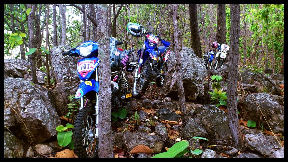
Talking about a hellish trail. I went for a ride on Sunday with Alex USA and our Thai friends, we did a 10km trail up and down a mountain in the Sankampeang area which was basically a boulder field... Only recommended for masochist people haha... I think Derren would have loved it though. Don't think it's worth putting it on the north Thailand map as it's barely doable walking.
Ally
Well-known member
MastaMax said:Talking about a hellish trail. I went for a ride on Sunday with Alex USA and our Thai friends, we did a 10km trail up and down a mountain in the Sankampeang area which was basically a boulder field... Only recommended for masochist people haha... I think Derren would have loved it though. Don't think it's worth putting it on the north Thailand map as it's barely doable walking.
[attachment=0:17h35ryz]boulders.jpg[/attachment:17h35ryz]
Max, can you provide the co-ordinates for that trail, I think I know someone that will want them. They like taking bikes for walks!
:boxing
Ally
KTMphil
Senior member
That looks horrendous - like the Erzberg rock field


