Captain_Slash
Community Manager
- Joined
- Jun 28, 2011
- Bikes
- BMW 310GS Honda Wave 125 Honda MSX 125
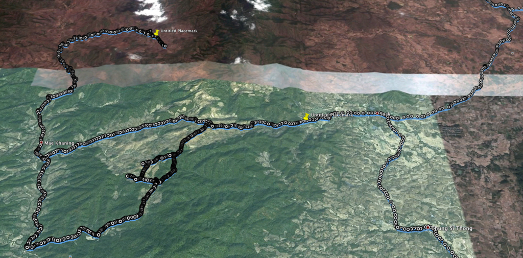
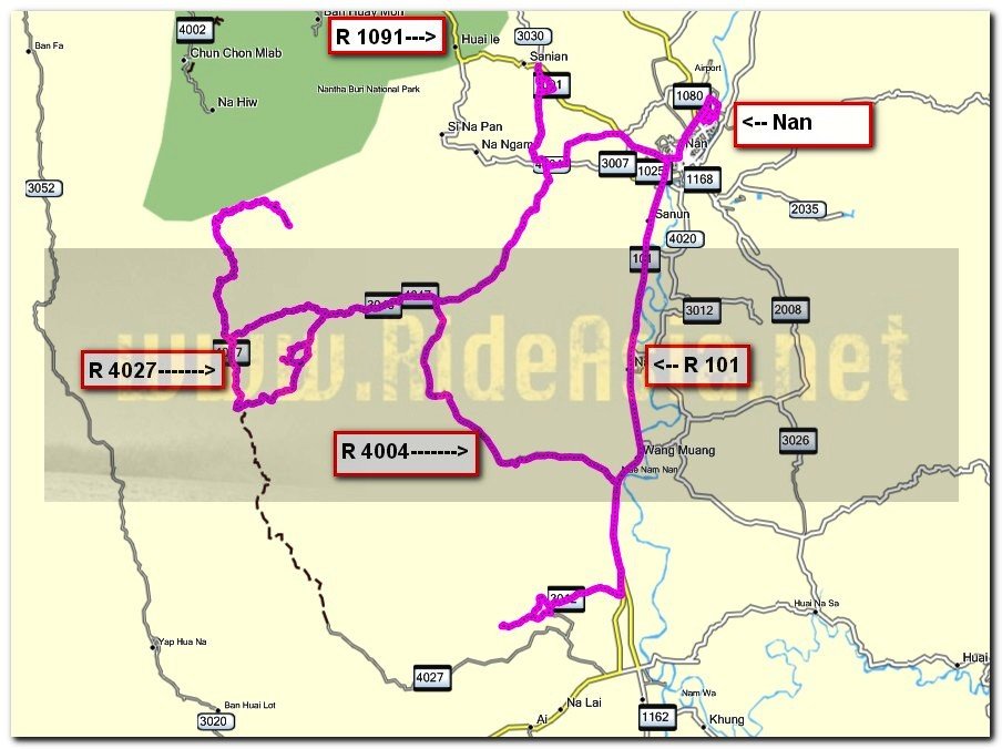
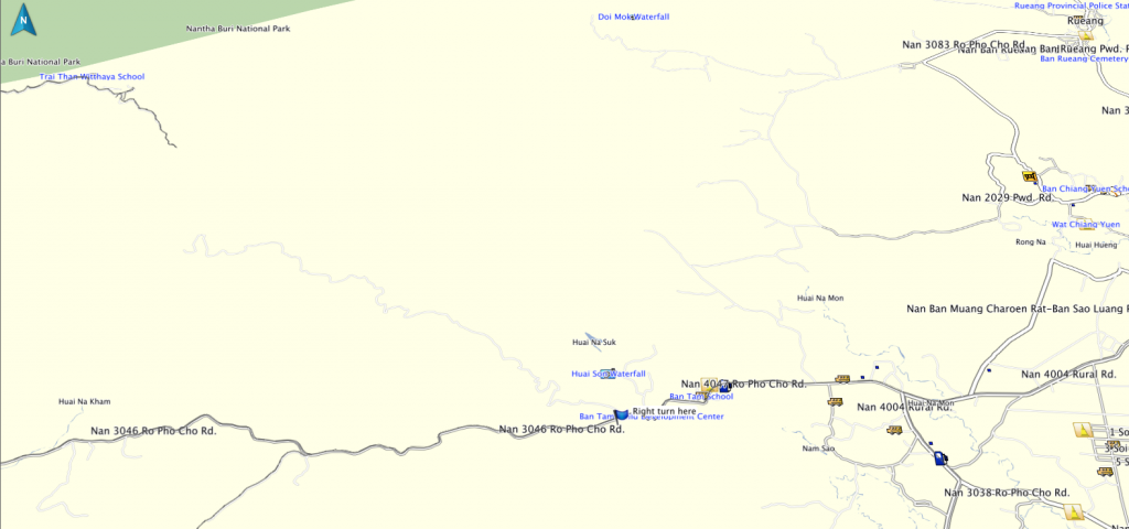
The route 1091, 4004, 4100, 4062, 4047, 3046, Offroad, 101, 3012
Total distance 186 km

Due to the fact that Nan was going to be without electricity today from 8am to 4 pm I thought it wise to ensure I didnt need any fuel so a local trip was hastily planned.
First stop was the Nong Na To reservoir on the 4004

Virtually at capacity


Then along the 4004 where the workers are busy in the fields

On the 4100 is the overflow of the Nong Ok Ru reservoir, this is the reservoir that the 1091 goes over a few km outside of Nan


Slightly overflowing is this one


I take a small side road to get back to the 4062

There was a sign saying the road was closed but the KLX soon found an opening

This guy was busy picking chillies from the bush

Thats rather a wide load


On the 3046 and some smoke in the distance


Up in the hills now and the good scenery starts


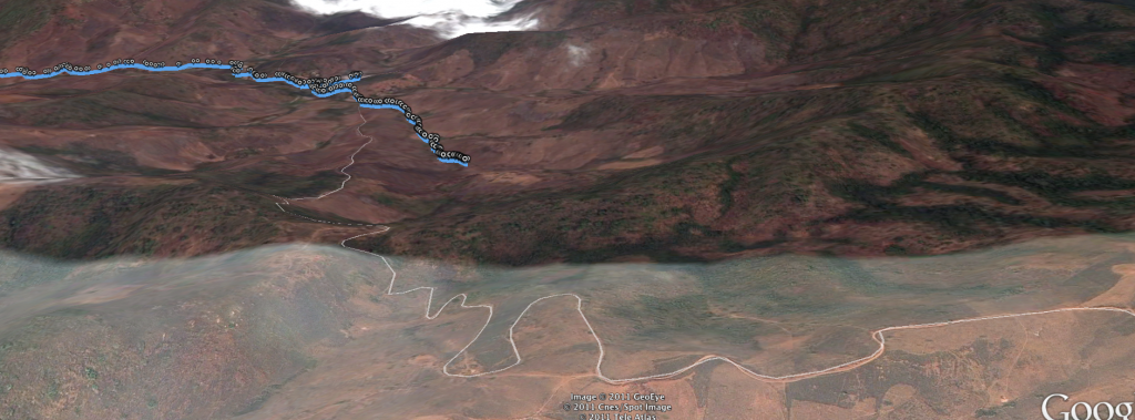
At a t junction I take a right and ride to the end of the asphalt at N18.45.143 E100.32.555

Here I take a right and ride the track in front of me which alternates between concrete and dirt from now on


I rode to about here last trip and have come here today to ride to the end

Theres a village near the end and this old Lady is busy splitting the wood


I ride through the village and over this narrow bridge only to discover theres a proper wide track if I took another turning, I discover this on the way back


Out the other side of the village and its good fun riding


I stop here and turn around as it appears just tracks to harvest crops now


Plenty of wildlife out here

Now on the way back


I reach the asphalt and ride southwards until N18.40.695 E100.34.231 and here I explore another dirt track to see where it goes to


Lots of corn here as well

I like how the handle of the saucepan fits over the wood and keeps the saucepan in place


At this point I turn around to find another track as its getting very steep and with a loose surface too, plus I dont appear to be heading north towards the 3046 anymore

This track just ends and a third one suddenly goes down a very steep hill on loose dirt to nothing and its a bit of a struggle to get traction on the way back up

Thinking there was possibly no way across to the 3046 I ride back to the asphalt and start to ride back

Heading east on the 3046 there is a dirt track to my right which is sort of in the area that is about right so I take it, it soon turns into a steep dusty ride but is heading towards my turnaround point from earlier on

I come to a fork and take the left but this is the wrong one and goes steeply downhill leading away from my point but then it turns and meets the mornings track further on.
Having made the loop I was happy and now I am riding back up the steep rocky hill

Back at the fork I take the left and this goes up a very steep loose rocky surface that needed a bit of clutch work to get up it and I wasnt looking forward to coming back down it that much

Time for a breather and the bikes fan has come on a few times today


Right at the top and some great scenery up here.
I ride down and meet the point I was really looking for where I made my turnaround earlier on, now really happy to have conquered this route I ride back to the 3046

Back to the red dust just before reaching the asphalt

I ride to the Nam Hin reservoir just outside Wiang Sa off the 3012

Not far from capacity

These friendly youngsters were only too happy to pose for a photo, from here its back to Nan

Chicken cordon bleu with double fries and onions at Tonys Place for 200 Baht
You can get the gdb file from my website here … http://www.captainslash.com
Total distance 186 km

Due to the fact that Nan was going to be without electricity today from 8am to 4 pm I thought it wise to ensure I didnt need any fuel so a local trip was hastily planned.
First stop was the Nong Na To reservoir on the 4004

Virtually at capacity


Then along the 4004 where the workers are busy in the fields

On the 4100 is the overflow of the Nong Ok Ru reservoir, this is the reservoir that the 1091 goes over a few km outside of Nan


Slightly overflowing is this one


I take a small side road to get back to the 4062

There was a sign saying the road was closed but the KLX soon found an opening

This guy was busy picking chillies from the bush

Thats rather a wide load


On the 3046 and some smoke in the distance


Up in the hills now and the good scenery starts


At a t junction I take a right and ride to the end of the asphalt at N18.45.143 E100.32.555

Here I take a right and ride the track in front of me which alternates between concrete and dirt from now on


I rode to about here last trip and have come here today to ride to the end

Theres a village near the end and this old Lady is busy splitting the wood


I ride through the village and over this narrow bridge only to discover theres a proper wide track if I took another turning, I discover this on the way back


Out the other side of the village and its good fun riding


I stop here and turn around as it appears just tracks to harvest crops now


Plenty of wildlife out here

Now on the way back


I reach the asphalt and ride southwards until N18.40.695 E100.34.231 and here I explore another dirt track to see where it goes to


Lots of corn here as well

I like how the handle of the saucepan fits over the wood and keeps the saucepan in place


At this point I turn around to find another track as its getting very steep and with a loose surface too, plus I dont appear to be heading north towards the 3046 anymore

This track just ends and a third one suddenly goes down a very steep hill on loose dirt to nothing and its a bit of a struggle to get traction on the way back up

Thinking there was possibly no way across to the 3046 I ride back to the asphalt and start to ride back

Heading east on the 3046 there is a dirt track to my right which is sort of in the area that is about right so I take it, it soon turns into a steep dusty ride but is heading towards my turnaround point from earlier on

I come to a fork and take the left but this is the wrong one and goes steeply downhill leading away from my point but then it turns and meets the mornings track further on.
Having made the loop I was happy and now I am riding back up the steep rocky hill

Back at the fork I take the left and this goes up a very steep loose rocky surface that needed a bit of clutch work to get up it and I wasnt looking forward to coming back down it that much

Time for a breather and the bikes fan has come on a few times today


Right at the top and some great scenery up here.
I ride down and meet the point I was really looking for where I made my turnaround earlier on, now really happy to have conquered this route I ride back to the 3046

Back to the red dust just before reaching the asphalt

I ride to the Nam Hin reservoir just outside Wiang Sa off the 3012

Not far from capacity

These friendly youngsters were only too happy to pose for a photo, from here its back to Nan

Chicken cordon bleu with double fries and onions at Tonys Place for 200 Baht
You can get the gdb file from my website here … http://www.captainslash.com


