Captain_Slash
Community Manager
- Joined
- Jun 28, 2011
- Bikes
- BMW 310GS Honda Wave 125 Honda MSX 125
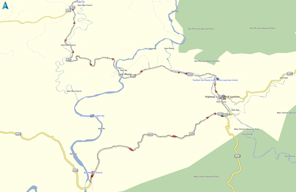
The route 1168, 1258
Total distance 135 km

Out on the 1168 past Mae Charim

It was a cloudy cold start but the sun soon broke through then it quickly turned into a warm day


I stop in Ban Nam Wa and the sand on the steps suggests the Wa rises a long way in the wet season

I wonder if this was caused by the last wet season


Now on the 1258 to visit Ban Nam Pu


Apart from these three I saw no one else in Ban Nam Pu, I guess they are all busy out in the fields


The temporary crossing that gets put here yearly, do I cross it or not

I walk across, the bridge is a bit wonky, the Wa is deep enough to submerge the bike if it goes in, plus theres no help around so I give it a miss


I meet these performing dogs on the way back


Now back in Mae Charim

Time to look again for the offroad track that goes back to Nan


Its lovely scenery up here and on a mostly dry dirt track


Some single track now

The track has really deteriorated now, its deeply rutted with no sign of being used by anything

Heres far enough, times getting on and I am alone, hopefully it can be explored further another time

Time to ride back to Nan.
Its back to Chiang Mai tomorrow as the KLX will be at 12000 km by the time I get there

Roast chicken, stuffing, roast potatoes, cauliflower, broccoli and gravy for 260 Baht at Tonys Place.
I am sure going to miss these lovely meals once I leave
You can get the gdb file from my website here … http://www.captainslash.com
Total distance 135 km

Out on the 1168 past Mae Charim

It was a cloudy cold start but the sun soon broke through then it quickly turned into a warm day


I stop in Ban Nam Wa and the sand on the steps suggests the Wa rises a long way in the wet season

I wonder if this was caused by the last wet season


Now on the 1258 to visit Ban Nam Pu


Apart from these three I saw no one else in Ban Nam Pu, I guess they are all busy out in the fields


The temporary crossing that gets put here yearly, do I cross it or not

I walk across, the bridge is a bit wonky, the Wa is deep enough to submerge the bike if it goes in, plus theres no help around so I give it a miss


I meet these performing dogs on the way back


Now back in Mae Charim

Time to look again for the offroad track that goes back to Nan


Its lovely scenery up here and on a mostly dry dirt track


Some single track now

The track has really deteriorated now, its deeply rutted with no sign of being used by anything

Heres far enough, times getting on and I am alone, hopefully it can be explored further another time

Time to ride back to Nan.
Its back to Chiang Mai tomorrow as the KLX will be at 12000 km by the time I get there

Roast chicken, stuffing, roast potatoes, cauliflower, broccoli and gravy for 260 Baht at Tonys Place.
I am sure going to miss these lovely meals once I leave
You can get the gdb file from my website here … http://www.captainslash.com


