KTMphil
Senior member
Making your own tracks from Google Earth to use with a Garmin GPS
Was just making some tracks from Google Earth NW of Mae Sariang to use with the Garmin GPS, thought it might be worth sharing how to do it.
1. In google earth get to the location where you want to make the tracks, zoom to a level where you can see the track you want to create
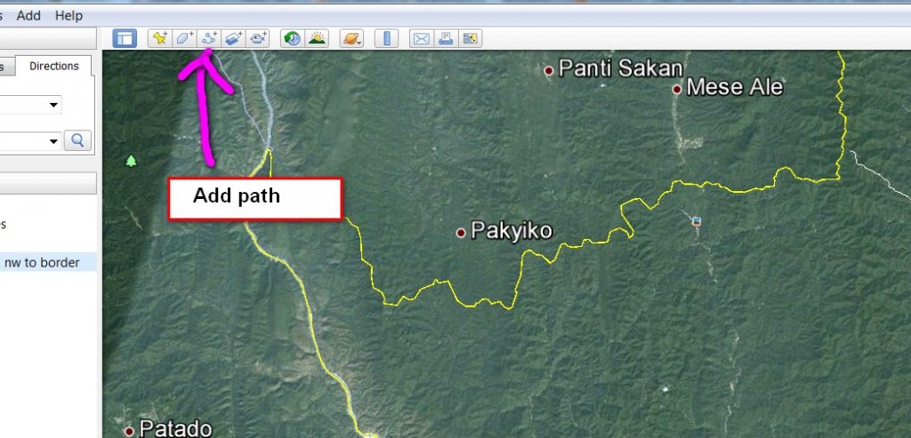
2. Click the "Add Path" button from the top of the screen

3. Click the cursor along the track leaving a trail
4. When done, in the window that opened, give the track a name and click ok
5. On the LHS the track will have saved --- right click on it and choose "save place as" and save as a KML file NOT a KMZ file ( you can choose in the pulldown at the bottom)
6. Save to a location on your computer where you can find it
7. In your browser open the URL http://gpx2kml.com/ - this program converts the KML file to a GPX file that Garmin can understand
8. Change the 1st field to KML to GPX
9. Browse and open the KML file you just saved from google earth
10. Click on convert
11. Where "here" is underlined right on it and save link as ----- this will save the gpx file to your computer
12. Open Mapsource.... "file- open" the gpx file you just saved
13. Once you have loaded the track, you can then plug in your gps to the computer then send the track data to the GPS
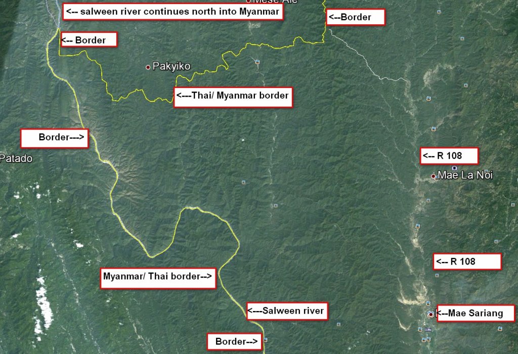
Here's Google Earth of the area NW of Mae Sariang

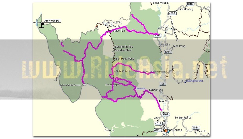
Here's the tracks we've made from it. Some maybe dried river beds, there's no way of telling until we get there.

Was just making some tracks from Google Earth NW of Mae Sariang to use with the Garmin GPS, thought it might be worth sharing how to do it.
1. In google earth get to the location where you want to make the tracks, zoom to a level where you can see the track you want to create
2. Click the "Add Path" button from the top of the screen

3. Click the cursor along the track leaving a trail
4. When done, in the window that opened, give the track a name and click ok
5. On the LHS the track will have saved --- right click on it and choose "save place as" and save as a KML file NOT a KMZ file ( you can choose in the pulldown at the bottom)
6. Save to a location on your computer where you can find it
7. In your browser open the URL http://gpx2kml.com/ - this program converts the KML file to a GPX file that Garmin can understand
8. Change the 1st field to KML to GPX
9. Browse and open the KML file you just saved from google earth
10. Click on convert
11. Where "here" is underlined right on it and save link as ----- this will save the gpx file to your computer
12. Open Mapsource.... "file- open" the gpx file you just saved
13. Once you have loaded the track, you can then plug in your gps to the computer then send the track data to the GPS
Here's Google Earth of the area NW of Mae Sariang

Here's the tracks we've made from it. Some maybe dried river beds, there's no way of telling until we get there.


