Laos Dams

KTMphil

Senior member
Joined
Jan 11, 2011
Location
Chiang Mai, Thailand
Bikes
2007 KTM 990 Adventure Suzuki DRZ 400
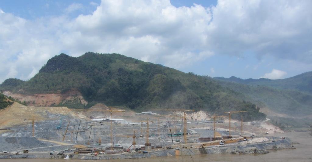
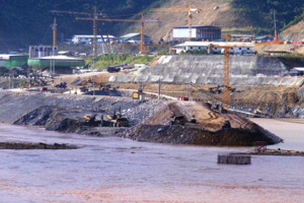
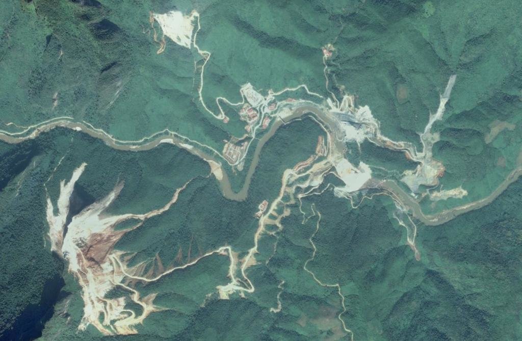
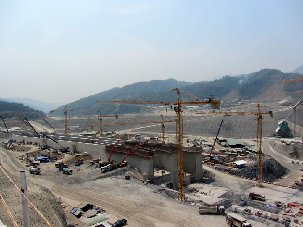
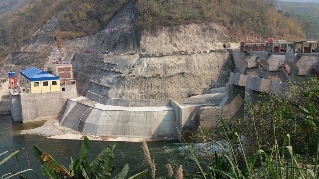
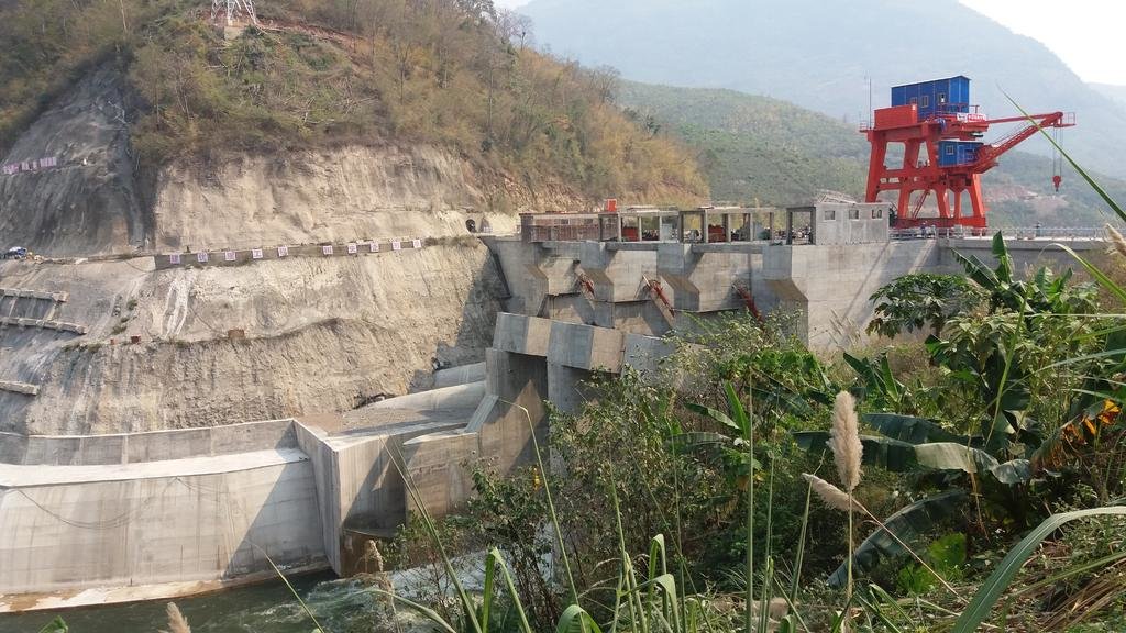
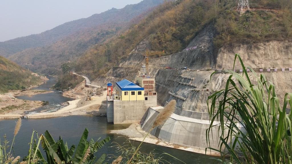
MidniteMapper was just doing some mapping work NE of Vientiane and sent this fantastic photo of the Xayabouri (Sayabouri) dam construction.


You can see more of Don's amazing photo's especially bridges in the below link:

Bridges of the Mekong | Laos GPS Map


8696624169_5f93f1ee6c_b.jpg
 
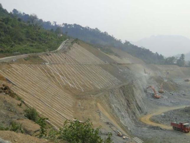
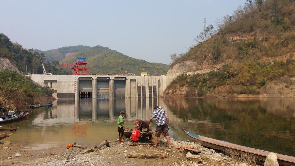
Just back from a mapping trip from Laos and just like MidniteMapper, as I was in the neighbor-hood, I could not resist a quick visit to the Xayaboury Dam.

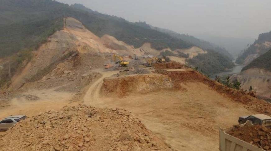
Just a small snapshot of the construction site as well as how the dam is supposed to look like once it is ready. It was quite dusty on the site as there were hundreds of trucks moving around as well as rock crushing going on in the mountains on the west side. More snapshots to follow in my brief trip report.

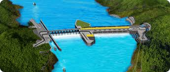
Mock-up of the dam.png
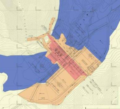
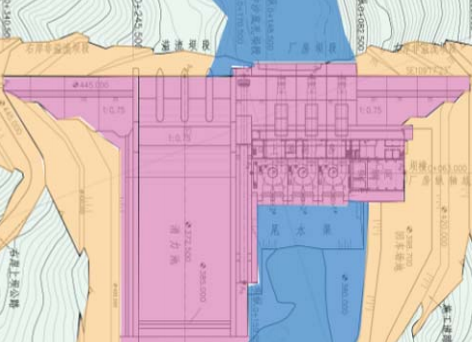
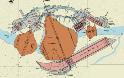
Mock up of the dam to study the effects of the newly designed silt removal system and spillway on the left hand side and the new fish ladder on the right hand side. On the far left side there will be a navigation lock so that boats can pass the dam while the electricity generating system is on the right hand side.

XYB Dam.jpg
 
Not sure about it but I guess that the other Run of River Dams planned in the Mekong in Laos (Pak Beng, Nam Ou/Luang Prabang, Paklay, Xanakham, etc.) will have a navigation lock as well probably with the exception of the Don Sahong Dam in the 4000 island area.
 
Midnitemapper.jpg

Just having a peek over the hill,
Check out some more Mekong Dam Photos
Mekong Dam


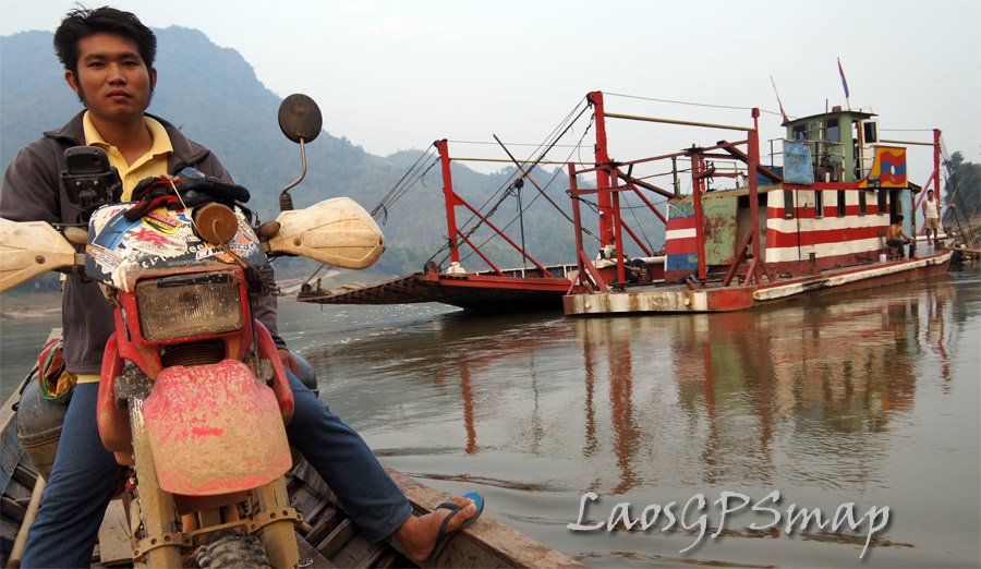
laosgpsmap-mekong-crossing.jpg

I am quite happy to report there is great trail riding South and North of Saya, please do not try river crossings at night like silly Falong me.
 
bridge.jpg
Funny bridge in the middle of the river
buffalo.jpg
Wild Life yawn
elyphant.jpg
Getting ready for a day of logging
ooil.jpg
I am at the mercy of these villagers, please find some oil for my bike, it does not run too well with all that water in the crankase.
rider.jpg
Nai Ban
 
mekong.jpg
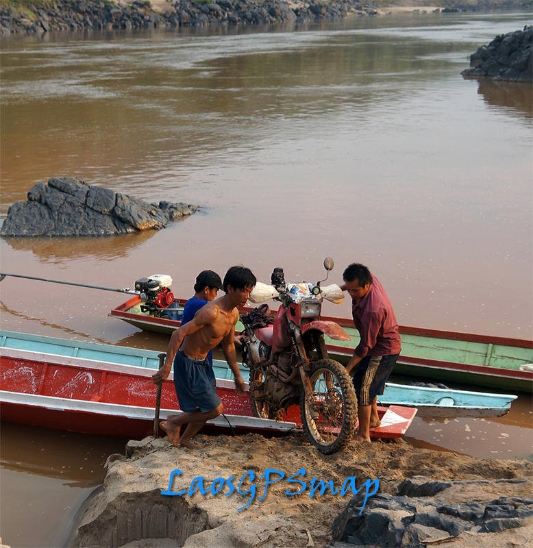
Too muddy after the rains to return on the small tracks that got me up in the mountains, so I retreated to the river where the boatman made a killing on my rescue.

wild-animals.jpg
The last herd of Elephants?

peanuts.jpg
Hmong Village
mekong-sand.jpg
The Beach, great sand riding!
 
Just back from a mapping trip from Laos and just like MidniteMapper, as I was in the neighbor-hood, I could not resist a quick visit to the Xayaboury Dam.

Just a small snapshot of the construction site as well as how the dam is supposed to look like once it is ready. It was quite dusty on the site as there were hundreds of trucks moving around as well as rock crushing going on in the mountains on the west side. More snapshots to follow in my brief trip report.

View attachment 16775
Mock up of the dam to study the effects of the newly designed silt removal system and spillway on the left hand side and the new fish ladder on the right hand side. On the far left side there will be a navigation lock so that boats can pass the dam while the electricity generating system is on the right hand side.

View attachment 16774

Well, they had a small mishap at the dam as the water in the Mekong suddenly rose some 3 meters and flooded the dam site. Story here:

Xayaboury dam construction halted as Mekong rises, floods site

Construction of the Xayaboury hydropower plant in northern Laos was halted after the Mekong River rose to exceptionally high levels and water flooded a portion of the site on Tuesday. The dam's flooded construction site inundated by the swollen river caused by the unseasonal heavy rain. Work on the dam's spillway had to stop when water flowed over the temporary barriers and lower parts of the area were submerged, the Xayabouri Power Company, owner of the US$3.5 billion hydropower project, announced yesterday. The Mekong River's water level rose sharply and unexpectedly by around 3 metres over December 16-17, according to a statement from the company. The statement said this sort of event was exceptional for this time of year. Water started leaking into the main construction pit on the morning of December 17 and by the end of the day the lower parts of the site were underwater.

XYB Dam flooded.png

Lao weathermen said they spotted heavy rainfall in southern China and northern Laos earlier this week. In Phongsaly province, rain was measured at around 100 millimetres. It was this unseasonal downpour that caused the Mekong River's levels to rise. The company said though a portion of the site was flooded, all mobile equipment had been safely moved to higher ground. No one was injured and there are no environmental impacts expected, the company said. The company will pump the water out and resume work next week.

“Water levels are expected to recede by the end of this week based on forecasts for Luang Prabang. After that the water will be pumped out from the construction pit. This operation will take about one week after which construction works will resume,” the company said in response to inquiries from Lao news media on Tuesday.

Construction of the 1,285 MW Xayaboury hydropower plant on the mainstream of the Mekong River began at the end of 2012 after the Lao government addressed concerns raised by Mekong River Commission member countries. Commercial operation is expected to begin in 2019. The project will create jobs for Lao people and the export of power to Thailand will earn foreign reserves to help reduce poverty in the Lao PDR.

Vientiane Times
 
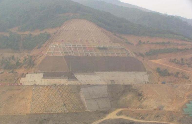
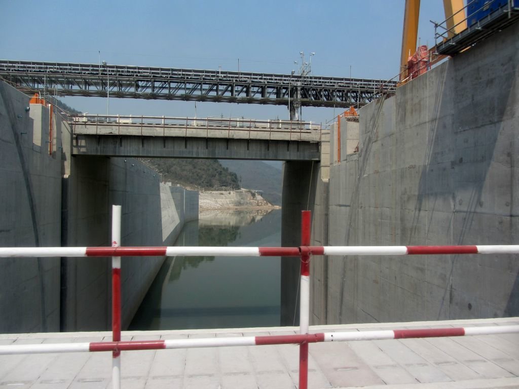
Got another picture of the Xayaboury Dam which was taken a few weeks after the sudden rise of the water level in the Mekong flooded the building pit. This is the view as seen from the south of the site (down-stream side) and shows the construction of the spillway and the navigation lock. The spillway and the navigation lock are expected to be ready on schedule in late 2014.

XayabouryHydroPower.png


IntermediateBlockWallXayaboury.jpg

Diagram of the construction of the spillway and the navigation lock
 
Nam San (Nam Xan) 3A & 3B

Still early days (March 2014) so there was not much to see yet other than the sign and a lot of earth moving going on. The sign indicated that it was only 2.5 Km. to the site but that was to the project office and I had to travel another 14 km. to get to the project site of the Nam San 3B dam.

IMG_7799.jpg

Site location north-east of Rd 1D with the turn-off to the project site just north of Thathom

IMG_7810.jpg


IMG_7805a.jpg


IMG_7804.jpg


IMG_7806a.jpg


IMG_7808.jpg


IMG_7812a.jpg


The river is being diverted to enable the dam builders to get on with their job
IMG_7820a.jpg


IMG_7816.jpg


IMG_7819.jpg


IMG_7821a.jpg


Nice views to the east from where the dam will be constructed and from here it is another 16-17 km. before you reach Rd 3908 at Ban Phouviang on the road from Phonsavan to Muang Moc (Mork)
IMG_7818a.jpg
 
The Nam Ngiep 3 Hydropower system

While spending a few days in Phonsavan I made a trip to check on some roads as well as have a look at the Nam Ngiep 3 hydropower system near Mueang Khoune. This hydro-power system is built on the Nam Ngiep river and further south the Nam Ngiep 2 (180 MW) and 1 (260 and 19 MW) are being constructed before the Nam Ngiep flows into the Mekong river a bit west of Pakxane on Rd. 13 South.

Nam Ngiep 3 is a smallish system (no information available on its size) and construction started around 2011 more or less at the same time as the Nam Ngiep 2 dam. Here are some pictures of the project:

The reservoir filling up
IMG_7916.jpg


The intake structure
IMG_7915.jpg


Part of the spillway structure
IMG_7874.jpg


IMG_7882.jpg


View towards the location of the powerhouse site and the access road to the Nam Ngiep 2 hydropower system
IMG_7883.jpg


Water from the power station channeled back into the Nam Ngiep river
IMG_7884.jpg


The powerhouse and the access road to Nam Ngiep 2
IMG_7886.jpg


Powerhouse at N19.28925 E103.34171 and the Nam Ngiep river in the background
IMG_7887.jpg
 
Nam Khan 3

Nam Khan 3 - posted earlier but the post disappeared during problems with the server

The construction of Nam Khan III hydropower dam has been reported as over 20 % complete since construction commenced in late 2012. An investment of Electricite du Laos (EDL), the dam is located on the Nam Khan River, between Ban Done Mo and Ban Khone Wai, five km north of Xieng ngeun District and 24 km southeast of Luang Prabang. The dam is expected to be fully complete by mid 2016. At US$132 million, the dam will be 154m in length and 67m high. It will be installed with two 30MW generators.

el13.jpg


Source: :: KPL :: Lao News Agency

During one of my last Laos trips I was in the neighborhood of this dam and I had a look at the dam-site as well as the resettlement area.

The same cofferdam shown in the picture in the KPL News paper
IMG_8104.jpg


Artist impression on how the Nam Khan 3 Hydropower project will look like when ready
IMG_8093.jpg


IMG_8106a.jpg


The base of the dam and the pipe which will channel the water from the reservoir to the powerhouse
IMG_8099.jpg


IMG_8114a.jpg


IMG_8117a.jpg


Preparing the site for the powerhouse
IMG_8105.jpg


Intake and the Outlet of the Diversion Channel of the Nam Khan river. This channel will be closed once the dam is complete.
IMG_8081a.jpg


IMG_8121a.jpg


Some villages will be inundated by the reservoir so the people will have to move to the resettlement village which is being built near Xieng Ngeun
IMG_8139.jpg


IMG_8135.jpg


IMG_8141.jpg
 
Last edited:
Got another picture of the Xayaboury Dam which was taken a few weeks after the sudden rise of the water level in the Mekong flooded the building pit. This is the view as seen from the south of the site (down-stream side) and shows the construction of the spillway and the navigation lock. The spillway and the navigation lock are expected to be ready on schedule in late 2014.

XayabouryHydroPower.png


IntermediateBlockWallXayaboury.jpg

Diagram of the construction of the spillway and the navigation lock

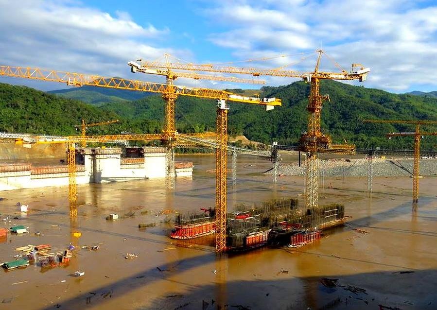
I had the plan to go again to the Xayaboury Dam construction site during my last trip to Laos but that did not work out so I am using some pictures taken by someone else (mainly taken in February and March this year) of the construction of the Xayaboury Dam. The construction seems to be more or less on schedule even-though they had a set-back when the construction site flooded in December last year. They have started preparatory work for the second stage upstream cofferdam and it is expected that by June next year the Mekong river is blocked and sometime late this year or early next year ships going up/down stream should use the navigation lock on the west side in order to pass the dam construction site.

The next step in the construction - removing the 1st up-stream and down-stream cofferdams and opening the spillway, start using the navigation lock and constructing the 2nd up-stream and down-stream cofferdams to facilitate the construction of the dam/powerhouse.
XayabouryDamNextstep.jpg


Night time view of the construction area
XayabouryDamworkingarea.jpg


Construction of the spill way structure
XayabouryDamSpillway.jpg


Construction of entrance to the navigation lock
XayabouryDamNavigationLock.jpg


Construction of the Intermediate block which separates the spillway from the dam/powerhouse
XayabouryDamIntermediateBlock2.jpg


XayabouryDamIntermediateBlock17.jpg


XayabouryDamIntermediateBlock.jpg


Start excavation of the area for the powerhouse
XayabouryDamExcavatingPowerHouseArea.jpg


Start of the construction of the 2nd up-stream cofferdam
XayabouryDamUpstream2ndCofferdam.jpg


See also http://www.rideasia.net/motorcycle-forum/laos-information/2170-xayaboury-dam-mekong-river-laos.html for some opposing views to the Xayaboury Dam
 
Stage 2 of Xayaboury dam set to begin

A major milestone in construction of the US$3.5 billion Xayaboury Hydropower Project will be reached later this month when work shifts from the Xayaboury province side to the Luang Prabang province side of the Mekong River. Preparations are under way to make the shift. Major work on the navigation lock, spillway and intermediate block has been ongoing on the Xayaboury side of the river since December 2012 and is nearly complete.

Phase1.png

Phase 1 of the Xayaboury Dam - Construction of the Navigation lock, Spillway and Intermediate block

Stage 2 of construction will begin on the Luang Prabang side later this month when a coffer dam is put in place to shift the water flow. The exact date for the event has yet to be confirmed. High-ranking government officials are expected to attend the ceremony. “Moving construction to the other side of the river will be a major milestone for this world-class project,” said Deputy Minister of Energy and Mines Mr Viraphonh Viravong. In mid-2015, construction will begin on the powerhouse and fish passage facilities. Commercial operation of the 1,285 MW dam is slated to begin in 2019. The dam's operational phase covers 29 years of the concession agreement from 2019 to 2048, before ownership is transferred to the Lao government.

Phase2.png

Phase 2 of the Xayaboury Dam - Construction of Powerhouse and Fish ladder

Source: Vientiane Times, 5 Jan 2015
 
Full stream ahead at Xayaburi, Lao PDR

Xayaburi%20-%20Mekong%20river%20flowing%20through%20the%20low%20level%20outlet%20gates.jpg


Another milestone has been reached at the Xayaburi 1285MW HEP on the Mekong River as water started flowing though the low-level outlet (LLO), part of the Phase I works, earlier this year. The coffer dam is now being constructed for the Phase II works which includes the powerhouse and the fish passages.

Source: Water-flowing-at-xayaburi

And a picture from the other side (northern side looking south)

11xaya%201025x300%20copy.jpg
 
There's been a lot of talk about the "fish ladder". Is it true that ONLY salmon know how to do this?

Phase2.png

Indeed, there has been a lot of talk about it and during the last few years there have been a lot of studies on these "ladders" and the "fish ladders" have been redesigned/improved, etc. As a result, the proponents say the fish ladder systems will now work while the opponents are sure that they still don't work. As I am not a "fish ladder" expert, I'll just have to wait and see who is right.

An article about the re-design of the fish-ladder/lift/passage:

laos-xayaboury-redesign-addresses-concerns-consultants-say
 
Last edited:
The Nam Ou Cascade Hydropower project

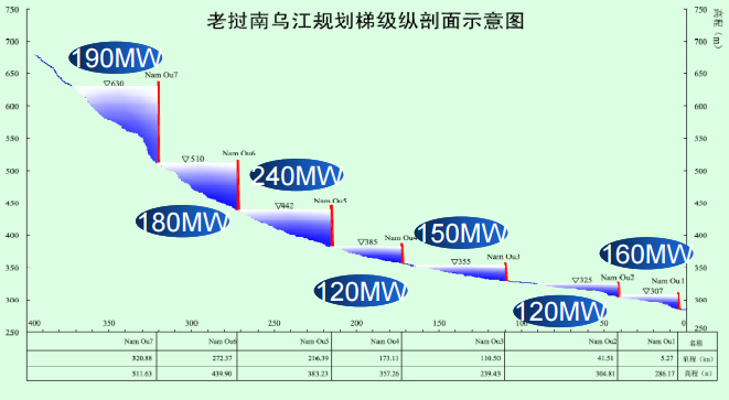
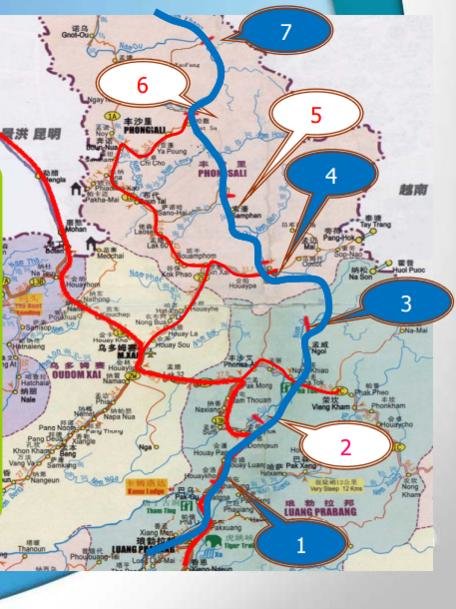
The Lao government and Chinese hydropower developer Sinohydro are working in cooperation towards the construction of seven hydropower projects (HPP) and 2 major reservoirs on the Nam Ou River in northern Laos. The project is a joint development by Electricite du Laos (EDL) and Sinohydro, in which Sinohydro will hold an 85 percent share and Electricite du Laos (EDL) a 15 percent share. The seven dam projects will span over 350 kilometres of the river and have an installed capacity of approximately 1,156 MW. Financing of the US$2 billion project is reportedly being provided by the China Development Bank. Given the enormity of the project, China’s state-owned Sinohydro Corporation has divided the 10-year construction period into two stages. During the first phase, HPP 2, 5 and 6 will be built and are intended to be operational by 2018 under the build-operate-transfer model, each of which will have a 29 year concession period. The second phase, consisting of the Nam Ou 1, 3, 4 and 7 HPP will be built at a later stage once there is a market for the electricity to be generated.

The Lao government and Sinhydro will build a total of seven hydropower plants on the Nam Ou under the build-operate-transfer (B.O.T.)model. Currently the installation of one of the three generators is being carried out by the company and it is expected to finish construction and installation by September 2015 and the first turbine of the Nam Ou 6 HPP is set to start generating electricity by November 2015 along with the first generator of the Nam Ou 2 HPP and Nam Ou 5 HPP respectively.

With the exception of HPP 2, environmental impact assessments of the other six dams and Resettlement Action Plans for affected communities have not been released publicly, as required by Lao law. Sinohydro’s own environmental policy – which restricts the company from being involved in hydropower developments in national parks – is also being violated due to the planned inundation of sections of the Phou Den Din NPA.

HPP 1234567 altitude.PNG HPP 1234567.jpg
Location of the 7 individual hydropower projects in the Nam Ou river in Laos

Some info and pictures of the three hydropower projects

The Nam Ou 2 HPP is located in Ngoi district of Luang Prabang province and will have an installed capacity of 120 MW.

uN6pgguk9L8RrkB0qumtkyD2ePDG4WjhfOhrRRgmSG4=w852-h478-no

T2uh3nYfMx9p0NNH5kISHimL1NmwE8VcsWnFEVBAxU8=w782-h517-no

Pictures Copyright http://www.laoenergy.la/

HPP 2.PNG
Nam Ou 21.jpg
Pictures Copyright Sinohydro

Some more pictures in my trip report from April 2014 - http://www.rideasia.net/motorcycle-forum/showthread.php?t=5373&p=41944&viewfull=1#post41944


The Nam Ou 5 HPP is located in Samphan district of Phongsaly province and will have an installed capacity of 240 MW.

6SuOdwGNyA7OG2kuJeO89WIMgZqfprFrwMqihCQNGeg=w1131-h634-no

Pictures Copyright http://www.laoenergy.la/

HPP 5.PNG
Nam Ou 5.jpg
Pictures Copyright Sinohydro

http://www.rideasia.net/motorcycle-forum/showthread.php?t=2951&p=22357&viewfull=1#post22357 (Trip report December 2012)
http://www.rideasia.net/motorcycle-...-off-road-surveying-bloody-freezing-cold.html (Trip report from January 2015)


The Nam Ou 6 HPP is located in Phongsaly district of Phongsaly province and will have an installed capacity of 180 MW.

qS-7GGhvKc8neS0jOI9YNhxnpygs_HIddh_LFeUzYBs=w846-h634-no

Pictures Copyright http://www.laoenergy.la/

HPP 6.PNG
Nam Ou 61.jpg
Pictures Copyright Sinohydro

Went there in 2012 but could not get access to the site nor get close to the site
 
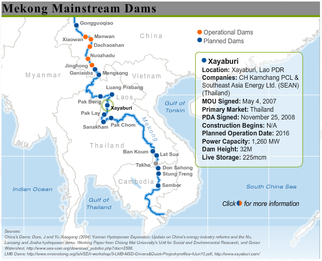
A nice overview of all the dams built and planned on the Mekong river. There is an interactive version of this map available on the website of the Stimon Center which provides more info on each of the individual dams built/planned at Interactive Mekong Map/.

Mekong Dams.PNG
 
Just found a panoramic picture which some of you might find interesting of the construction of the Xayaboury Dam taken by Richard Cronis of the Stimson Center. The picture was taken on December 2014 during a site visit to the dam area.

LP-Panorama-of-Xayaburi-Dam-Rich.jpg

Copyright: Richard Cronin, Senior Associate, The Stimson Center, Washington, USA - http://www.stimson.org/
 
Two ongoing dam projects on the Nam Khan river.

View attachment 21949

More Photos @ Laos Dams

LaosGPSmap.com


Luang Prabang to trial Nam Khan 2 dam next month

Energy generation at the Nam Khan 2 dam in Luang Prabang province is expected to get underway in September after the reservoir that supplies water to the dam began filling on 18 April when they lowered the 276 ton weighing diversion tunnel gate. Construction began in 2011 in Xieng Ngeun district and “is now 99.44 percent complete”. “Based on current progress, we will start testing energy generation on September 25.” The testing will take about three months or until the end of December, after which the dam will be handed over to Electricite du Laos (EDL).

The Nam Khan 2 dam is a government project that will be managed and operated by EDL. The project involves total investment of about 2.4 trillion kip (US$308 million) which has been borrowed from the Exim Bank of China. It has an installed capacity of 130 megawatts (MW) and will be able to generate 558 GWh of electricity per year that will be transmitted via a 115kV transmission line to a substation in Xiengngeun district to supply the northern provinces and Vientiane.

Source: Vientiane Times, August 31, 2015.

Note LR: The dam is located on the Nam Khan river at N19.67975 E102.36973 which is about 38 km (along the road or about 20 km. in a straight line) south-east of Xieng Ngeun on Rd. 13 North

Nam Khan 2 HPP 1.jpg
Screen grab from Google Earth of the location of the Nam Khan 2 hydro power project (center-right)
 
So much for the consultative process!! Laos forges ahead, the rest of the Lower Mekong countries be damned.

Mac

http://thediplomat.com/2015/09/laos-officially-approves-controversial-dam-project/


[h=1]Laos Officially Approves Controversial Dam Project[/h]Parliament okays concession agreement for Don Sahong project despite regional concerns.

thediplomat_2015-01-27_18-57-02-36x36.jpg

By Prashanth Parameswaran
September 04, 2015


1


1 Shares
0 Comments


Laos’ parliament has approved the concession agreement for a controversial dam project, with construction expected to begin before the end of 2015, media sources reported earlier this week.
As I wrote in a previous piece for The Diplomat, the proposed 260-megawatt Don Sahong hydropower project is critical part of the Lao government’s hopes to transform the country into “the battery of Southeast Asia,” with revenues generated from exporting power to neighboring countries. But the other three neighboring countries in the lower Mekong – Thailand, Cambodia and Vietnam – have repeatedly called for construction to be halted because they fear the project will dramatically alter the flow of the Mekong River and disrupt the migration of fish to the detriment of downstream communities in neighboring countries (See: “Laos Dam Risks Damaging Mekong River, Igniting Tensions With Vietnam”).
On September 1, according to The Phnom Penh Post, Daovong Phonekeo, director general of the Energy Policy and Planning Department at the Lao Ministry of Energy and Mines, confirmed in an email statement that the National Assembly had approved the concession agreement for the Don Sahong dam with Malaysian developer MegaFirst. He added that a power purchase agreement between state-owned Electricite du Laos and the company was awaiting signature and construction would begin before the year ends.
The move further confirms what many have feared – that despite several protests, delays and adjustments, the Lao government is determined to eventually complete the Don Sahong project. In June, Laos and its neighbors failed to reach agreement on the dam through the Mekong River Commission (MRC), a body designed to facilitate inter-governmental consultations before the construction of new dams. The MRC said the matter would be referred to governments to resolve through diplomatic channels, which some read as a further blow to sub-regional consensus.
The Don Sahong dam is the second project to undergo the MRC’s process of prior consultation following the 1,285-megawatt Xayaburi dam located on the mainstream of the Mekong River in Laos.

 
A nice overview of all the dams built and planned on the Mekong river. There is an interactive version of this map available on the website of the Stimon Center which provides more info on each of the individual dams built/planned at Interactive Mekong Map/.

View attachment 39975

Some more news on Mekong dams:

"Don Sahong Dam" Construction of the dam is expected to start in November this year according to the Vientiane Times of yesterday

Don Sahong project to begin construction in November - VT Times, September 22, 2015

The 260-MW Don Sahong hydroelectric project is anticipated to begin construction before the end of this year after a number of agreements related to the project have been signed to guide the project's go ahead. The Lao Ministry of Energy and Mine's Policy and Planning Department Director General Dr Daovong Phonekeo told Vientiane Times on Monday that “I think that the construction of the project is expected to commence in November and should be operational in early 2020.”

“Our National Assembly has approved the project's go ahead and the concession agreement between the government and developer have been inked but the purchasing agreement related to the project has yet to be signed.” Dr Daovong said electricity generated by the project in the Hou Sahong Channel of the Mekong River in southern Laos would be sold to Laos' state-owned Electricité Du Laos (EDL) under a power purchase agreement which will soon be signed. The construction of the run-of-river project will come at the cost of about US$500 million and the concession period has been set at 25 years.


"Pak Beng Dam" KPL Newspaper reports that the government and the developer brainstormed yesterday the sustainable development of the Pak Beng hydro powr projecy during a high level technical consultation workshop.

(KPL) The Lao government and the potential developer of a Pak Beng hydropower project met yesterday to discuss the development of the hydropower project with a focus placed on ensuring that it is sustainable, environmentally friendly, and favourable for socio-economic development. At the Pak Beng hydropower project high-level technical workshop, the project developer “China Datang Overseas Investment” made a presentation about the Pak Beng hydropower project’s design which will feature a barrage structure, fish passage, navigation lock, and sediment passage area.

The objective of the workshop was to hear information from the world-renowned consultant French firm Compagnie Nationale du Rhône” (CNR) which has been hired by the Lao government to find out whether the project’s design is feasible and in compliance with the 1995 Mekong Agreement. Once the project is approved by the Lao government, all information about the Pak Beng hydropower project will be submitted to Mekong River Commission member countries and international organizations so that they may comment on the project. High-ranking officials from line ministries and other relevant sectors attended the workshop.


Model Pak Beng Hydropower project.png
Model of the Pak Beng hydro power project
 
Xayabouty HPP - Powerhouse construction Pit September 2015

Just found a panoramic picture which some of you might find interesting of the construction of the Xayaboury Dam taken by Richard Cronis of the Stimson Center. The picture was taken on December 2014 during a site visit to the dam area.

LP-Panorama-of-Xayaburi-Dam-Rich.jpg

Copyright: Richard Cronin, Senior Associate, The Stimson Center, Washington, USA - http://www.stimson.org/

Some more recent pictures of the Xayaboury Hydro Power project of the construction of the Powerhouse - Pictures Copyright Xaosaiya - https://www.facebook.com/xaosaiya

12047119_825886167510399_3066186671123458712_n.jpg

Looking south

12119098_825886187510397_894329368168740236_n.jpg

Aerial view of the powerhouse construction pit

12079658_825886230843726_4754098575323031593_n.jpg


12046717_825886197510396_1865387225769110412_n.jpg
 
The Nam Ou Cascade Hydropower project

During the first phase, HPP 2, 5 and 6 will be built and are intended to be operational by 2018 under the build-operate-transfer model, each of which will have a 29 year concession period. The second phase, consisting of the Nam Ou 1, 3, 4 and 7 HPP will be built at a later stage once there is a market for the electricity to be generated.

View attachment 39894 View attachment 39895
Location of the 7 individual hydropower projects in the Nam Ou river in Laos

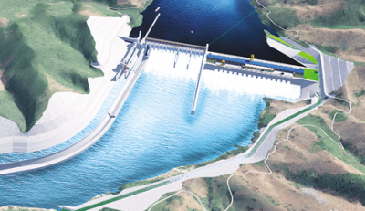
It seems that the market for electricity is OK as work has started on the Nam Ou 1 hydropower project.

IMG_3478.JPG

IMG_3477.JPG
 
Nam Ngum 3 construction again kicked off

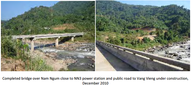
The construction of the Nam Ngum 3 Hydropower Project appears to be restarted again after a "false start" a few years ago when the Thai company which was going to construct the Nam Ngum 3 project constructed the basecamps for the dam and powerhouse as well as access roads in the area west of Long Chaeng and Nam Ngone. Some of you have made use of part of the access roads and the new bridge over the Nam Ngum river when travelling from Vang Vieng/Nam Mone to Long Chaeng.

Access road to NN3 Powerhouse.jpg
The access road to the Nam Ngum 3 Power House

Bridge NN3.PNG

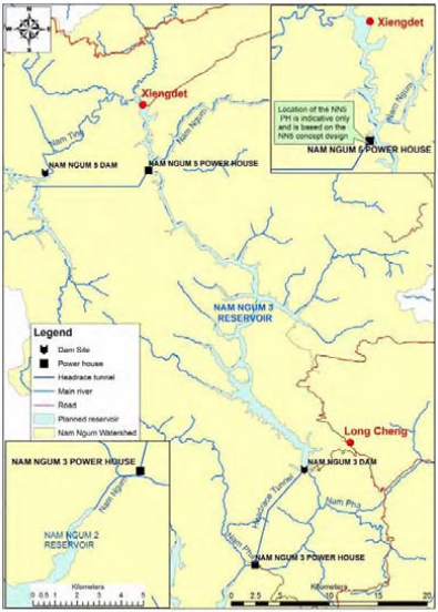
NN3 and 5.PNG
Location of Nam Ngum 3 Hydropower Project

Last week a groundbreaking ceremony for the construction was held in Vientiane Capital on 11 November in the presence of Deputy Prime Minister Somsavat Lengsavad, the minister of Energy and Mines Khammany Inthilath, the Xaysomboun governor, the Xieng Khuang deputy governor, and Chinese Ambassador to Laos, Mr Guan Huabing.

NAM-NGUM3N.jpg

Copyright: KPL Newspaper

The Nam Ngum 3 hydropower plant will have a a generation capacity of 480 MW. and is being built with a US$1.2 billion loan from EXIM Bank of China by the Sinohydro Company of China. Construction is expected to take about five years and be completed in 2020. The electricity generated by Nam Ngum 3 hydropower plant will be used for domestic consumption.
 
Indeed, there has been a lot of talk about it and during the last few years there have been a lot of studies on these "ladders" and the "fish ladders" have been redesigned/improved, etc. As a result, the proponents say the fish ladder systems will now work while the opponents are sure that they still don't work. As I am not a "fish ladder" expert, I'll just have to wait and see who is right.

An article about the re-design of the fish-ladder/lift/passage:

laos-xayaboury-redesign-addresses-concerns-consultants-say

Yesterday I had a chance to have a quick look at the Xayaboury Dam. Work is progressing with the Dam as well as the Fish ladder system. Below is a picture of the Fish ladder "in progress". The picture shows part of the fish ladder system (lower left of the picture) which is supposed to let the fish "climb" 5 meter of the 50 meters which will be the height difference between the downstream and upstream river at the dam. The concrete structure will be followed by a "fish left/elevator" which should bring the fish another 45 meters up from where they can migrate up the mighty Mekong.

IMG_3787.JPG
Part of the Fish Ladder / Migration system

In addition fish can migrate up the Mekong through the ship passage system which is 700 meter long and 12 meters wide so that ships up to 500 ton can pass the dam on their way up and down the Mekong

IMG_3800.JPG
The ship passage system
 
The fish ladder is over the other side. This shot shows the ship lift side. They are using this several times a day at present, with accumulator devices that attract the fish.....

xaya1-3455x969.jpg


Here's an overview from 500 metres.

sai3-X3.jpg
 
Here's a wider view with the fish ladder under construction

xaya2-2889x969.jpg
 
Re: Nam Khan 3

Nam Khan 3 - posted earlier but the post disappeared during problems with the server

The construction of Nam Khan III hydropower dam has been reported as over 20 % complete since construction commenced in late 2012. An investment of Electricite du Laos (EDL), the dam is located on the Nam Khan River, between Ban Done Mo and Ban Khone Wai, five km north of Xieng ngeun District and 24 km southeast of Luang Prabang. The dam is expected to be fully complete by mid 2016. At US$132 million, the dam will be 154m in length and 67m high. It will be installed with two 30MW generators.

el13.jpg


Source: :: KPL :: Lao News Agency

During one of my last Laos trips I was in the neighborhood of this dam and I had a look at the dam-site as well as the resettlement area.

The same cofferdam shown in the picture in the KPL News paper
IMG_8104.jpg


Artist impression on how the Nam Khan 3 Hydropower project will look like when ready
IMG_8093.jpg


IMG_8106a.jpg


The base of the dam and the pipe which will channel the water from the reservoir to the powerhouse
IMG_8099.jpg


IMG_8114a.jpg


IMG_8117a.jpg


Preparing the site for the powerhouse
IMG_8105.jpg


Intake and the Outlet of the Diversion Channel of the Nam Khan river. This channel will be closed once the dam is complete.
IMG_8081a.jpg


IMG_8121a.jpg


Some villages will be inundated by the reservoir so the people will have to move to the resettlement village which is being built near Xieng Ngeun
IMG_8139.jpg


IMG_8135.jpg


IMG_8141.jpg


Nam Khan 3 HPP - March 2016

Almost 2 year later and went to have another look at the Nam Khan 3 hydropower project. The dam is finished and they have started filling up the reservoir in order to test the turbines. Just some pictures.

20160310_100253.jpg
Panoramic view of the Power house and the Dam

20160310_100338.jpg

20160310_100335.jpg

20160310_100312.jpg

20160310_102741.jpg

20160310_102709.jpg
The reservoir is filling up and the spot where the people are repairing their boats is now under water
 
Just a quick look at the video I shot that day. I'll have to tidy up when I get to a desktop...

 
Yes, the fish ladder is useless for the fish that are in the Mekong. There are other types of jumping fish, but you are correct it is generally speaking only salmon that use ladders in dams. This is why all of the "run of river" dams on the Mekong are an ecological disaster, aside from the siltation issue. Most of the fish that are moving up and down the river are migrating during specific times and along a specific depth gradient. Some move along the bottom of the river, some higher up. None of them are going to use a fish ladder. What this means, as we've seen well documented at other dams (such as the Pak Moon Dam in Ubonratchathani) is that almost all of the fish species will not migrate past the dam. Even if the footings of the dams that only rise 1-3 meters from the riverbed will be enough to block a lot of the fish. The Xayaburi in particular has a long history of corruption and the "fish ladders" are just part of it. I've worked on issues around dams and the social/ecological impact for years, including Xayaburi and other dams in Thailand and Laos. Generally great for the people building the dams (very profitable), but a disaster for the ecosystems and broader communities impacted by the dams. There is a reason the only dams going up now are in developing countries, while a lot of developed countries are decommissioning and pulling down their dams where possible.
 
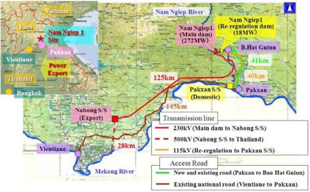
Nam Ngiep 1 dam

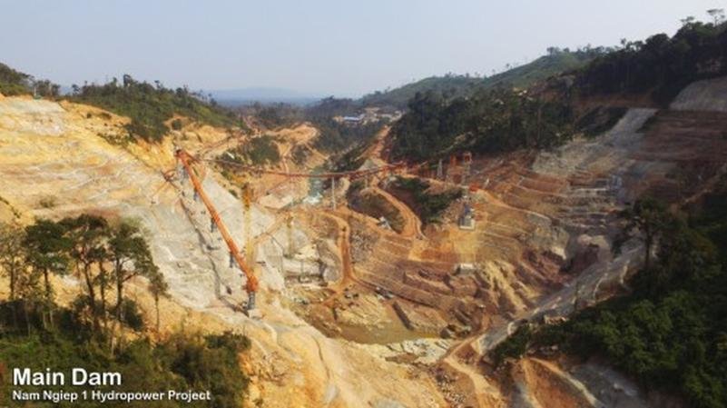
The Nam Ngiep 1 Hydropower Project (NNP1) has begun the construction phase for the highest Roller Compacted Concrete (RCC) gravity dam in Laos and highest ever constructed by a Japanese company. The dam is being built across the Nam Ngiep River in Borikhan district, Borikhamxay province and when complete, it will be 167 metres in height with a crest length of 530 metres, according to press release from the project.

Location Nam Ngiep 1 HPP.jpg

The official ceremony to mark the start of RCC placement in the dam was held yesterday at the dam site in Borikhan district, Borikhamxay province, and was attended by Deputy Minister of Energy and Mines Dr Sinava Souphanouvong, Deputy Minister of Finance Ms Thipphakone Chanthavongsa, Borikhamxay provincial Governor Dr Kongkeo Xaysongkham, Xaysomboun provincial Governor Major General Dr Thongloy Silivong, other high-ranking government officials, shareholder representatives, contractors and local communities.

RCC is a concrete mix consisting of cement and fly ash, locally quarried aggregates and water. It is a workable mix and more economical to place than conventional concrete. To attain its design characteristics, the RCC needs to be maintained at a temperature of no more than 24 degrees Celsius during delivery and placement to avoid thermal cracking during hydration as the concrete dries and gains strength. “The total concrete volume will be 2,300,000 cubic metres and this quantity will be placed by the fastest means currently available in the world in keeping with maintaining the high standards of quality,” Mr Yamabayashi added. At the NNP1 project, RCC is transported from the mixing plant along a 2km long belt conveyer to the dam, loaded into a truck, and dumped at the designated location. It is then spread by a bulldozer to create a 30cm thickness, and finally compacted by a 15 tonne vibration roller which passes over it four times until the design density is obtained. This process will be carried out 24 hours a day, seven days a week until completion of the dam, which is scheduled for May 2018.

Main Dam.jpg

Nam Ngiep 1 is a 290-megawatt installed capacity hydropower project under construction in Borikhamxay and Xaysomboun provinces. The project consists of the construction of two dams and two powerhouses along the Nam Ngiep River. Since construction started in late 2014, the project has made good progress, with about 40 percent of work completed at the end of April. The project will start generating electricity in January 2019 of which around 95 percent will be sold to Thailand with the remainder used for domestic consumption.

Source: Nam Ngiep 1 Hydro Power Project (Latest Update May 31, 2016)
 
Some more news on Mekong dams:

"Pak Beng Dam" KPL Newspaper reports that the government and the developer brainstormed yesterday the sustainable development of the Pak Beng hydro powr projecy during a high level technical consultation workshop.

(KPL) The Lao government and the potential developer of a Pak Beng hydropower project met yesterday to discuss the development of the hydropower project with a focus placed on ensuring that it is sustainable, environmentally friendly, and favourable for socio-economic development. At the Pak Beng hydropower project high-level technical workshop, the project developer “China Datang Overseas Investment” made a presentation about the Pak Beng hydropower project’s design which will feature a barrage structure, fish passage, navigation lock, and sediment passage area.

The objective of the workshop was to hear information from the world-renowned consultant French firm Compagnie Nationale du Rhône” (CNR) which has been hired by the Lao government to find out whether the project’s design is feasible and in compliance with the 1995 Mekong Agreement. Once the project is approved by the Lao government, all information about the Pak Beng hydropower project will be submitted to Mekong River Commission member countries and international organizations so that they may comment on the project. High-ranking officials from line ministries and other relevant sectors attended the workshop.


View attachment 40447
Model of the Pak Beng hydro power project


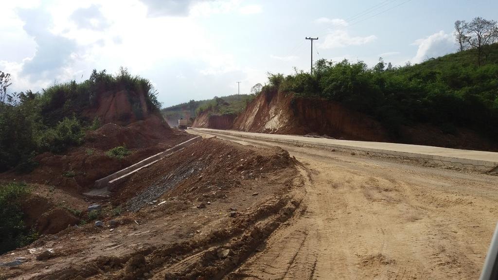
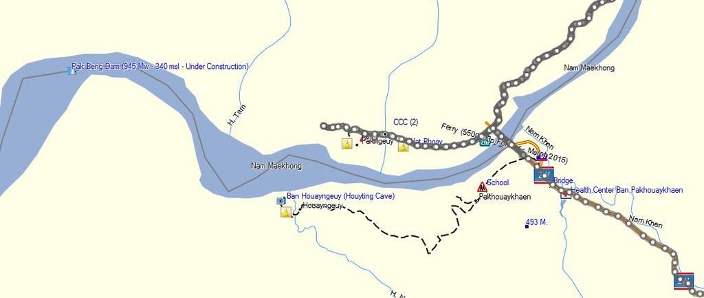
Work on the Pak Beng Mekong Dam (approximate coordinates N19.84998 E101.02309 or about 5 km. west from the new bridge over the Mekong) has started. While on my way back from Laos I tried to have a look but the staff of the Chinese construction company were very unhappy to see me. They could not stop me at the start of the road at the new bridge as there is a village (Ban Pakngeuy) along the road but once past the village they blocked the road with a big truck and forced me off the road. So just a picture of the concrete access road under construction and hopefully later some pictures of the construction work on the dam.

20160525_161836.jpg
The access road under construction

PBM Dam.jpg
Location of the Pak Beng Mekong dam in relation to the new Mekong bridge
 
It seems that the market for electricity is OK as work has started on the Nam Ou 1 hydropower project.

View attachment 40617

View attachment 40616

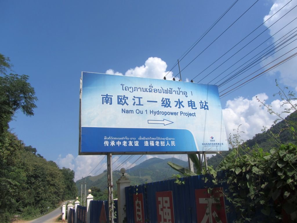
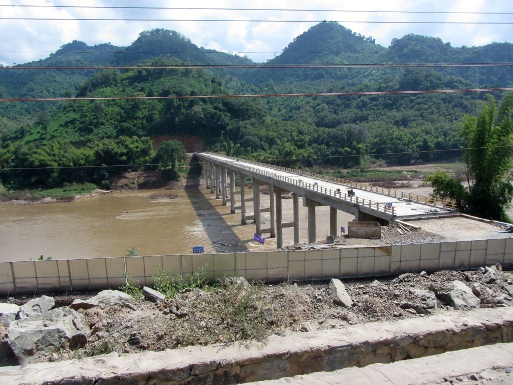
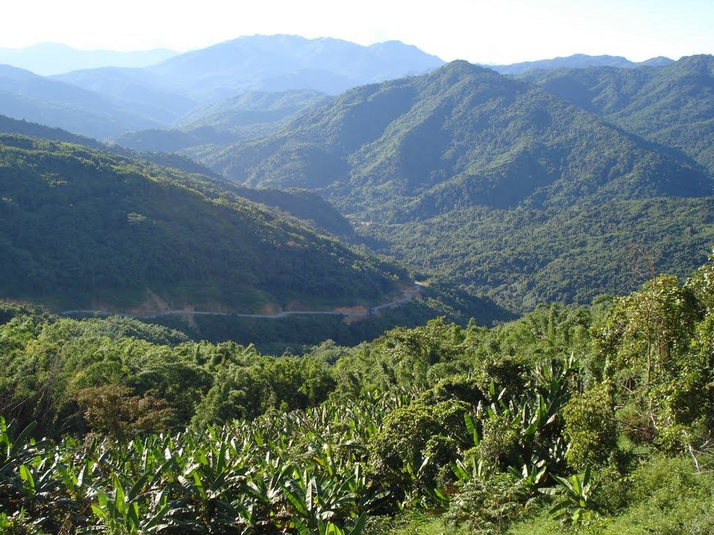
Was passing by the Nam Ou 1 HPP site a few weeks ago and work has now started in earnest. Just some pictures:

20160525_094219.jpg
Road 13 N and the offices of SinoHydro which builds the dam

20160525_094223.jpg
Preparation for the dam construction on the north side

20160525_094150.jpg
Tings are happening also on the south side

20160525_094323.jpg
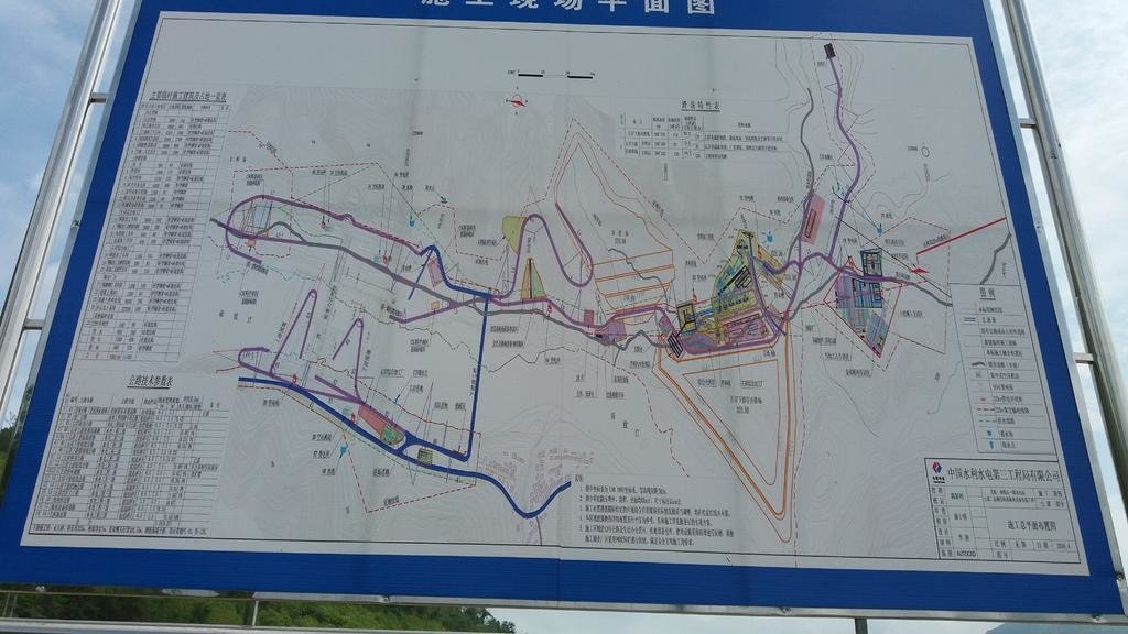
The construction plans
 
Back
Top Bottom