KTMphil
Senior member
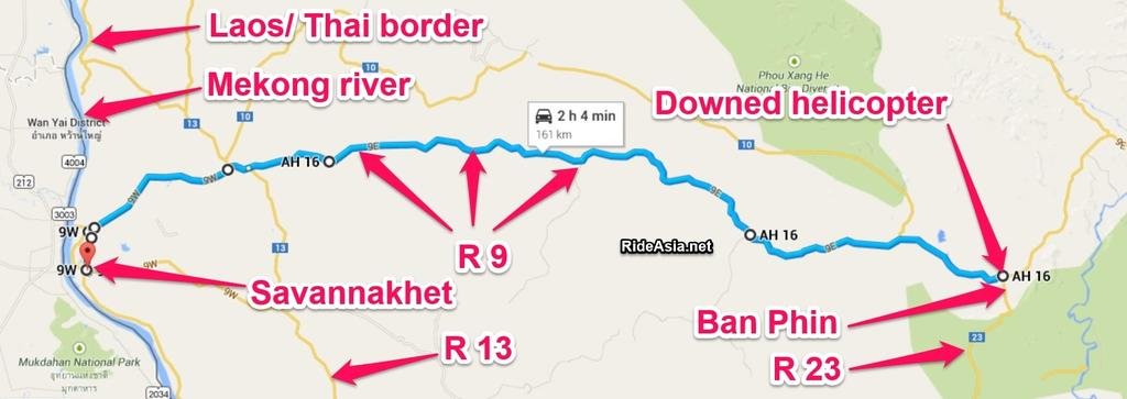
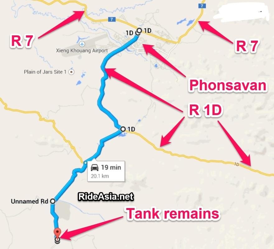
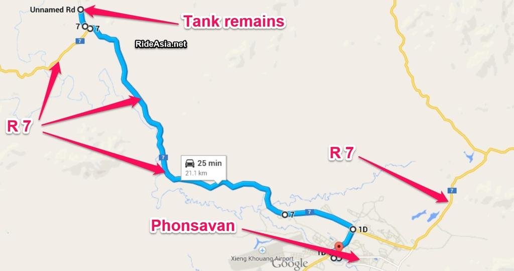
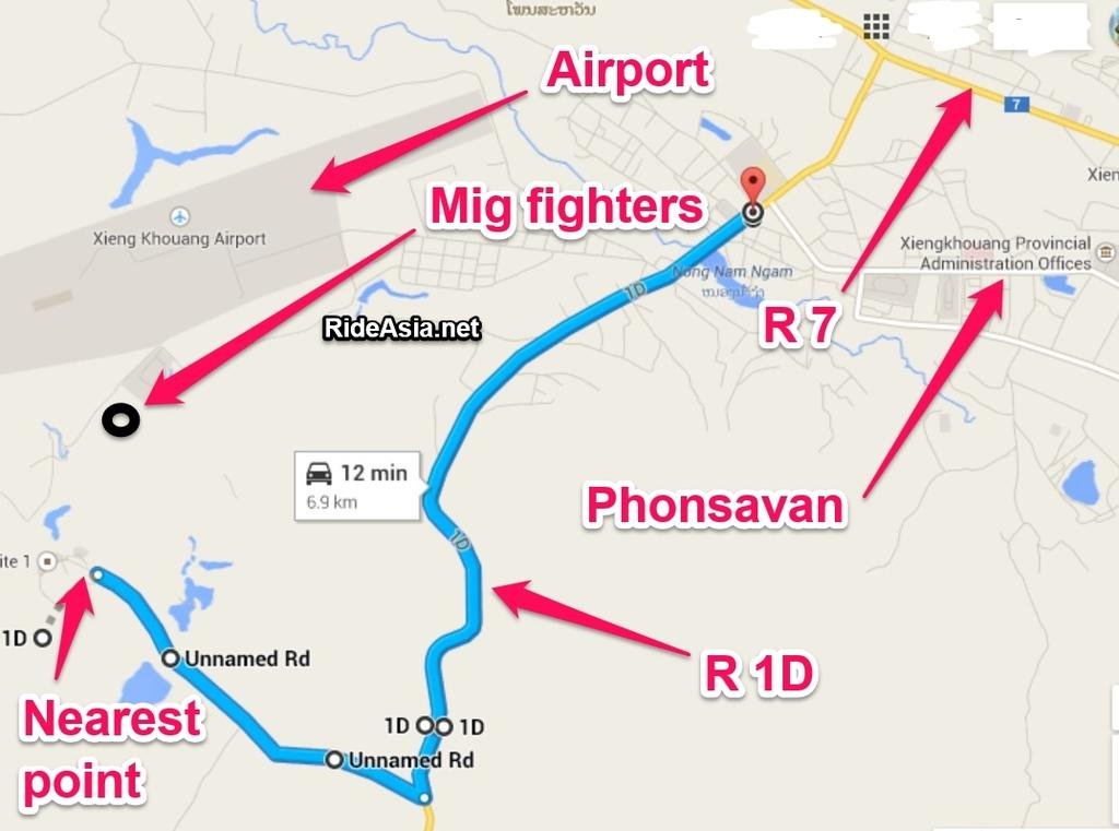
A lot of rider's that are headed towards south Laos, have the intention of immersing themselves in the Ho Chi Minh Trail history, but without some lengthy research, it's not too easy to actually to find things with significant, historic military interest away from tourist museums in larger towns.
Hopefully this thread will develop and give some useful information on how to make the most of the Ho Chi Minh Trail area in south east Laos towards the Vietnam border.
Anyone who has some interesting information(regarding the HMT in Laos), please contribute it here as the area is still a bit mysterious to all of us. Obviously make sure it's not copyrighted etc.......
A brief introduction from Wikipedia:
Ho Chi Minh trail - Wikipedia, the free encyclopedia
The Hồ Chí Minh trail (also known in Vietnam as the "Trường Sơn trail") was a logistical system that ran from the Democratic Republic of Vietnam (North Vietnam) to the Republic of Vietnam (South Vietnam) through the neighboring kingdoms of Laos and Cambodia. The system provided support, in the form of manpower andmateriel, to the National Front for the Liberation of South Vietnam (called the Vietcong or "VC" by its opponents) and the People's Army of Vietnam (PAVN), or North Vietnamese Army, during the Vietnam War.
It was named by the Americans for North Vietnamese president Hồ Chí Minh. Although the trail was mostly in Laos, the communists called it the Trường Sơn Strategic Supply Route, after the Vietnamese name for theAnnamite Range mountains in central Vietnam.[SUP][1][/SUP] According to the United States National Security Agency's official history of the war, the Trail system was "one of the great achievements of military engineering of the 20th century."[SUP][2][/SUP]
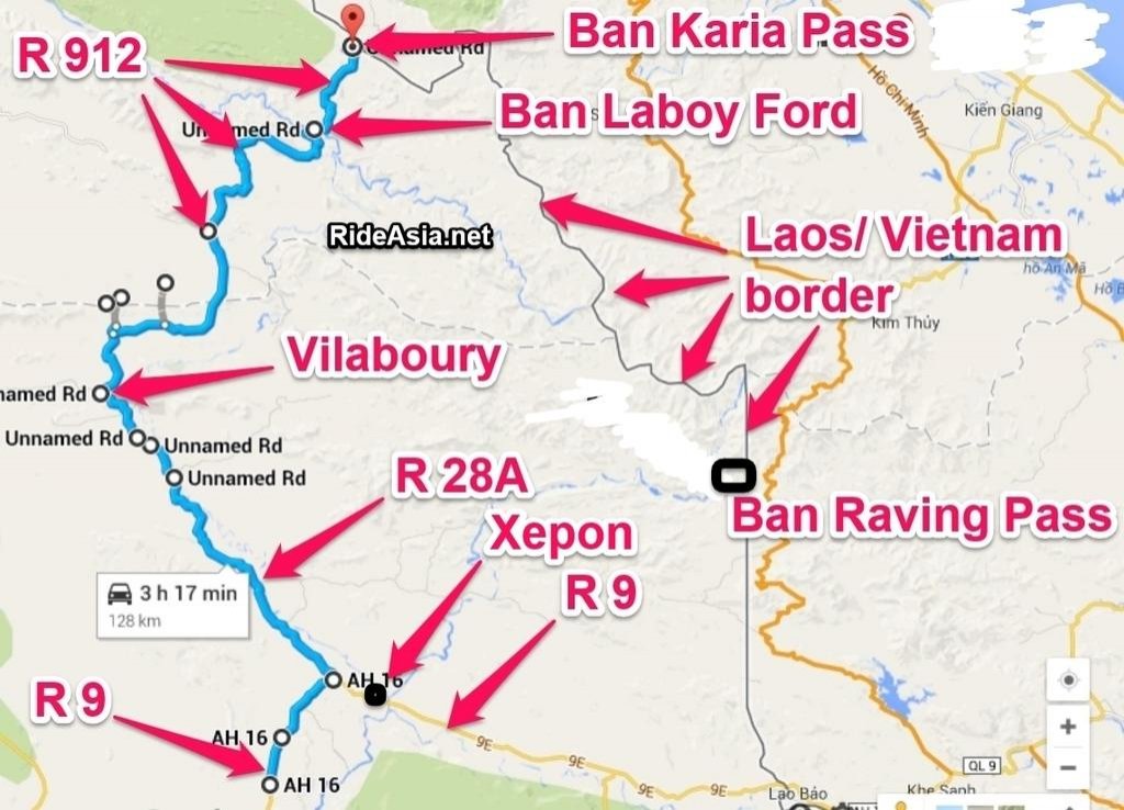
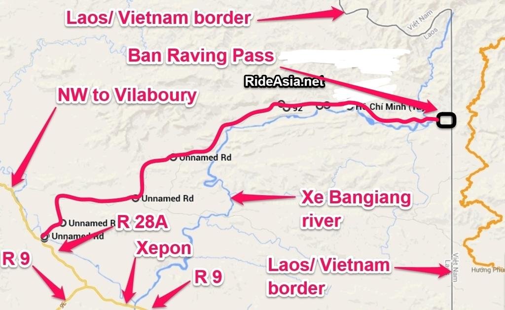
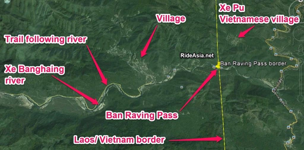
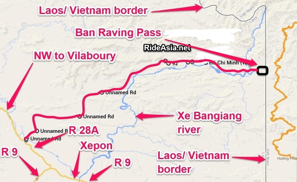
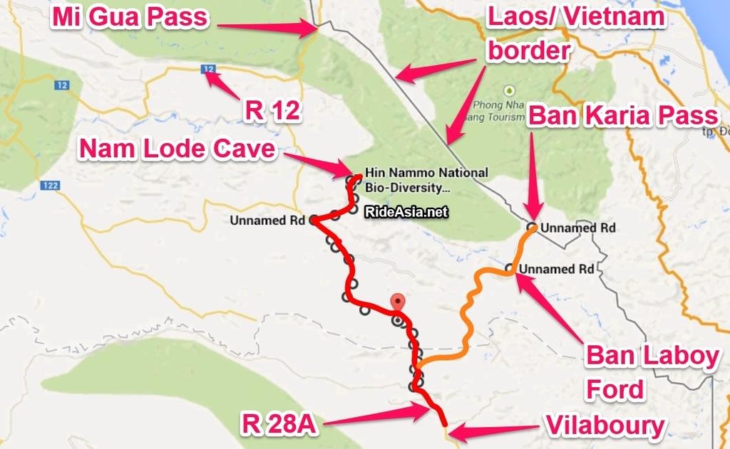
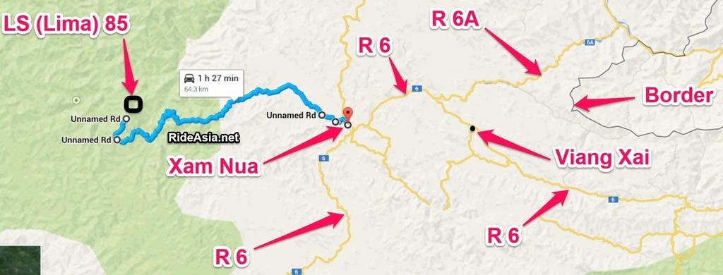
Maps below explain where the traffic areas are along the Laos/ Vietnam border:
 full map by Triangle Golden 007, on Flickr
 hmt wiki 1 by Triangle Golden 007, on Flickr
 hmt wiki by Triangle Golden 007, on Flickr
Hopefully this thread will develop and give some useful information on how to make the most of the Ho Chi Minh Trail area in south east Laos towards the Vietnam border.
Anyone who has some interesting information(regarding the HMT in Laos), please contribute it here as the area is still a bit mysterious to all of us. Obviously make sure it's not copyrighted etc.......
A brief introduction from Wikipedia:
Ho Chi Minh trail - Wikipedia, the free encyclopedia
The Hồ Chí Minh trail (also known in Vietnam as the "Trường Sơn trail") was a logistical system that ran from the Democratic Republic of Vietnam (North Vietnam) to the Republic of Vietnam (South Vietnam) through the neighboring kingdoms of Laos and Cambodia. The system provided support, in the form of manpower andmateriel, to the National Front for the Liberation of South Vietnam (called the Vietcong or "VC" by its opponents) and the People's Army of Vietnam (PAVN), or North Vietnamese Army, during the Vietnam War.
It was named by the Americans for North Vietnamese president Hồ Chí Minh. Although the trail was mostly in Laos, the communists called it the Trường Sơn Strategic Supply Route, after the Vietnamese name for theAnnamite Range mountains in central Vietnam.[SUP][1][/SUP] According to the United States National Security Agency's official history of the war, the Trail system was "one of the great achievements of military engineering of the 20th century."[SUP][2][/SUP]
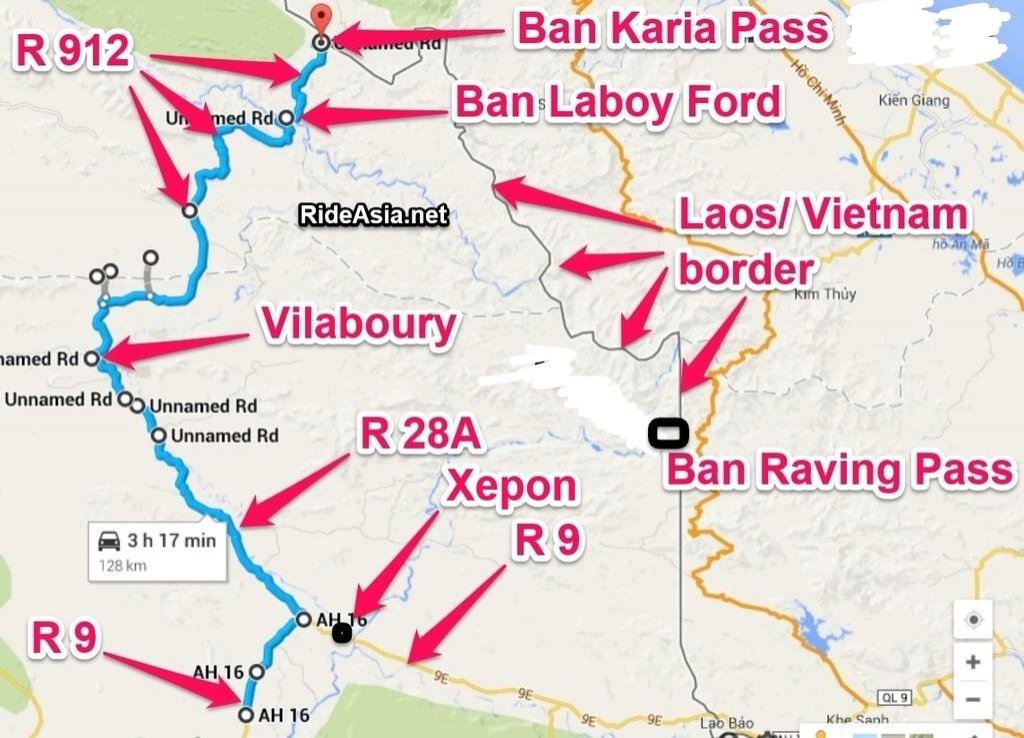
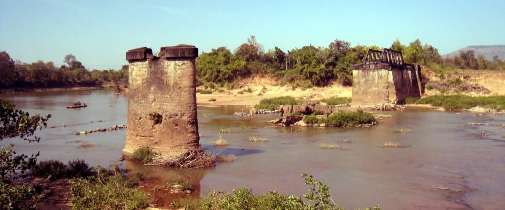
Maps below explain where the traffic areas are along the Laos/ Vietnam border:
 full map by Triangle Golden 007, on Flickr
 hmt wiki 1 by Triangle Golden 007, on Flickr
 hmt wiki by Triangle Golden 007, on Flickr


