Google Earth tracks?

alexuk

Senior Member
Joined
Jan 30, 2011
on Google Earth, when I zoom in to 1.5km to 3.5kms, I see many white lines, following the tracks I can see on the satellite picture.
What are these?
Are they actual routes, or approximations drawn between tracks on the map, or what?
It looks like they may be routes, but they dont seem so accurate, beside the trails you see on the map
It looks like I may be able to trace them on google earth then save as kml and convert to put on my gps
Here is an example from doi suthep
6200522119_14d45aaf97_z.jpg
 
Yes & no.
They may have been tracks at one stage but be careful (or adventurous)
Last Xmas ride I had traced a route out behind Doi Mae Salong over to Thoed Thai. It looked like a well worn path on Google Earth but when we got there there was no track. I was so overgrown we couldn't find it. Luckily I had it saved on the GPS so we had a rough idea where it was going so we battled through the flora. We got where we were going & it was fun but a little daunting.
All you can do is try it. If you get stuck, turn around.
 
So any idea who made the lines?
Some guy at google??
Or local experts?
 
alexuk said:
So any idea who made the lines?
Some guy at google??
Or local experts?

Almost certain it's Royal Thai Survey Department data. The government survey maps are really good in places and have tons of forest trails.

Not sure if anyone's using these maps, but they could be hugely helpful for off-road exploring.

http://www.rtsd.mi.th/
 
ThePoMoBro said:
Almost certain it's Royal Thai Survey Department data. The government survey maps are really good in places and have tons of forest trails.

Not sure if anyone's using these maps, but they could be hugely helpful for off-road exploring.

http://www.rtsd.mi.th/

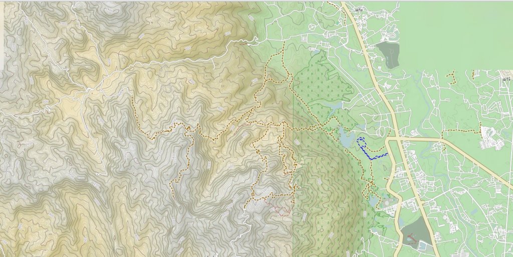
My guess is it comes from the open street map:

http://www.opencyclemap.org/

They have a lot of trails around here.

openstreet.jpg
 
I was looking at the OSM here, want to connect some tracks up,and find a waterfall
Will check out the Royal Thai Survey Department link,BUT it doesnt work now
I was checking some tracks out on Google Earth SW of Pai where you two were the other week, found a bridge over the river and tracks from the south, joining up these lines, but I dont remember seeing anything there on Open StreetMap.
 
The white lines (roads) may well come from one of the mapping companies as I remember seeing Navteq mentioned on the Google Earth screen on the bottom as being one of the suppliers of information. Navteq provided the data to Garmin for the South-East Asia GPS map which included Thailand.

By the way, there are new maps available from the Royal Thai Survey Department at the bookshops which replace the old green military maps (the 7017 series) so maybe pop over to DK and see if they have the maps you need.
 
Is that the L7018S series? there're not so many tracks on there
I got the one that covers the samoeng loop. 150bt
 
Back
Top Bottom