KTMphil
Senior member
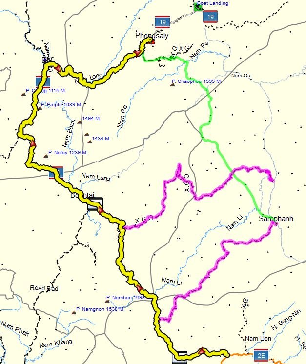
Alternative to R 1B stone road NE Laos to Phongsaly
Route 1B (in NE Laos), the 150km stone road that goes NE from Pak Nam Noi and joins to R 19 which goes NE to Phongasly is a bitch of a road.

Copyright GT Mapper
An experienced rider in laos who has a Honda Baja 250 refuses to do this road now as his headlights come loose no matter how much locktite he applies to the fixings nuts.
It's hard on you but harder on the bike, something will come loose, my rear fuel tank which was locktited everywhere nearly fell off --first time ive ever had something come loose on the KTM.
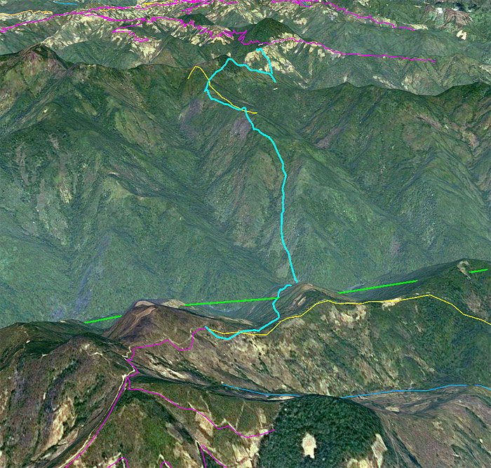
Having dinner with the Guru of laos in Vientiane a couple of weeks ago, Midnight Mapper, he told me there IS an alternative. He tells me its a silky smooth trail that takes 2 days and bypasses the 1B stone road to the east.

Copyright laosGPSmap
This is pretty interesting as its an unknown route and an excellent alternative to shaking your bike to bits. MM says its beautiful.
i hope to get there in a couple of weeks
Route 1B (in NE Laos), the 150km stone road that goes NE from Pak Nam Noi and joins to R 19 which goes NE to Phongasly is a bitch of a road.
Copyright GT Mapper
An experienced rider in laos who has a Honda Baja 250 refuses to do this road now as his headlights come loose no matter how much locktite he applies to the fixings nuts.
It's hard on you but harder on the bike, something will come loose, my rear fuel tank which was locktited everywhere nearly fell off --first time ive ever had something come loose on the KTM.
Having dinner with the Guru of laos in Vientiane a couple of weeks ago, Midnight Mapper, he told me there IS an alternative. He tells me its a silky smooth trail that takes 2 days and bypasses the 1B stone road to the east.
Copyright laosGPSmap
This is pretty interesting as its an unknown route and an excellent alternative to shaking your bike to bits. MM says its beautiful.
i hope to get there in a couple of weeks