The Pak Ou ferry route

KTMphil

Senior member
Joined
Jan 11, 2011
Location
Chiang Mai, Thailand
Bikes
2007 KTM 990 Adventure Suzuki DRZ 400
The Pak Ou ferry route


There is a nice trail that starts just north of Luang Prabang at Muang Pak Ou (from R 13 N) and heads NW, coming out just south of Oudomxai on R 2W. The only inconvenience with this trail, is there is a 10km ferry section to link the trail NW.

The whole trail in magenta (pink) on the map is 150 KM.


CLICK ON THE MAP TO ENLARGE
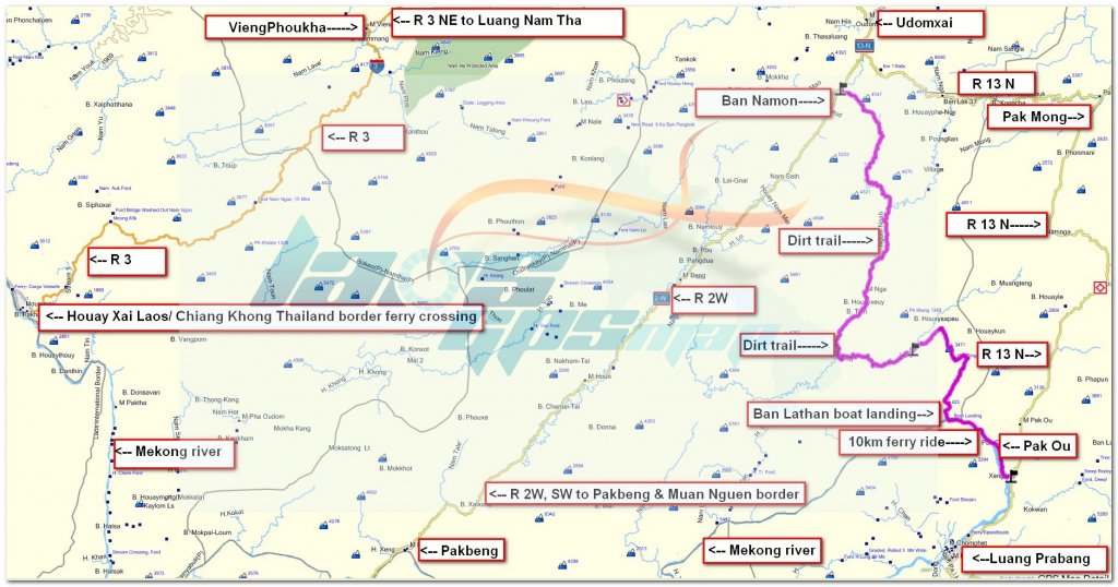

pak ou ferry  wm.jpg


Below is a detailed look at the ferry section west of Pak Ou
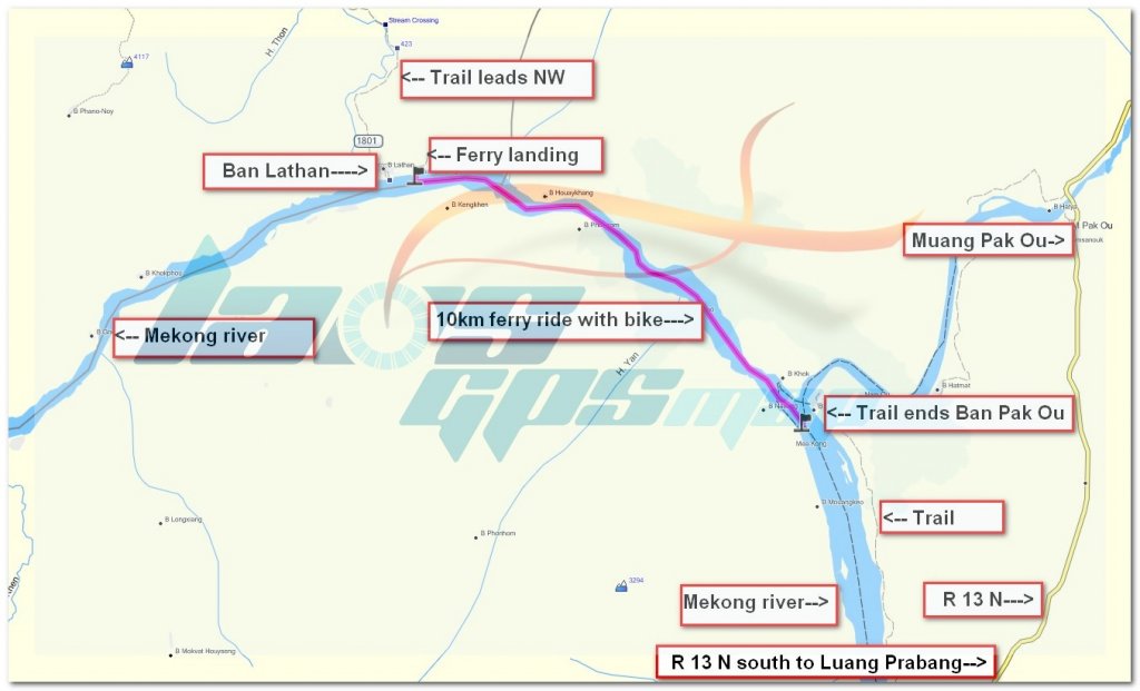

pak ou ferry zoom.jpg


Looking to take some big adventure bikes along this trail and wondering if the last people through know if they have any bigger ferry boats currently than dug out canoes?, do they have any catamaran canoes running currently?
 
Looks like there's still decent sized ferries running there, just want to check


P1010350.jpg


P1010349.jpg


If you have a big bike, one idea is to hire a boat from Luang Prabang and get it to take you 10 km NW of Pak Ou to B. Lathan where you can join the trail NW to Oudomxai
 
Taking bike adventure bikes from Ban Lathane north would be a bit of a mission, doable, but a hard ride.
The trail turns into a brilliant single trail for small bikes & gets a bit rough, steep & rutted/rocky in places.
If you watch this, I'm going down a steep hill for 9 minutes so you'ld have to go up it.

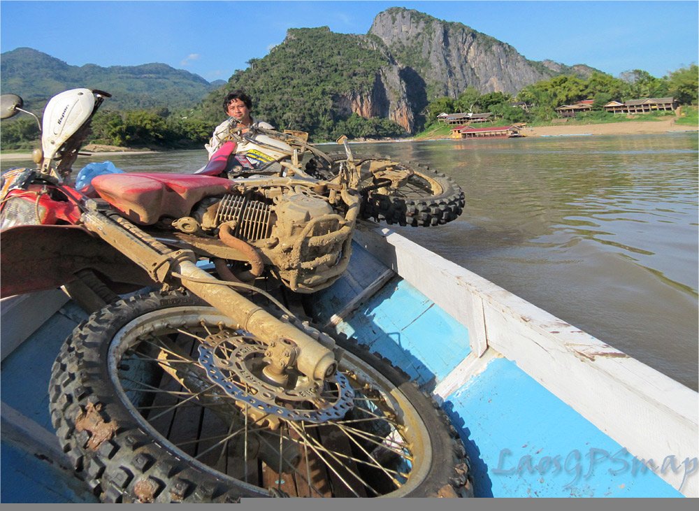
I stuck my bike on a big boat at Ban Lathane to go to Luang Probang. I don't know what you'ld find at Pak Ou though. I think you'ld struggle getting anything larger in this type of boat.
P1010350.jpg


I didn't see any catamarans around there.

Make sure you have plenty of time for the track.
 
Actually, if you watch all 3 Ban Senchot - Mekong videos, you'll get a good idea of the track.
Going the northerly route, once you get to Ban Senchot, the track becomes a road.
Before you get there though, you'll get to a junction at some point where if you go right, you'll hit that land slip/tree that stopped me. If you do, just go back & take the left fork. Dons map is very accurate except for that detour.
 
Pounce said:
Actually, if you watch all 3 Ban Senchot - Mekong videos, you'll get a good idea of the track.
Going the northerly route, once you get to Ban Senchot, the track becomes a road.
Before you get there though, you'll get to a junction at some point where if you go right, you'll hit that land slip/tree that stopped me. If you do, just go back & take the left fork. Dons map is very accurate except for that detour.


Do you happen to have the track of the detour from the map zoomed? Might be useful for future riders on this trail.
 
Would be fun to poke around there on small dirt bikes and see if there's a way through without using the ferry.
 
Just sent you a link to the .gpx file so you can post the detour.

Many rivers to cross there too.
 
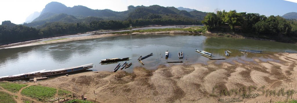
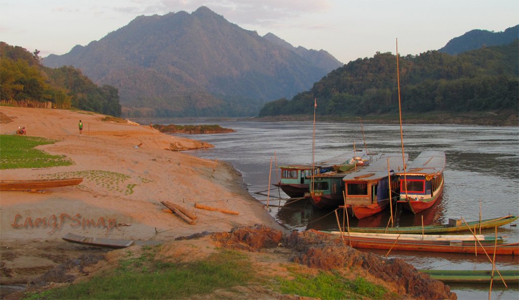
Mekong Boats At Nam Ou

mekong-pan-1.jpg
Good selection of boats for tours
Mekong-boat.jpg
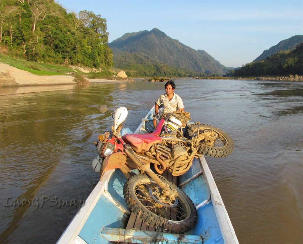
Slow ride upstream
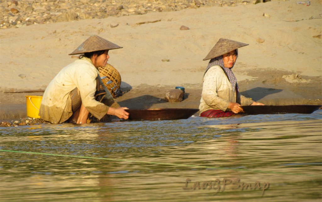
mekong-panning.jpg
Gold Panning on the Mekong banks
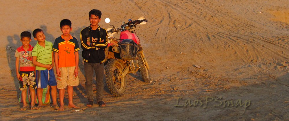
beach-lathane.jpg
Welcome commitee
Lathane.jpg
Cargo Boats
 
Gold panning with those teak dishes, a small vile of mercury in the pocket to pick up the gold in the bottom of the pan.
Expect to pay $ 10 - $15 for this ferry ride.


bike-mekong.jpg
 
Thanks to Pounce's great post, I and 3 friends were headed for exactly that trail, 1 day out, until this happened... which Pounce will recognize as the stream crossing at Baan Pouchale...

3 broken ribs and a hard abort back to Namtha...


And yes, i missed the critical 1.1 seconds....

Mike
 
You missed the bit where he fell Mike.
So I take it you didn't get to go any further? I was hoping you could have to give some feedback on the track as I'll defiantly be doing it this December.
 
Thread starter Similar threads Forum Replies Date
M Trail Riding Reports (Laos) 4
Similar threads
Houei Xai to Pak Beng
Back
Top Bottom