Lone Rider
Blokes Who Can
The "Burma Road"

Yesterday evening, after having had dinner with my good friend Theo from Lampang, I bumped into another interesting guy at one of my watering holes and we started talking about Myanmar and the hope that it would open up soon for the motorbike community. During that discussion we talked also about maps and interesting roads and the name "Burma Road" came up. I did not know much about it and last night I did a search to find some information on it which might be of interest to some of you:

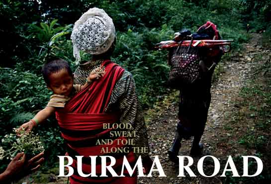
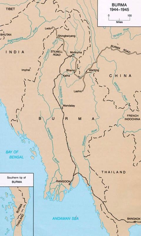
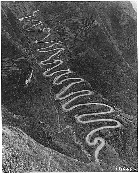
The Burma Road is a road linking Burma (also called Myanmar) with the southwest of China. Its terminals are Kunming, Yunnan, and Lashio, Burma. When it was built, Burma was a British colony. The road is 717 miles (1,154 km) long and runs through a very rough mountain country. The sections from Kunming to the Burmese border were built by 200,000 Burmese and Chinese laborers during the Second Sino-Japanese War in 1937 and completed by 1938. It had a role in World War II, when the British used the Burma Road to transport material to China before Japan was at war with the British. Supplies would be landed at Rangoon (now Yangon) and moved by rail to Lashio, where the road started in Burma. In 1940 the British government yielded to Japanese diplomatic pressure to close down the Burma Road to supplies to China for a period of three months.

After the Japanese overran Burma in 1942, the Allies were forced to supply Chiang Kai-shek and the nationalist Chinese by air. They flew these supplies from airfields in Assam, India, over "the hump", the eastern end of the Himalaya uplift. At the insistence of the United States, and much to the chagrin of Winston Churchill, the wartime leader of Britain, British forces were given, as their primary goal in the war against Japan, the task of recapturing Burma and reopening land communication with China. Under British command Indian, British, Chinese, and American forces, the latter led by Vinegar Joe Stilwell, defeated a Japanese attempt to capture Assam and recaptured northern Burma. In this area they built a new road, the Ledo Road also known as the Stilwell road which ran from Ledo Assam, through Myitkyina and connected to the old Burma Road at Wandingzhen, Yunnan, China. Both roads have lost their former importance and are in a state of disrepair, but India began rebuilding its section of the Stilwell Road in 2007.
Some more information and pictures on the National Geographic site: Burma Road @ National Geographic Magazine
For more information on "The Hump" see Burma, 1942
Images of the Burma and Ledo/Stilwell Road: "burma road" - Google Search

Yesterday evening, after having had dinner with my good friend Theo from Lampang, I bumped into another interesting guy at one of my watering holes and we started talking about Myanmar and the hope that it would open up soon for the motorbike community. During that discussion we talked also about maps and interesting roads and the name "Burma Road" came up. I did not know much about it and last night I did a search to find some information on it which might be of interest to some of you:

The Burma Road is a road linking Burma (also called Myanmar) with the southwest of China. Its terminals are Kunming, Yunnan, and Lashio, Burma. When it was built, Burma was a British colony. The road is 717 miles (1,154 km) long and runs through a very rough mountain country. The sections from Kunming to the Burmese border were built by 200,000 Burmese and Chinese laborers during the Second Sino-Japanese War in 1937 and completed by 1938. It had a role in World War II, when the British used the Burma Road to transport material to China before Japan was at war with the British. Supplies would be landed at Rangoon (now Yangon) and moved by rail to Lashio, where the road started in Burma. In 1940 the British government yielded to Japanese diplomatic pressure to close down the Burma Road to supplies to China for a period of three months.

After the Japanese overran Burma in 1942, the Allies were forced to supply Chiang Kai-shek and the nationalist Chinese by air. They flew these supplies from airfields in Assam, India, over "the hump", the eastern end of the Himalaya uplift. At the insistence of the United States, and much to the chagrin of Winston Churchill, the wartime leader of Britain, British forces were given, as their primary goal in the war against Japan, the task of recapturing Burma and reopening land communication with China. Under British command Indian, British, Chinese, and American forces, the latter led by Vinegar Joe Stilwell, defeated a Japanese attempt to capture Assam and recaptured northern Burma. In this area they built a new road, the Ledo Road also known as the Stilwell road which ran from Ledo Assam, through Myitkyina and connected to the old Burma Road at Wandingzhen, Yunnan, China. Both roads have lost their former importance and are in a state of disrepair, but India began rebuilding its section of the Stilwell Road in 2007.
Some more information and pictures on the National Geographic site: Burma Road @ National Geographic Magazine
For more information on "The Hump" see Burma, 1942
Images of the Burma and Ledo/Stilwell Road: "burma road" - Google Search


