bsacbob
Administrator (Retired)
- Joined
- Jul 1, 2012
- Location
- Chiang Rai
- Bikes
- Honda CRM-AR 250, Honda CRF 250-L, Suzuki V Strom XT 650 Honda XR250 Baja BMW F650GS
If you plan to travel to or from Phonsavan to Luang Prabang you have a couple of options, you can ride the paved way on routes 7 and 13 which is a pretty nice route or you have two alternatives the 3901 or the 3909 both meeting up on the bridges trail 2504 as the attached map, the 3901 is NOT for big touring type bikes the 3909 is graded all the way and should pose no problem for any ADV motorcycle.
 Screenshot 2015-12-22 15.21.08 by bsacbob, on Flickr
As you can see there are a couple of nice climbs along the way.
 Screenshot 2015-12-22 15.21.34 by bsacbob, on Flickr
I started the ride pretty early since i had not ridden the 3901 before, my plan was to gas up before leaving route 7 and stop for a while until the morning mist had cleared so i could see the views.
 Untitled by bsacbob, on Flickr
Rest up point watching the locals pass by, all graded to this point.
 2015-11-21 07.52.06 by bsacbob, on Flickr
 2015-11-21 07.52.11 by bsacbob, on Flickr
 2015-11-21 07.55.22 by bsacbob, on Flickr
Sun beginning to break through it was time to go.
 Untitled by bsacbob, on Flickr
Freshly graded looking good.
 2015-11-21 08.25.05 by bsacbob, on Flickr
Came across a small Jar site on the side of the road.
 2015-11-21 08.48.31 by bsacbob, on Flickr
Untitled by bsacbob, on Flickr
Now the trail starts to get rutted, but nothing serious.
 2015-11-21 08.45.00 by bsacbob, on Flickr
Looking at the track not many 4WD's come this way.
 2015-11-21 08.56.33 by bsacbob, on Flickr
More interesting ruts.
 2015-11-21 09.00.16 by bsacbob, on Flickr
Starting to climb down.
 2015-11-21 09.01.37 by bsacbob, on Flickr
One of the easier sections.
 2015-11-21 09.14.22 by bsacbob, on Flickr
This was very steep.
 2015-11-21 09.11.24 by bsacbob, on Flickr
First signs of life for a few hours, just two small hut's.

Untitled by bsacbob, on Flickr
 Untitled by bsacbob, on Flickr
Further along i came across this guy living in a small hut weaving baskets, he had the radio on playing an all English station but did not speak a word of English.
 2015-11-21 09.59.58 by bsacbob, on Flickr
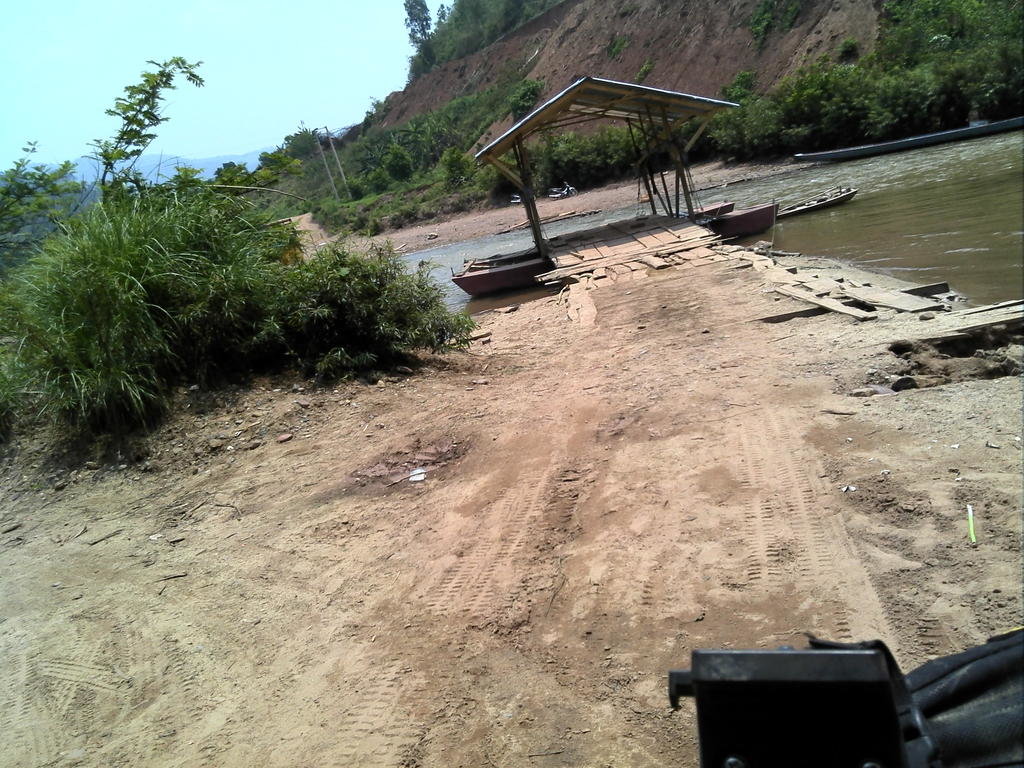
Eventually i come to the scenic nam Khan river, a word of warning here, as you come down the hill it turns sharply right onto the landing and its very steep downhill, making it very difficult to dismount your bike even in gear !!
 2015-11-21 10.31.55 by bsacbob, on Flickr
I sat there for felt like a dog's age trying to get some attention across the river, i could see a pretty good ferry capable of taking a pickup and some, but no signs of life, eventually a bunch of kid's rowed across i explained i needed a ride across (pretty obvious really).
 2015-11-21 10.35.34 by bsacbob, on Flickr
To my dismay, an old guy came puttering across on a wide canoe, what happened next was oscar winning, the old guy got his boat side on to the bank (he was alone) holding one end of the boat he called me down onto the short ramp and onto the platform, easy you would think, well it should have been if the idiot had tied off the other end of the boat. So you guessed it i hit the ramp the boat moved away the ramp fell off the boat along with myself and the bike on top of me. His frantic screams got the attention of several kid's who managed to extract me and my now ruined camera from the river. To cut a long story short he blamed me charged me 50k kip for the crossing which incidentally dropped me off on the nice ferry i hoped to cross on and i was on my way !!!
 2015-11-21 10.56.05 by bsacbob, on Flickr
 2015-11-21 10.36.21 by bsacbob, on Flickr
So that was it for pictures, for your information the section after the water crossing from hell is very very rutted until you reach the 2504 after that it plain sailing all the way to the cave of teeth and Luang Prabang.
Here is the only picture after the event from my waterproof phone, of what is obviously a very cute mixed race girl at a drink stop.
 2015-11-21 13.14.27 by bsacbob, on Flickr
Last edited:


