Perth > Perth - Via Cape York 2014

Pounce

Senior Member
Joined
Jan 23, 2011
Location
Here
Sod it all.
I had up to around day 16 done on my laptop then the bastard died, so I lost the lot.
So now you're only getting a photo journal with the odd note or two.
If you have any questions about any of the pics, please ask.

It was bandied about by some of the guys to do a ride from the lower left corner of Australia to the upper right corner. I'll be in that.
This wasn't a stop & see everything tour, it was primarily a ride to Cape York & back, with sightseeing only if we were riding past it, no out of the way bits.

007215

Now we knew it was going to be a long ride so we allocated the month of May to do it, planning to be back in Perth around the end of the month.

Day 1 Perth - Kookynie 739 klm's
Day 2 Kookynie - Great Central Road S26 52.873 E125 35.040 595 klm's
Day 3 S26 52.873 E125 35.040 - Yulara 696 klm's
Day 4 Yulara - Alice Springs 493 klm's
Day 5 Alice Springs - Tobermorey Station 568 klm's
Day 6 Tobermorey Station - Mt Isa 674 klm's
Day 7 Mt Isa - Normanton 459 klm's
Day 8 Normanton - Atherton via Gulf Developmental Rd 630 klm's
Day 9 Atherton - Lions Den Hotel via Bloomfeld Track 254 klm's
Day 10 Lions Den Hotel - Cooktown 42 klm's
Day 11 Cooktown - Arcehr River Roadhose via Battlecam Rd 567 klm's
Day 12 Archer River Roadhouse - Bamaga 397 klm's
Day 13 Bamaga - Cape York Tip & back 82 klm's
Day 14 Bamaga - Musgrave Roadhouse 567 klm's
Day 15 Musgrave Roadhouse - Chillagoe 544 klm's
Day 16 Chillagoe - Normanton via Bourke Development Rd with no fuel between them 572 klm's
Day 17 Normanton - via Hells gat to Bush Camp on Savanah Way S16 17.628 E136 54.051 641 klm's
Day 18 S16 17.628 E136 54.051 - Katherine & JNR with beers 765 klm's
Day 19 Katherine pissing about getting tyres rfrom a robbing bastard
Day 20 Katherine - Lake Argyle Resort 517 klm's
Day 21 LAR - Drysdale River Station via Gibb River Rd 474 klm's
Day 22 DRS - Windjana Gorge via GRR 380 klm's
Day 23 Windjana Gorge - Broome 380 klm's
Day 24 Broome - Marble Bar via Borelines Rd 587 klm's
Day 25 Marble Bar - Gasgoyne River camp 190klm's north of Meekatharra S25 12.118 E119 20.073 563 klm's
Day 26 S25 12.118 E119 20.073 - Home 980 klm's
 
Day 1

GpxViewer

Bike - 235 kg's

20140427_085328

Me - 115 kg's

P1030661

Less than 100klm's from the start, I have lost my front brakes. Couldn't see brake fluid anywhere on my boots, so I lean over the handle bars & notice my caliper isn't bolted on anymore. Loctite your bolts people.

P5010002

90% of the trips scenery will turn out to be like this.

P1030669
P1030674
P1010605
P1030685
P5010003

Me trying to get some "Artsy" photos

P5010007

Result

P1030679

Kookynie Hotel in the back yard

P1030688
 

Attachments

  • 01-05-14.gpx
    1.9 MB · Views: 414
Day 2

GpxViewer

Grand Hotel Kookynie.
Not the first to stay here, have a look at TB-Racing's report AUS Goldfields Run WA 2011

P5020012

P1030693_stitch
P1030697_stitch

We carried everything we needed, I have sleeping gear in the top bag, food & cooking in the left & clothes in the right.

P1030700

P1030705
P1030707
P1030714
P5020016
P5020018
P5020021
P5020031 by
P1010613

This was my home for the month, got the set up & breakdown of camp down to around 20 minutes by the end of the trip

P1030717

P5020038
P1030720
P1030722
P1030723
 

Attachments

  • 02-05-14.gpx
    1.5 MB · Views: 439
Day 3

GpxViewer

P5030043

By now you should be convinced of the outback scenery.

P1030731 by Pounce400, on Flickr
P1030732
P5030048
P5030049
P1030736
P1030745
P1010609

Wait, that's not flat barren landscape!

P1030746_stitch
P1030738

The Great Central road on the WA side was rough but reasonably good but once we had crossed into the NT though, it turned into another beast altogether.
To ride this with any confidence or comfort, it was literally a case of power & more power.
3" deep sand in places with long deep corrugations meant sitting on 100kph & hanging on was the best option. I think my decision to use a motocross tyre & install a steering damper was a very good choice. A normal touring tyre would not steer in this crap, as some of the guys found out.

P1030749
P1030750
P1030753
P1030755

We are heading for Yulara (Uluru/Ayres Rock)
This section is taking longer than we thought, so we make it into Yulara as the sun is setting & are able to just catch the sunset over the Olgas & The Rock. Point & shoot cameras do not capture the beauty of this.

P5030061
P1030758
P1030759
P1030760
 

Attachments

  • 03-05-14.gpx
    1.8 MB · Views: 423
Great stuff Pounce very nice pictures, having never ridden in Australia amazed have flat it is, although you look as you had more than your share of bull dust along the way.

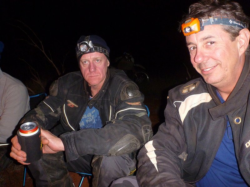
Notice you haven't lost the ability to keep your mates captivated with you banter around the campfire :DD

14309711353_a792f3815b_c.jpg
 
Geez, I'm looking forward to seeing the creeks and rivers on the Cape. We had enough "fun" with the Paske and Nolans in early August ('11). Did you guys have to float them over?
 
….having never ridden in Australia amazed have flat it is, ….

The
Australian landscape is much like an Australian accent: Flaat n Dreye.

(Please don't be offended Aussies: Its just me kidding around. I have made many good friends in Australia over the years and have enjoyed the freedom of riding in your massive country, including some great roads & scenery in parts of QLD and VIC).
 
Grand Hotel Kookynie.
Not the first to stay here, have a look at TB-Racing's report AUS Goldfields Run WA 2011

Great area out there in WA.... Kevin Pusey still the proprietor and manager of the Grand Hotel Kookynie, went through Menzies / Kookynie and the rest of the WA Goldfields a few times doing the Great Central Road rides between Perth - Brisbane since 88....
 
Day 4

GpxViewer

Today was meant to be a short run from Yulara up to Alice Springs.

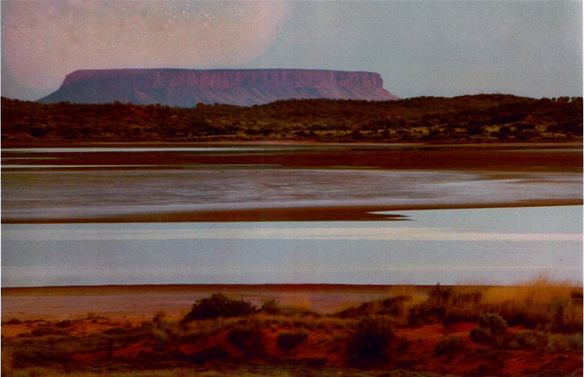
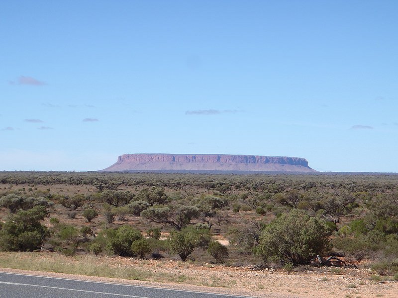
There is a huge table top hill thing near Curtain Springs I have never heard about. It is the only think out there for miles. Shame it's not more famous.
P1030764
P5040068

Mick had found a "short cut" to take us off the main highway through the Finke River National Park.
On the GPS & Map it said track, in reality it was deep river sand & river rocks for around 80klm's? that took us an extra 4 hours & nearly killed us all with exhaustion.
P5040073
P1030767
P1030776
P1030778
P1030780

Me going for a swim in the Finke River
P1030786
P1010627
P1030787

Our first decent river crossing of the trip. This was reasonably deep in one spot.
P1010638
P1010639

P1010635

There were multiple offs by multiple people because of the tyre sucking sand. Trying to wrestle a quarter of a tonne through this & helping to pick up bikes takes it out of you.
P5040087
P5040088
P1030790
20140504_153819

We made it to the main highway late in the afternoon but still had to get to Alice Springs.
We didn't make it there until after dark. Everyone was totally shattered from taking the short cut.
 

Attachments

  • 04-05-14.gpx
    1.3 MB · Views: 389
Day 5

GpxViewer

Today we hit the Plenty Highway heading for the Queensland border.

Tropic of Capricorn
P5050092

The first flat tyre of the trip. Note the patented tyre changing stand
P1030800
P1030801

Guess what todays scenery will be...
P5050097
P5050100
P5050102

Fuel stop at Jervois Cattle Station. Believe it not but they raise 4,000 head of cattle out here on the sparse vegetation.
The rocket tests launched from Woomera in the 1950's in South Aus used to land around here, hence the bomb shelter.
P1030803
P1030805
P1030804
P1030806
P1030807

Cute English backpacker, by far the nicest scenery of the day.
P1030808

P1030813
P1030814
P1030818
P1030823

Tobermory Station just east of the Qld border is our stop for the night.
P1030824
P1030825
 

Attachments

  • 05-05-14.gpx
    1.5 MB · Views: 503
Day 7

GpxViewer

Heading north into croc country now.

P5070110
P1030832

Bourke & Wills roadhouse
P5070114

Today is the first day we really start feeling the heat too. We had to stop several times to try & cool off & stop falling asleep on the bike while riding. There is not a lot of places with shade in the tropical desert
P5070117

We start seeing rivers now too.
P1030837

with signs...
P1030841

but thank god for country pubs. We make it into Normanton.
IMAG0292
IMAG0294
IMAG0295

Did someone say crocodile?
P5080122
P5080123


I forgot to mention that while in Mt Isa 2 days ago, I ran into my friends father John from Perth who was doing a similar ride to the Cape on a Husky terra, on his own at 69 years of age. Today we ran into him again in Normanton. I hope I'm still doing this as I mature.
20140507_164614
 

Attachments

  • 07-05-14.gpx
    1.2 MB · Views: 493
Good one Pounce; great images of a wonderful land.

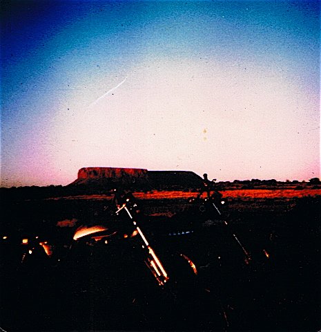
re this place …
14413240441_dca17c680e_c.jpg

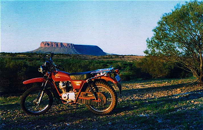
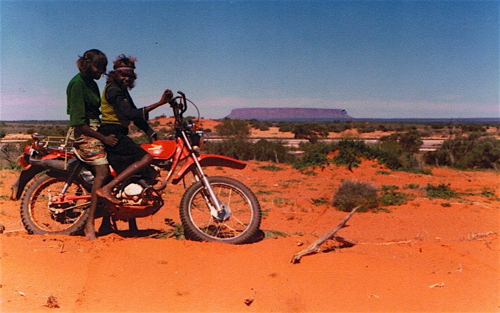
Known to the indigenous Pitjantjatjara and Yankunytjatjara people as 'Atila' and to others as Mt Conner.
It's really worth a stop-over in its own right.
Technically, visitors would need to get permission from the Severin family back at Curtin Springs (if they are still there) as it's on their cattle land.
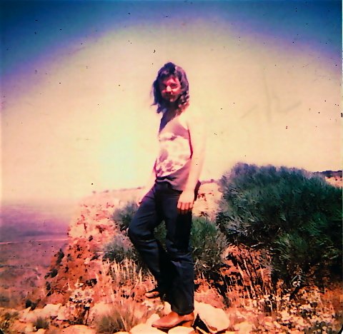
I used to visit often during the 70s and 80s.
Near the base are white clay pans which are related to the folklore (Dreaming) of the indigenous folk.
They believe that the dried clay pans are the foot-prints of the travelling 'Ninnga Man' who, ironically, is a man of ice. (It does get surprisingly cold out there).
The area is rich in folklore and about two decades ago was revisited by the locals who performed their traditional ceremonies there in an effort
to rekindle the site and to pass on knowledge to their children. It's part of the Seven Sisters Dreaming.

On another level, it's excellent camping there (well, used to be) because there's fresh bore water and the Mesa/Tor can actually be climbed fairly easily.
When on the top (which is not flat!) one can see how the monoliths of Kata Tjuta (Olgas), Uluru (Ayers Rock) and Atila (Mt Conner) actually align.
CCI00019.jpg

CCI00018.jpg

CCI00012.jpg

CCI00011.jpg
 
Great info Ron, thanks for that. You look the part too.
I will definitely head back over there in the future as we didn't really stop & smell the roses.

- - - Updated - - -

Great info Ron, thanks for that. You look the part too.
I will definitely head back over there in the future as we didn't really stop & smell the roses.
 
Well, my Australia trip might now come sooner rather than later - First TB-Racing tempting me with all his cheese and food pictures and now Pounce and Ron adding to it with their pictures and mystical stories - a BIG THANK YOU for posting all these pictures and stories.
 
Well, my Australia trip might now come sooner rather than later - First TB-Racing tempting me with all his cheese and food pictures and now Pounce and Ron adding to it with their pictures and mystical stories - a BIG THANK YOU for posting all these pictures and stories.

I'm sure we can rustle up a bed or two (or even a couch) at various points across the country.
 
It's really worth the effort Auke; at the right time of the year depending on what part(s) of Oz you want to visit.

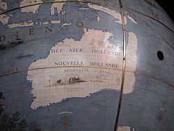
Incidentally, it all could have been Dutch!

"The history of the Dutch and Australia began in 1606 with Captain Willem Janszoon, a Dutch seafarer, landing on the Australian mainland, the first European to do so." (Wiki)

And then Abel Tasman named a great portion of this new land 'New Holland' ('Hollandia Nova') in 1644 and that named stuck for until the Brits arrived on the east coast in 1788.
250px-Globe_Coronelli_Map_of_New_Holland.jpg

And I agree with 'BigFella'.
 
Hey Pounce.... I think this RR is motivating some folks. I can see Tour Guide Ron leading a few of us oldies on a tour of Oz's fierce inner regions.
 
Now where were we.

Day 8 & 9

GpxViewer
GpxViewer

From Normanton we wanted to start heading north along the Burke Development Rd then follow old roads & tracks heading north after crossing the Mitchell River.
Talking to some locals we found out that the Mitchell was still in flood as we are right at the end of the wet season & from Normanton to Chilligoe is about 600klm's on unknown dirt roads with no fuel stops.
Being early in the trip we take the safer & boring option & head east along the main highway towards the Pacific Ocean.
We get to Atherton on day 8 & stay there the night.

20140508_133903
P1010656
p5090069

Coast to Coast

20140509_103647
p5090070
p5090072

We are now on the East coast of Aus just below the world famous Daintree rain forrest.

Daintree River crossing
20140509_105901
P1010663
P5090140

This area has some similarities to Thailand, winding dirt roads through jungles, steep concrete roads to get up mountains, river crossings etc but it only lasts for about 3 hours then you're through it all when you reach the Lions den pub just south of Cooktown

p5090076
P1030855
P1030859
P1030863
P1030867
p5090078
P1010670
20140509_133832
P1030869
P1030873
P1030876
P1010678
20140509_150722

We got here around 4pm I think & Tommy says his bike is playing up, the suspension is shot.
A quick look over & the valve on the nitrogen canister has broken off somehow so there is no dampening. We piss about for 15 minutes then Tommy & Ralph decide to ride back 350 odd klm's to Atherton via the main hwy to try & get it fixed as there is a bike shop there.
All good, the rest of us will stay here the night & try to meet them in Cooktown tomorrow.
 

Attachments

  • 08-05-14.gpx
    1.6 MB · Views: 503
  • 09-05-14.gpx
    686.5 KB · Views: 528
Day 10

GpxViewer

The 7 of us head into Cooktown after a late start as we're in no hurry today.
We end up hanging around here all day while Tommy & Ralph get the bike sorted. The guy in Atherton who said he could fix it didn't have the correct tools so after re assembling the bike & not charging the guys sends them off to Mareeba to a different shop (which we happened to get a new tyre at for Todd 2 days ago) who is a suspension guru type guy. He has the bike up & fixed in no time. The two of them the head off to Cooktown to meet up with us in time for afternoon beers & food.

Tommy's day

P5100155
P5100157
P5100159
P5110168

Our day

P1010692
P1010690
P1010693
P1030883
p5100090
P1010694
P1010695
20140510_144959
 

Attachments

  • 10-05-14.gpx
    120.6 KB · Views: 494
Day 11

GpxViewer

We're heading up into the Gulf country proper today.
Jack has ridden up here many times & knows some good roads, that's if they're open. He did not disappoint.

Our first "get off the bike & check the river out before crossing" crossing but us stupid city boys keep forgetting where we are.

P1010706
P1030888

We spoke to a tour guide a few days later who told us they had to carry their bikes cross here using the dinghy on the other bank so we were a bit lucky the river had dropped its level.

P1030889
P1030890
P1030894
P1030898
P1030904
P1030907
p5110096

Another crossing or two until we come across a ranger. Jacko asks him if a certain road is open & gets told to get out of here (we just came along a closed road apparently) as it's huge fines for using closed roads, so onto the main road into Laura for lunch.
We get a sanctimonious lecture form some dipshit tour guide about us destroying his track so we ignore him.
Jacko is nowhere to be seen. he went straight on to Musgrave roadhouse.

P1030913
P1030915
P1010709
P1010708
p5110108
P1010730

We find Jack at the Musgrave Roadhouse then head onto the Archer River roadhouse where we'll spend the night.

P1030918
P1010721
P1030924

You can swim in the river here. $75 a carton of beer is a lot though.

P5120177
P1030945
P1030934
p5110109
20140511_171326
P1030947
P1030949
P1030952
 

Attachments

  • 11-05-14.gpx
    1.2 MB · Views: 467
Damn good pizza at that Lions Den. We pigged out there after getting caught out on the CREB track and having to camp on it overnight. It rained on us overnight... and we managed 7km in 24 hours and lost one rider (ie she got taken back to Cairns in a 4wd, bike recovered a few days later). CREB is now closed I believe, which is a pity.Keep 'em coming. Gotta be some bulldust and deep crossings to come.
 
Day 12

GpxViewer

Today we head to the top of Australia.

p5120112
P1030958
P1030960

I stop to take photos because I know how deep this is, Mick doesn't.

P1030970
Tommy does.
P1030973
P1030975

P1010743

Jacko keeps banging on about the old Telegraph Track & as we're all keen for adventure, once we get to Bramwell Junction roadhouse, we decide to have a go at it.
We get down to the first river crossing at Palmer or Palm creek. We meet this young bloke on a proper enduro bike coming from the opposite direction, so we help him through. He tell us further along the Cockatoo river is impassable & he spent half an hour de-watering his bike where he drowned it in another.

P1010752

Jack is still keen though. You have to know something here. Jacko weighs all of 70kg & is an a DRZ400. We all weigh over 100kg each & are on DR650's & Tenere 660's

The entrance to the creek
P1010755

The exit of the creek.
P1010757

I will be the first to admit I'm not going that way, soon 7 others join my decision after watch Tommy have a go.

P1010765
20140512_110620
20140512_110653

It took a good 20 minutes just getting those two bike through with Jacko's clutch squealing & Tommy's chain jumping teeth on the sprocket, so no, we're going via the main road & we'll meet them at Elliot falls.
On an enduro bike with all that I am carrying, no hesitation at doing it but this is a trip to get to the Cape & that's my main priority.

P1010744
p5120113
20140512_083550
20140512_083730

Jacko & Tommy's route.
p5120120
p5120121
p5120122
p5120123
p5120125

P1010781
20140512_140148
P5120192
20140512_140019_stitch

We only have to wait around half an hour for the lads top arrive, they go have a swim then we're back on the road.
There are more waterfalls at Twin Falls further up but you need to cross another river, which we're told by some blokes in 4WD's is bonnet deep, so yeah, we'll give them a miss.

Only one obstacle left before we reach Bamaga & that's the act of getting your wallet out & paying the $67 for a 100 metre crossing of the Jardine River.

P1030980
P1030982
P1030984
p5120127
20140512_160602

Onto our last port of call at the Loyalty Beach Campground

20140512_174047
20140512_174119
P5120203
P1030989
P1030986

Tomorrow, The Tip
 

Attachments

  • 12-05-14.gpx
    1 MB · Views: 453
Nice stuff as always Mr P , i noticed some nice looking water crossings along the route, what tent are you using mate ?
 
Nothing special Bob, it's an Outer Limits Vertex, just a cheap free standing 2 man from the local camping store.
 
I forgot all about this until some other blokes we know did a ride there this year, I suppose I should finish it.

Day 13 – The top of Australia

From Bamaga to the Tip isn’t far & I was pleasantly surprised by the scenery. All the photos you see are of the sign, never the road there which is a great windy dirt road through sub tropical forest, not the barren landscape I was expecting.
Once there it’s a short walk over the hill to the spot.

p5130134 by P C, on Flickr
P5130207 by P C, on Flickr
20140513_113214 by P C, on Flickr
20140513_113201 by P C, on Flickr
20140513_120546 by P C, on Flickr
20140513_120537 by P C, on Flickr
IMAG0309 by P C, on Flickr
P1030992 by P C, on Flickr
IMAG0310 by P C, on Flickr

Well we’ve made it, Perth to Cape York via the middle of Australia.

P1040006 by P C, on Flickr

I suppose we have a beer now, turn around & head back.

P5130221 by P C, on Flickr
 
Day 14

Cape York to Bramwell Station

Time to start heading south.
There are some aircraft remains fro WW2 just south of the Cape.

p5140135 by P C, on Flickr
P5140222 by P C, on Flickr
p5140136 by P C, on Flickr

We decide to head for Bramwell station & stay there the night.
Covering previous ground so it was a nice fast run on the bikes.

P5140225 by P C, on Flickr
20140514_085755 by P C, on Flickr
P5140228 by P C, on Flickr

Repairs to Todds Tenere, the front rattled to pieces.

P1040018 by P C, on Flickr

P5140230 by P C, on Flickr
P1040024 by P C, on Flickr
P1040025 by P C, on Flickr
 
Day 15

Bramwell Station to Chillagoe

Discussion are had as to whether we try the Bourke Development Rd on the way back as we were told it was impassable due to the Mitchell River height on the way up. There are several options so we take the Chillagoe one & head there today.

p5150137 by P C, on Flickr
P1040034 by P C, on Flickr
20140515_101801 by P C, on Flickr

We decide to have a look at a shortcut across the Mitchell to save riding a fair distance on the main highway.
It doesn’t look that bad until the guys nearly get swept away walking it without the bikes.

p5150138 by P C, on Flickr
P5150238 by P C, on Flickr
P1040037 by P C, on Flickr
20140515_123814 by P C, on Flickr
P1040041 by P C, on Flickr

Oh well, time to head on.

20140515_122214 by P C, on Flickr
20140515_122201 by P C, on Flickr
P5160240 by P C, on Flickr

20140515_175527 by P C, on Flickr
20140515_175700 by P C, on Flickr
20140515_180305 by P C, on Flickr
 
Day 16

Chillagoe to Normanton

Today will test the fuel range of the bikes, we all take extra on board just in case.

P5160241 by P C, on Flickr
20140516_074535 by P C, on Flickr

The road is great in places, bad in others & shit in some, not much scenery, hot & very remote. Totally worth doing.

P1040043 by P C, on Flickr
P1040048 by P C, on Flickr

P1040066_stitch by P C, on Flickr

p5160139 by P C, on Flickr
P1040052 by P C, on Flickr
P5160242 by P C, on Flickr
20140516_101306 by P C, on Flickr
P5160244 by P C, on Flickr
P1040068 by P C, on Flickr
20140516_161426 by P C, on Flickr
20140516_182440 by P C, on Flickr

I can't remember how the others went, but I made it into Normanton without going onto reserve.
32 litre tank & not over working the motor, just taking it easy seems the trick.
 
Day 17

Normanton to Free Camping spot

We're heading west today to the Northern Territory via the Savannah Way. Another remote road that you need to take seriously.
We leave early & finally, road kill. Rothy mows down one of the millions of Agile Wallabies around the place doing about 80 kph. We're surprised it has taken this long for one of us to hit one, there have been way too many close calls. Killed it dead & luckily he didn't come off the bike.

20140517_075006 by P C, on Flickr
20140517_074703 by P C, on Flickr
P1040070 by P C, on Flickr
P1040071 by P C, on Flickr
P5170248 by P C, on Flickr
P1040073 by P C, on Flickr
P5170252 by P C, on Flickr
20140517_094553 by P C, on Flickr

We come to a causeway so I stop to get a pic, Allen decides to show his sliding skills. If you look, you can see him laying down across the other side

P1040074 by P C, on Flickr
P1040076 by P C, on Flickr
P1040077 by P C, on Flickr

We get onto the Hells Gate Roadhouse, well named too. The temp gauge on my speedo is showing 40 degrees Celsius (probably only about 35 really). They tell us the river further on may or may not be crossable & the road is in a really bad condition in some parts. Oh well, we fill up our water supplies & try it out anyway.

P5170253 by P C, on Flickr
p5170144 by P C, on Flickr
P1040079 by P C, on Flickr

Once we reach the border, the tar turns to dirt & the fun begins.

P1040081 by P C, on Flickr
P5170263 by P C, on Flickr
P1040089 by P C, on Flickr
p5170147 by P C, on Flickr

Now we're at the Robinson River that we were warned about. Jacko the ever adventurist walks it first & all is good.

P1040090 by P C, on Flickr

Me being a bit slow decides to ride into the middle, get off the bike & get pics of everyone crossing, totally forgetting we're but 40klm's from the coast & it's still croc country. Afterwards I wasn't that worried until I remember the deep dark water hole that was behind me.

p5170149 by P C, on Flickr
P1040093 by P C, on Flickr
P1040092 by P C, on Flickr
P1040095 by P C, on Flickr
P1040094 by P C, on Flickr
P1040097 by P C, on Flickr
P1040099 by P C, on Flickr

We ride on & find an old quarry to camp in for the night.

20140517_175410 by P C, on Flickr
P5170267 by P C, on Flickr
20140517_175438 by P C, on Flickr
20140517_180717 by P C, on Flickr
 
Day 18

Camp to Katherine

We head into Booraloola for breakfast & ask about the rest of the Savannah Way. We're informed it is bad & not worth doing, some other time then.

P5180268 by P C, on Flickr

It's a days ride now to Katherine where we've made a deal with a mate from Perth who's there with his family. As we'll get in on Sunday & alcohol sales are restricted Junior is buying a couple of cartons for us. Cool.
A few stops along the way.
Mataranka Hot Springs

P1040111 by P C, on Flickr
20140518_151423 by P C, on Flickr
20140518_151915 by P C, on Flickr

Junior

20140518_181413 by P C, on Flickr
p5190155 by P C, on Flickr
 
Day 19

Spend the day in Katherine getting tyres, having a swim in the hot springs & other crap, bring your wallet & patience.

Dunlop 606 lasted from Perth

20140519_114825 by P C, on Flickr

Pirelli 554 Motocross tyre, lasted from Mt Isa. Would definitely use one of these again for the fast speed dirt roads & deep sand. Tracked true always

20140519_114814 by P C, on Flickr

P1040116 by P C, on Flickr
P1040133 by P C, on Flickr
How do you say fart in French?
P1040136 by P C, on Flickr
20140519_170308 by P C, on Flickr
20140519_170312 by P C, on Flickr
 
Day 21

Lake Argyle to Drysdale River Station

Gibb River Road.
Over hyped, over used, over priced & over regulated.

Stopped in at El Questro for a look & beer, couldn't spend the night where we planned as there was a charity pushbike ride on & the 500 plus bikes had taken over everything. No takeaway beer either as you can't buy takeaways along this tourist route.
We push on for the Drysdale River Station & get in just on dusk.

P5210306 by P C, on Flickr
P1040167 by P C, on Flickr
P5210308 by P C, on Flickr
P5210314 by P C, on Flickr
P1040172 by P C, on Flickr
p5210008 by P C, on Flickr
p5210010 by P C, on Flickr
P5210326 by P C, on Flickr
P1040183 by P C, on Flickr
20140521_123511 by P C, on Flickr
P5210331 by P C, on Flickr
P5210567 by P C, on Flickr
P5210569 by P C, on Flickr
P5210336 by P C, on Flickr
20140521_185955 by P C, on Flickr
20140521_181509 by P C, on Flickr
20140521_181505 by P C, on Flickr
20140521_181516 by P C, on Flickr
 
Day 22

Drysdale River Station to Windjana Gorge

A couple of stops & swims, a few river crossings then a night under the stars.
10,000 klm mark today

P1040187 by P C, on Flickr
P5220342 by P C, on Flickr
p5220011 by P C, on Flickr
P1040191 by P C, on Flickr
P1040197 by P C, on Flickr
P1040206 by P C, on Flickr
p5220014 by P C, on Flickr
P5220351 by P C, on Flickr
P5220357 by P C, on Flickr
p5220022 by P C, on Flickr
P1040211_stitch by P C, on Flickr
P5220364 by P C, on Flickr
P1040216 by P C, on Flickr

Finally, crocodiles...

P1040221 by P C, on Flickr
P1040226 by P C, on Flickr
 
Day 23

Windjana Gorge to Broome

Apart from Jacko going the wrong way, breaking down & having to chuck his bike on some couples truck & getting a lift as close to Broome as he could, another uneventful day.
We finally get a phone call from him saying he's at the turnoff 80 (?) klm's out of town. We arrange the local bike shop to go get him & the prognosis isn't good. The bike's dead.
Tommy, Allen & I decide to leave the next day & head towards home, the other pissheads have a day in the sun while Jacko organises a flight for him & a truck for the bike.

P5230365 by P C, on Flickr
P1040230 by P C, on Flickr
P5230368 by P C, on Flickr
IMAG0323 by P C, on Flickr
IMAG0324 by P C, on Flickr
20140523_163942 by P C, on Flickr

------------------------------------------------------------------------------------------------------------

Day 24

Broome to Marble Bar

Highway south to the Borelines road, then into Marble Bar for a beer & sleep.

P5240372 by P C, on Flickr
P1040232 by P C, on Flickr

The local aboriginal kids in MB were telling us there are bull sharks in the De Geay River, so no swimming.

P5240373 by P C, on Flickr
P5240374 by P C, on Flickr
P5240377 by P C, on Flickr
IMAG0333 by P C, on Flickr
IMAG0335 by P C, on Flickr
P1040244 by P C, on Flickr
P1040245_stitch by P C, on Flickr

What Marble Bar is named after.

P5250385 by P C, on Flickr
P1040251 by P C, on Flickr

P5250389 by P C, on Flickr
P5250390 by P C, on Flickr
20140525_085108 by P C, on Flickr
 
Day 25

Marble Bar to 190klm’s north of Meekatharra

It’s getting cold now, time to put the liners back in the jackets & the thick gloves.

P5250391 by P C, on Flickr
P1040256 by P C, on Flickr
P1040254 by P C, on Flickr
P1040257 by P C, on Flickr
P1040258 by P C, on Flickr
P5250394 by P C, on Flickr
P1040265 by P C, on Flickr
P1040267 by P C, on Flickr

Day 26

Camp spot to Perth

Longest day, close to 1000 klm’s to get home.

Even colder today, time to put the thermals back on too.

P5260401 by P C, on Flickr
P1020003 by Fueltanker Allen, on Flickr
P5260403 by P C, on Flickr
P5260405 by P C, on Flickr
P5260406 by P C, on Flickr

We reach Payne’s Find around 2 or 3 in the afternoon.
Tommy’s itching to get home & decides he’s going to go for it. We’ve already done about 530klm’s, so what’s another 450?
We can’t let him go on his own. It’s home time.
Allen departs somewhere north of Perth as we’re going to different areas so Tommy & I get back to the southern suburbs around 7pm

All up around 13,000 klm’s, a country crossed twice, some great sights, memories & fun had with mates.
What else is riding for?
 
Back
Top Bottom