You are using an out of date browser. It may not display this or other websites correctly.
You should upgrade or use an alternative browser.
You should upgrade or use an alternative browser.
Storm/ weather warnings
- Thread starter KTMphil
- Start date
crs
Senior Member
KTMphil
Senior member
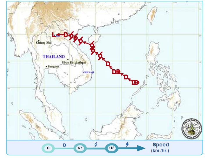
2200/ 10pm Aug 8th, 2013
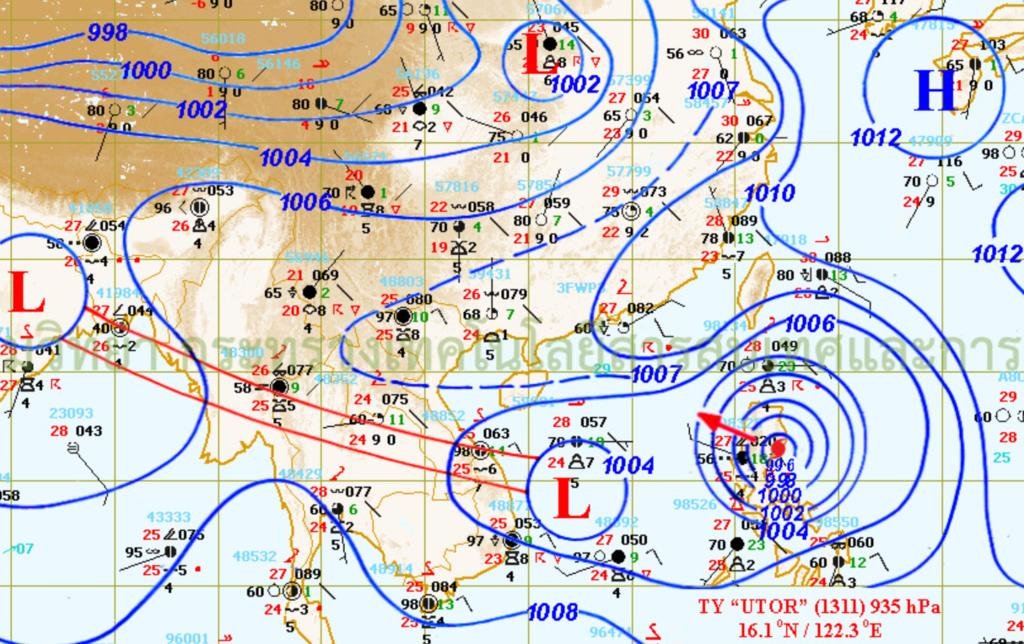
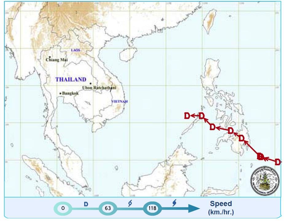
The remnants of the tropical depression "MANGKHUT" covers the upper North. Isolated heavy to very heavy rain is expected in northern and northeastern provinces during 1-2 days. People should beware of the severe weather. The areas include Nong Khai, Loei, Nong Bua Lam Phu, Mae Hong Son, Chiang Rai, Chiang Mai, Lamphun, Lampang, Phayao, Phrae, Nan, Uttaradit, Tak, Phitsanulok and Phetchabun. The rather strong southwest monsoon prevails over the Andaman Sea, Thailand and the Gulf. Isolated heavy rain remains over the East and the South West Coast. People in Nakhon Nayok, Chanthaburi, Trat, Ranong and Phang-nga should beware of heavy rain. The wind wave in the Andaman Sea is likely about 2 meters high. All ships should proceed with caution.
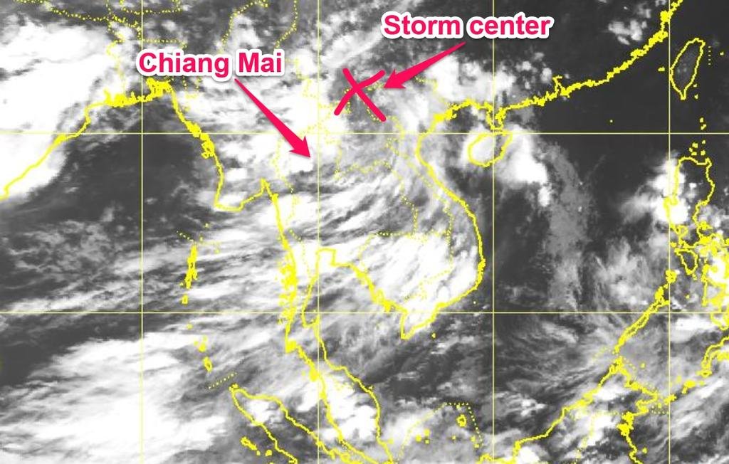
Looks like the storm center is over Mae Sai right now

Moving west north of Chiang Mai
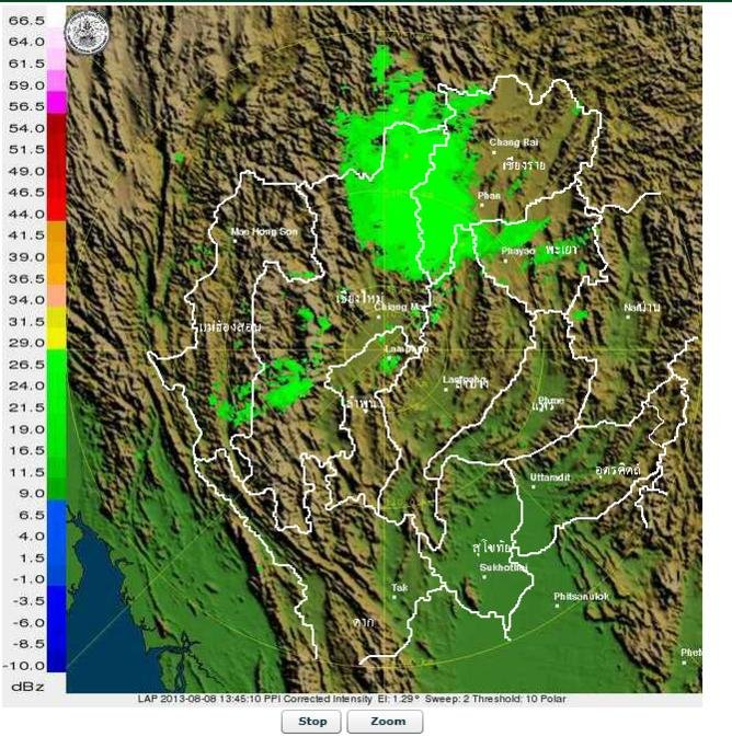
The remnants of the tropical depression "MANGKHUT" covers the upper North. Isolated heavy to very heavy rain is expected in northern and northeastern provinces during 1-2 days. People should beware of the severe weather. The areas include Nong Khai, Loei, Nong Bua Lam Phu, Mae Hong Son, Chiang Rai, Chiang Mai, Lamphun, Lampang, Phayao, Phrae, Nan, Uttaradit, Tak, Phitsanulok and Phetchabun. The rather strong southwest monsoon prevails over the Andaman Sea, Thailand and the Gulf. Isolated heavy rain remains over the East and the South West Coast. People in Nakhon Nayok, Chanthaburi, Trat, Ranong and Phang-nga should beware of heavy rain. The wind wave in the Andaman Sea is likely about 2 meters high. All ships should proceed with caution.
Looks like the storm center is over Mae Sai right now

Moving west north of Chiang Mai

crs
Senior Member
KTMphil
Senior member
Garden flooded again after last nights rain; found one of these splashing around:
<img src="http://www.rideasia.net/motorcycle-forum/attachment.php?attachmentid=19906"/>
Por eat it?
crs
Senior Member
Helped the lady over the road catch it with a scoop basket thing... Guess she'll scoff it, yes. Didn't fancy eel for tea, myself.
KTMphil
Senior member
Lone Rider
Blokes Who Can
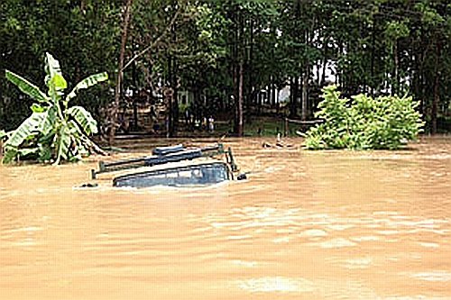
Well, this is not in Thailand but in Laos but yesterday morning they had heavy rain in the Paksan to Vientiane road (Rd 13S) caused by the Mangkhut Storm . On 5 locations on the road to the Phu Bia mine (Rd 4508) the water was over a meter high. The picture shows an army truck almost completely submerged and pushed along by the water from the Mang river near Ban Hatkhai.

KTMphil
Senior member
KTMphil
Senior member
From The Nation:
Storm causes flooding, landslides across the North - The Nation
Storm causes flooding, landslides across the North
The Nation August 12, 2013 1:00 am

A tractor removes debris from a landslide, which blocked a road between Pua and Bo Kluea districts in Nan province. The landslide was caused by tropical storm
Dozens of villages and paddy fields in the North are submerged under floodwater caused by the tropical storm "Mangkhut".
Torrential rains over the past three days in Nan province caused a landslide and paralysed transport in Pua district's Tambon Phukha and Bo Kluea district.
Phu Kha National Park officials were trying to remove rocks and debris from the landslide on a local road. People were advised to avoid the park and to use provincial highway number 1081 instead.
Meanwhile, the Water Resources Department's Flash Flood and Landslide Early Warning Centre instructed officials in Tha Wang Pha district to prepare to evacuate people in 13 villages to safer areas. Soldiers from Mobile Development Unit 13 were deployed to help local people get out of areas at risk.
In Uttaradit province, the heavy rain left paddy fields in two villages flooded. The provincial disaster prevention and mitigation office has warned locals in mountainous areas in Lab Lae district to keep alert for signs of flash floods and landslides. People living in Tambon Thung Yang and Tambon Phai Lhom in Lab Lae were advised to move their belongings to higher ground due to the increasing flood.
In Pai, in Mae Hong Son province, officials were closely monitoring the level of the Pai River. While the amount of water has yet to exceed critical levels, local people were told to be on standby around the clock and to prepare for another storm, Utor, which could reach the area in the near future.
Pai district chief Chathip Rujanaseri said a disaster prevention operation centre had been set up to handle any flood, but there had been no reports of damage to date.
Meanwhile, floodwater in Mae Sai, in Chiang Rai province in the far North, has been receding. Local people including merchants in Mae Sai market were cleaning out sand and mud left in their homes and shops.
Some tourists were still visiting Mae Sai. Some woke early in the morning and offered food to local monks yesterday, while others went across the border to the duty-free market in Myanmar's Tachilek town, as they learned that the Sai River level had receded over the past two days.
Storm causes flooding, landslides across the North - The Nation
Storm causes flooding, landslides across the North
The Nation August 12, 2013 1:00 am

A tractor removes debris from a landslide, which blocked a road between Pua and Bo Kluea districts in Nan province. The landslide was caused by tropical storm
Dozens of villages and paddy fields in the North are submerged under floodwater caused by the tropical storm "Mangkhut".
Torrential rains over the past three days in Nan province caused a landslide and paralysed transport in Pua district's Tambon Phukha and Bo Kluea district.
Phu Kha National Park officials were trying to remove rocks and debris from the landslide on a local road. People were advised to avoid the park and to use provincial highway number 1081 instead.
Meanwhile, the Water Resources Department's Flash Flood and Landslide Early Warning Centre instructed officials in Tha Wang Pha district to prepare to evacuate people in 13 villages to safer areas. Soldiers from Mobile Development Unit 13 were deployed to help local people get out of areas at risk.
In Uttaradit province, the heavy rain left paddy fields in two villages flooded. The provincial disaster prevention and mitigation office has warned locals in mountainous areas in Lab Lae district to keep alert for signs of flash floods and landslides. People living in Tambon Thung Yang and Tambon Phai Lhom in Lab Lae were advised to move their belongings to higher ground due to the increasing flood.
In Pai, in Mae Hong Son province, officials were closely monitoring the level of the Pai River. While the amount of water has yet to exceed critical levels, local people were told to be on standby around the clock and to prepare for another storm, Utor, which could reach the area in the near future.
Pai district chief Chathip Rujanaseri said a disaster prevention operation centre had been set up to handle any flood, but there had been no reports of damage to date.
Meanwhile, floodwater in Mae Sai, in Chiang Rai province in the far North, has been receding. Local people including merchants in Mae Sai market were cleaning out sand and mud left in their homes and shops.
Some tourists were still visiting Mae Sai. Some woke early in the morning and offered food to local monks yesterday, while others went across the border to the duty-free market in Myanmar's Tachilek town, as they learned that the Sai River level had receded over the past two days.
Loop
Senior Member
- Joined
- Oct 19, 2011
- Bikes
- VFR 800 PCX 150
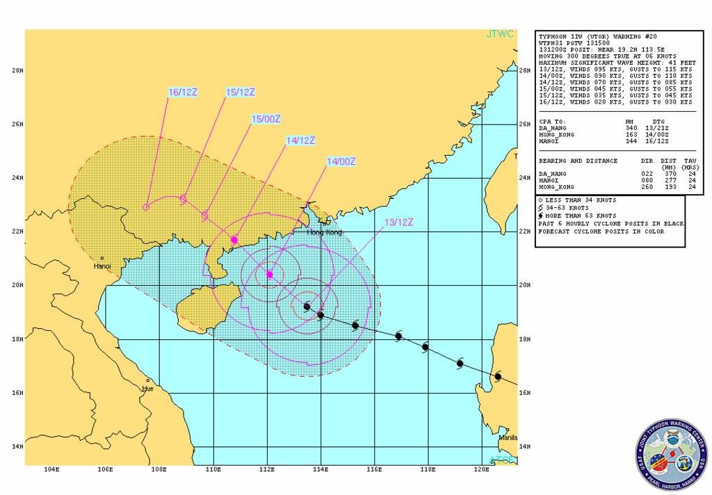
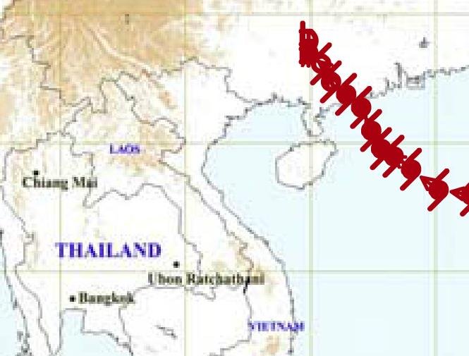
Another one,Utor,heading this way.
The Meteorological Department (TMD) has warned that Typhoon Utor, which struck the coast of China's Guangdong province late yesterday, will bring heavy rain to 27 Thai provinces today and tomorrow .
Typhoon Utor struck the Philippines as a Category 3 storm early Monday morning (August 12, 2013), leaving behind at least two dead. Today (August 13), the storm is pushing into China’s southern coastline and is expected to make landfall 150 miles southwest of Hong Kong around 08 UTC (4 a.m. EDT). Southeast China can expect heavy rain, flash flooding, potential mudslides, and gusty winds. China has been plagued with drought, flooding, and amajor heat wave this past year, and Utor is expected to create more weather-related problems. At this writing (August 13 at 4 p.m. EDT or 20 UTC), Utor is a Category 2 storm with sustained wind speeds around 90 knots, or 105 miles per hour. As it pushes ashore, the storm is expected to produce at least 3 to 6 inches of rain across southeast China and into parts of Vietnam. Typhoon Utor is the strongest tropical cyclone to form so far across the globe for 2013.
Attachments
crs
Senior Member
Think we'll be OK up in the North for this one:
Thai Meteorological Department
Thai Meteorological Department -- Storm Tracking
If anyone get's their bike dirty in all the wet and mud, apparently a new bike cleaning service opened up...
https://www.facebook.com/photo.php?v=563425263694385&set=vb.516326641737581&type=2&theater
10 baht a bike. 15 baht if you want 'extra polishing'.
crs
Senior Member
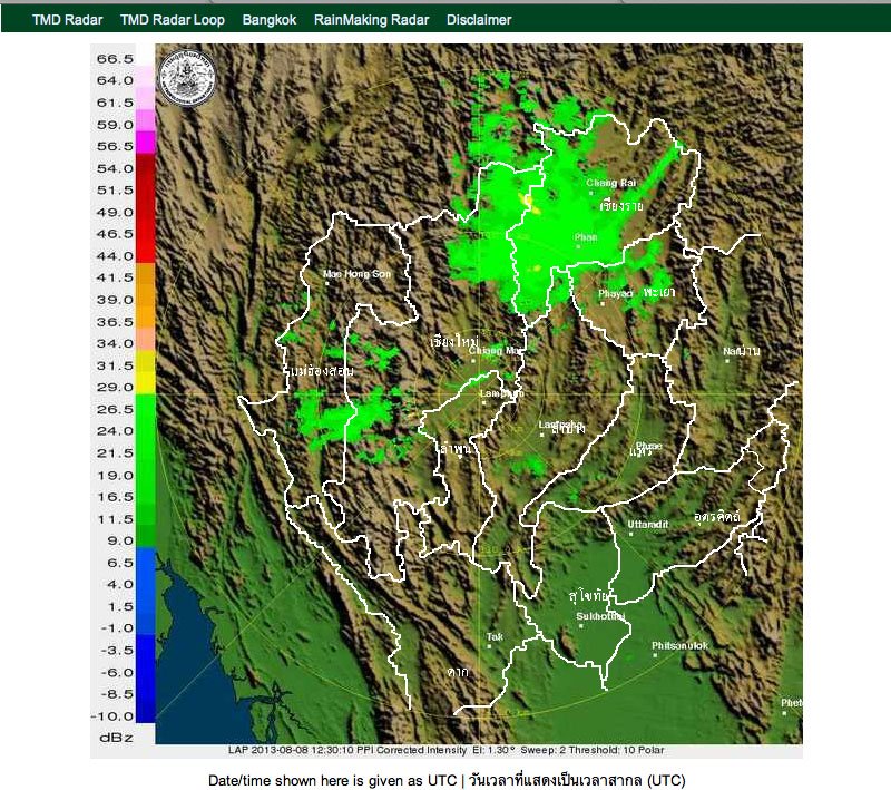
^ Saying that, it still rained most of last night and is now pissing it down big time in CR.
TMD Weather Radar
TMD Weather Radar
KTMphil
Senior member
KTMphil
Senior member
Lone Rider
Blokes Who Can
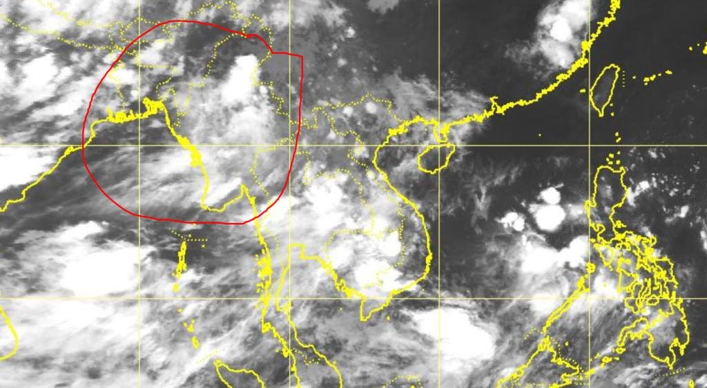
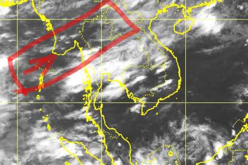
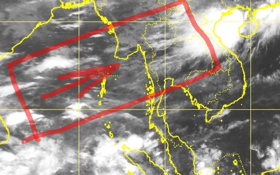
For those contemplating trail riding in north Thailand over the next few days (Sep 3rd - Sep 6th, 2013), right now the Satellite image looks pretty good and reasonably clear of squalls
Reassuring yourself for your upcoming ride in the Omkoi area?:LOL
KTMphil
Senior member
Reassuring yourself for your upcoming ride in the Omkoi area?:LOL
Looking for those windows in the heart of the SW Monsoon
KTMphil
Senior member
Just Bob
Senior Member
I'm looking at October for coming back out. How do the ocean temps and Tarrot cards look for the monsoon end this year.
KTMphil
Senior member
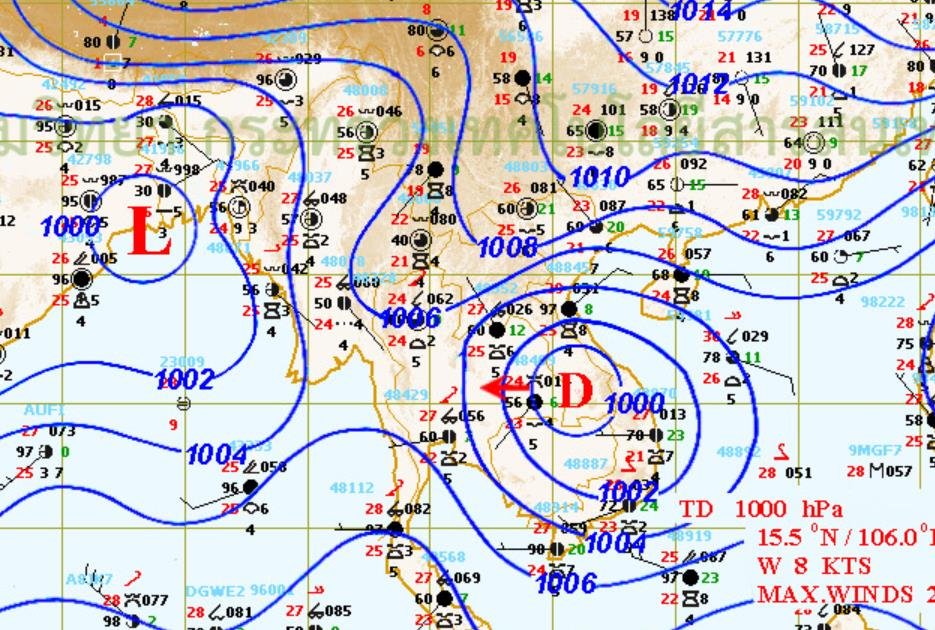
Looks like Korat (Nakhon Ratchasima) will get dumped on tonight & then the depression will weaken.[SIZE=+1]
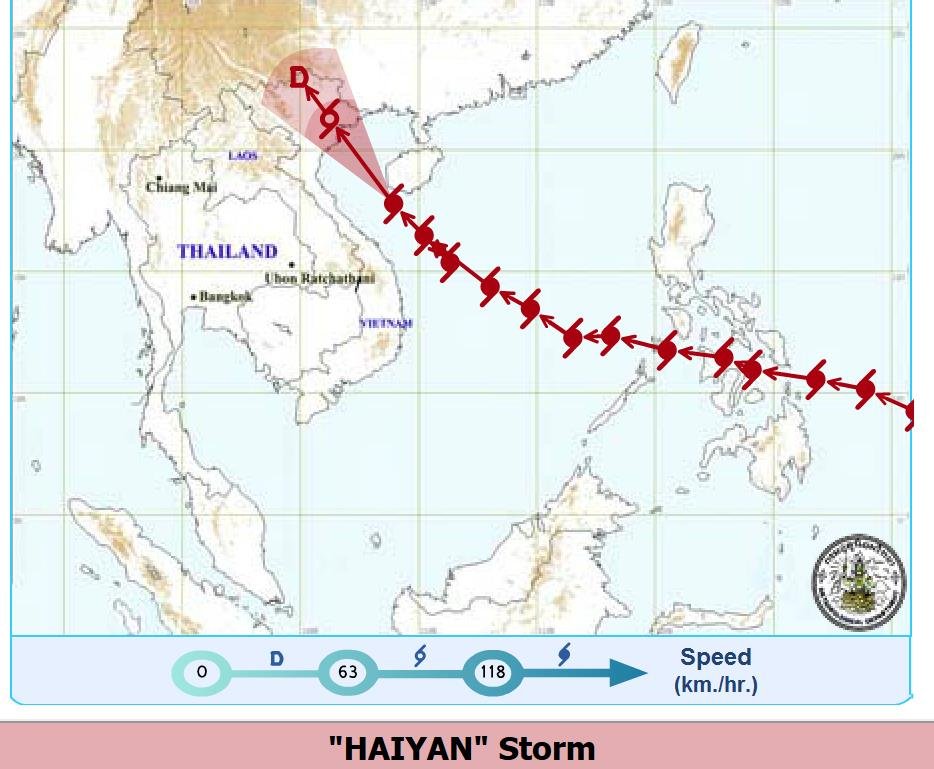
Warning
"Tropical Depression in South China Sea" [/SIZE]
No. 13 Time Issued : September 19, 2013
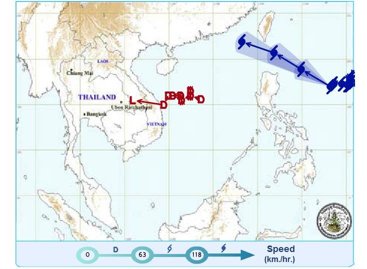
The tropical depression made landfall over middle Vietnam last night and passed Laos PDR heading Ubon Ratchathani, Thailand this morning. At 4.00 p.m. today, it declined to the low pressure over Roi Et province, and still it moved west. The low pressure was expected to pass through Maha Sarakham and Nakhon Ratchasima tonight and decay over the Central by tomorrow (20 Sep 13).
Torrential rain is likely much of northeastern provinces, namely, Roi Et, Surin, Buri Ram, Maha Sarakham, Nakhon Ratchasima, Chaiyaphum, Prachin Buri, Sa Kaeo, Rayong, Chanthaburi and Trat during this 19-20 September.
Another storm "USAGI" east of Philippines, tracked west-northwest to the upper part of the country. It is forecast to move to the South China Sea. All travelers are advised to follow the weather forecast before their departure.
The advisory will be effect on 19 September 2013
at 4.30 p.m.
(Signed) Worapat Tiewthanom
(Mr Worapat Tiewthanom)
Director-General, Thai Meteorological Department


KTMphil
Senior member
KTMphil
Senior member
KTMphil
Senior member
KTMphil
Senior member
15th November, 2013
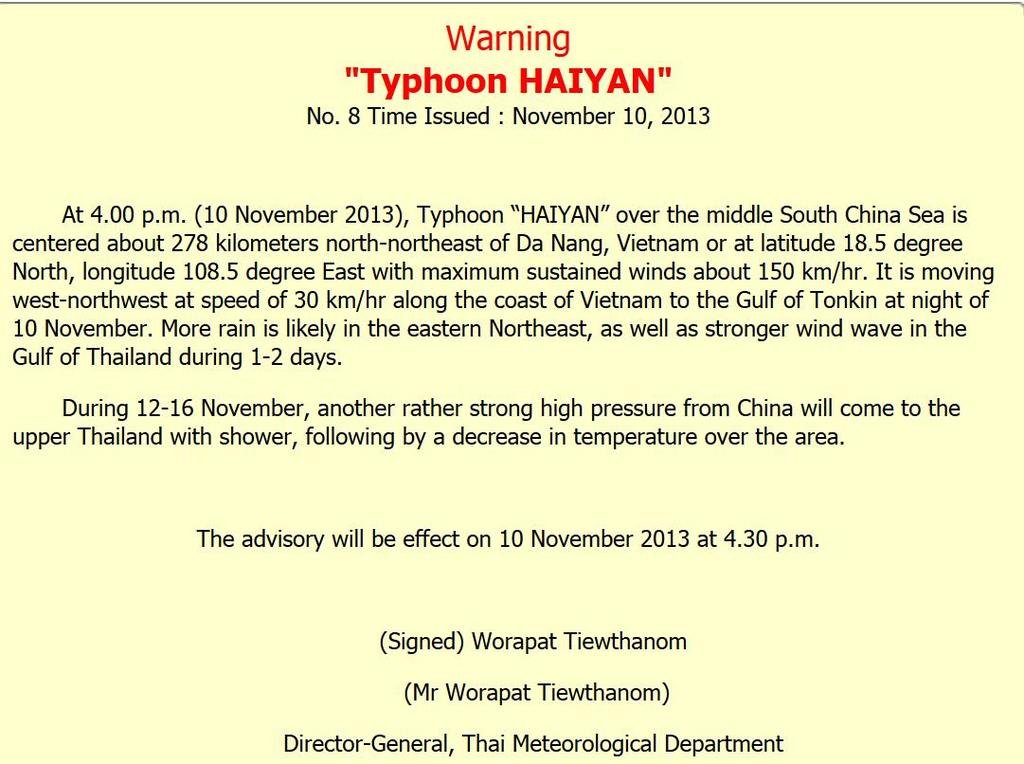
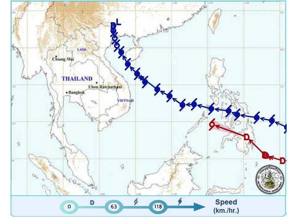
BANGKOK: -- At 05.00 p.m. on 14 November, the tropical depression in the lower South China Sea was centered about 750 kilometers east of Ho Chi Minh City, Vietnam or at latitude 12.0 degree north and longitude 113.5 degree east with maximum sustained winds about 55 km/hr. The depression was moving west at speed 20 km/hr.
It is forecast to move across southern Vietnam, Cambodia and cover the East and the upper South of Thailand during 15-17 November. More rain and isolated heavy rain are expected in the lower Northeast, the East, the Central and the upper South. The stronger wind wave 2-3 meters high is likely in the upper Gulf of Thailand.
The advisory will be effect on 14 November 2013 at 05.00 p.m.
(Signed) Worapat Tiewthanom
(Mr Worapat Tiewthanom)
Director-General, Thai Meteorological Department
Source
-- Thai Meteorological Department 2013-11-14
| Thread starter | Similar threads | Forum | Replies | Date |
|---|---|---|---|---|
|
|
Weather - Chiang Mai temperatures about to start dropping | Thailand Information | 0 | |
|
|
Darn! Chiang Mai weekend weather forecast! | Thailand Information | 10 | |
|
|
Weather and riding in the north... | Thailand Information | 9 | |
|
|
Thailand Weather | Thailand Information | 0 |


