Captain_Slash
Community Manager
- Joined
- Jun 28, 2011
- Bikes
- BMW 310GS Honda Wave 125 Honda MSX 125
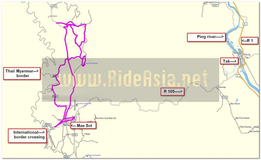
The Route 105, 3002, 1215, 3047, 4003, 5026
Total Distance 154 km

Out along the 3002 to explore some new roads that I have not rode on before and I found a few today

More smoke, just what we need


I ride very close to the Moei river this morning

That dog is being sensible hiding under there on this hot day

Sand is being dredged from the Moei


Now I am at the Mae Ka Sa waterfall at N16.51.672 E098.37.807

Sadly one useful ingredient is missing

A complete lack of H2O makes for a very uninteresting waterfall


I wonder how long before that tree falls over

Whilst riding along the 3047 I notice a road going up in the hills where only dirt tracks are showing on the ESRI

Its numbered as the 5026 on the km marker and strangely the GPS also has this number but only shows it as a dirt track


Its one awesome twisty well surfaced road that I am wondering where it will emerge.
The GPS shows loads of tracks out here all joined up but all dirt so I have no way of knowing which way this one goes until after I have rode it


This is just brilliant and theres loads of dirt tracks going off of it on both sides, a lot of exploring to do here just outside of Mae Sot

After 6 km of fun I need to slow down a bit as at N16.56.498 E098.35.749 the surface turns to unpaved and stays like that for 2.6 km until N16.57.584 E098.35.173 then its a paved surface back home.
One of the side tracks off of the unpaved bit was a good asphalt surface and that will be one of tomorrows projects

Fajitas at Krua Canadian for 140 Baht
You can get the gdb file from my website here … http://www.captainslash.com
Total Distance 154 km

Out along the 3002 to explore some new roads that I have not rode on before and I found a few today

More smoke, just what we need


I ride very close to the Moei river this morning

That dog is being sensible hiding under there on this hot day

Sand is being dredged from the Moei


Now I am at the Mae Ka Sa waterfall at N16.51.672 E098.37.807

Sadly one useful ingredient is missing

A complete lack of H2O makes for a very uninteresting waterfall


I wonder how long before that tree falls over

Whilst riding along the 3047 I notice a road going up in the hills where only dirt tracks are showing on the ESRI

Its numbered as the 5026 on the km marker and strangely the GPS also has this number but only shows it as a dirt track


Its one awesome twisty well surfaced road that I am wondering where it will emerge.
The GPS shows loads of tracks out here all joined up but all dirt so I have no way of knowing which way this one goes until after I have rode it


This is just brilliant and theres loads of dirt tracks going off of it on both sides, a lot of exploring to do here just outside of Mae Sot

After 6 km of fun I need to slow down a bit as at N16.56.498 E098.35.749 the surface turns to unpaved and stays like that for 2.6 km until N16.57.584 E098.35.173 then its a paved surface back home.
One of the side tracks off of the unpaved bit was a good asphalt surface and that will be one of tomorrows projects

Fajitas at Krua Canadian for 140 Baht
You can get the gdb file from my website here … http://www.captainslash.com


