Linking R 1150 (Phrao) to R 109 (Fang) Off-Road

KTMphil

Senior member
Joined
Jan 11, 2011
Location
Chiang Mai, Thailand
Bikes
2007 KTM 990 Adventure Suzuki DRZ 400
This has been talked about for a while, it's on a lot of people's agenda's, David Bailey re-lighted the interest in this a few weeks back.


8161718240_73c1aa0a5f_b.jpg


From Auke's data, we had an idea where would be a good starting point turning off from R 1150 at Khun Chae Bon & parking the truck at the school there.


This was all pretty exciting to all the school kids.


8161681937_5e60126996_b.jpg


Great clear day with beautiful views from the school

8161682177_4c76f49dd0_b.jpg
 
If you truck you're bike to this area for trail riding, there's a school which makes a good staging place to leave your vehicle at:


N19.33237


E99.31871


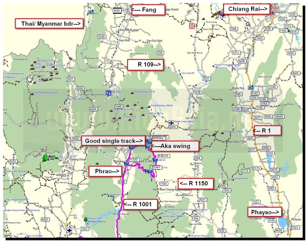
Below is a quick map of where we were exploring north of R 1150 (east of Phrao)


map.jpg
 
There was a lot of new data to be had, only one of these tracks had been mapped


8161682789_9b0886ff0a_b.jpg


Remnants from a Aka Hill Tribe Swing festival


8161714572_328d435f37_b.jpg


8161714724_e60a33c35d_b.jpg


Con's Platinum trail bike


8161683341_7b07ed6ed4_b.jpg
 
Many of the hill tribe villages had no electricity supply. always an good insight into how developed they are, this one surprisingly had a wind generator, very unusual to see out in the sticks


8161684199_a720b1b898_b.jpg


In this area there are a lot of farm access roads, everywhere was now pretty dry, no dust yet.


8161716100_ccbf22a984_b.jpg
 
One of the few hill tribe schools along the way, would be a great place for a children's charity ride


8161716298_5eed91fdcc_b.jpg


8161716440_0b1d947127_b.jpg
 
Great riding area, waiting for more pictures Phil :)

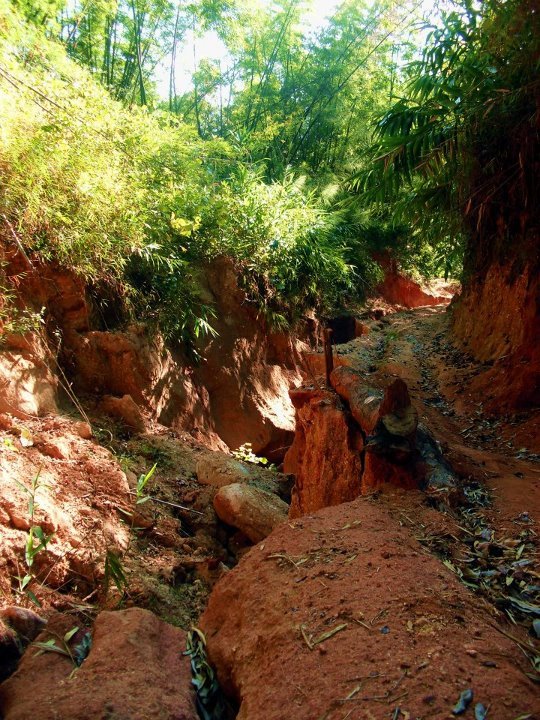
This is the area I went when going to Doi Mon Lan a few months ago. Dirt roads were pretty bad due to erosion back then and it was pretty dangerous at times.

Erosion and big ruts.jpg
 
Further north, we come across some beautiful, un-mapped single track


8161684977_232e940255_b.jpg


Huge bamboo

8161716898_6b16db0f65_b.jpg


We bump into some locals further up north along the single track, they unfortunately tell us that the track ends here & there's no way further north.


8161685785_b96818fa9d_b.jpg


The bamboo stems were huge up here

8161717838_e08461a05f_b.jpg


8161686327_8b55055c8a_b.jpg
 
The locals keep pointing around to the west to be the way through, so we backtrack and look for a trail westwards & come across this one. Con only has around 100km of fuel range, so you have to be a bit careful with a small tank doing this kind of exploring.


8161718442_49a456a08b_b.jpg


A view from the next track looking west


8161718636_0bbfaca46c_b.jpg


8161718822_b75cc4d01c_b.jpg


8161718990_6b265ef5ec_b.jpg
 
We end up far enough west that we can see the Phrao valley


8161720010_0f2e85d5df_b.jpg


8161688849_68a9f52664_b.jpg


Down into Phrao, the rice is ready for harvesting, no more hand cut rice here


8161720714_ef6f0b481b_b.jpg
 
A great new little restaurant in Phrao to try, co-ords:


N19.37110

E99.20490


8161689289_01bdb041c3_b.jpg


8161721098_cc0eefb831_b.jpg


8161721286_9b2a84eae6_b.jpg


Super clean/ dim sum & noodle soup all tasted great, well worth a try


8161689793_0e4df843d8_b.jpg
 
This has been talked about for a while, it's on a lot of people's agenda's, David Bailey re-lighted the interest in this a few weeks back.

From Auke's data, we had an idea where would be a good starting point turning off from R 1150 at Khun Chae Bon & parking the truck at the school there.

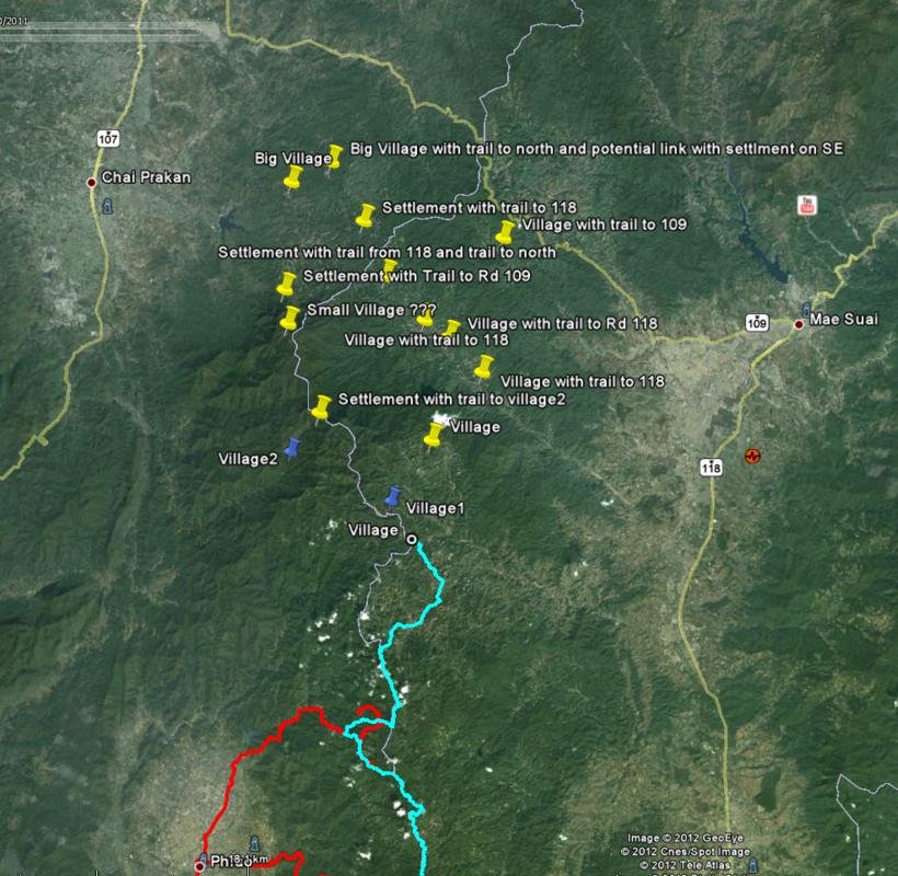
Don't remember ever having said that Phrao would be a good starting point but never mind. Attached is a screenshot from Google Earth showing your track in red, the blue line represents the track done some time ago (Mark, Luke and Justin?) which links with Rd 118 (good dirt road and doable by truck). Starting at where the blue track stops can be an option although I have my doubts that this is a real option. You probably have a better chance of linking the road a bit more to the north (Turn west at Ban Thako??) where there is a string of villages on a mountain ridge. You still will have to navigate the deep valley to the north before you can get up on the mountain ridge with Rd 109. By the way, the white line you see on the GE screenshot is a border line and not a road.

1150 to 109.jpg
 
GpxViewer

View attachment joinerEdit.gpx
map.jpg

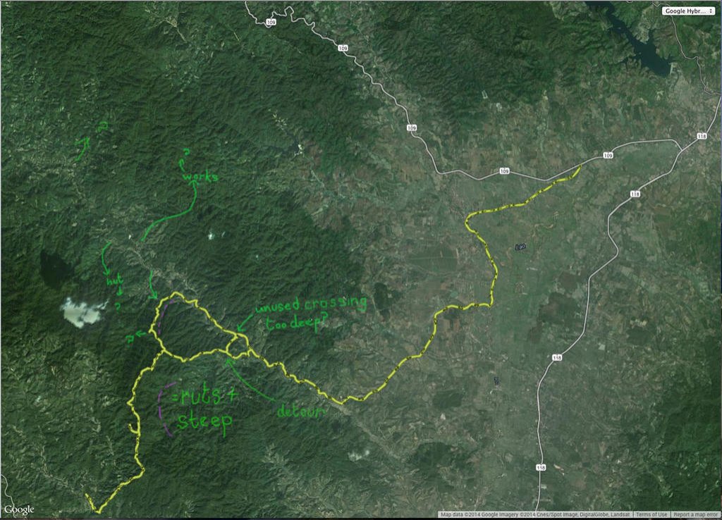
Seeing as everyone I usually ride with around CR is out of action or away, thought I'd go off exploring on my own and look into 'CR to CM off road'... Well, a route involving as little sealed road as possible between the two.

Spent a couple of days looking for routes and joiners from CR down to the 109 - will put info up on that when I've explored some more. South from this track on the gpx, there are tracks mapped, roughly following the CM/CR border, right down to the 118 near CM. (Link.) Don't know what these tracks are like, but will try get down that way when I can to check a route out. (Will put up a 'CR to CM off road' thread, if things come together well enough....)

Anyways, thought I'd head further south for a change and see if I could find a route over the hills south of the 109 down to the tracks already mapped north of Phrao. Captain Slash and Bob had mapped some of this (first time?) not too long ago (link) - so I had a few pointers already. I used Google and Apple maps for research also. (Using google and apple maps in 3d is useful when trying to figure likely track routes - and you get better detail in some areas as you swap between the maps due to resolution changes, date of pics and seasonal vegetation growth, etc.)

Found a joiner - there's maybe another south over the same hills to the west a bit (see the map) and maybe another 1 or 2 north over the hills bringing you up towards the 109.

Some of this track is steep and rutted - must have been made years back for pickup access and then left to get washed away. Some of it's great single track too... Wouldn't think to try it if the ground was wet, and would recommend 3+ prepared riders in case of problems as parts of the route are tricky - with drops and big ruts - and this is an isolated area.

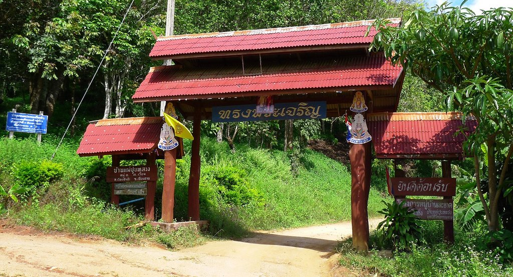
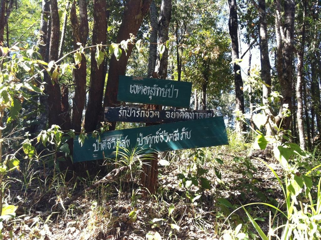
I'll get more pics sooner or later, but here's just one I took at the top junction, where there's a kind of lookout platform. The signs say something along the lines of 'Protected Area. Love the forest, Love your life, Don't think to do anything bad in the forest... Forest happy - you're happy, Forest sad - you'll get trouble!'.
IMG_0526.jpg
 

Attachments

  • crs7feb.gpx
    495.9 KB · Views: 325
Fantastic report Chris, looking at this on my phone, will look on a computer in a couple of days....well done.
 
Thread starter Similar threads Forum Replies Date
KTMphil Trail Riding Reports 6
Back
Top Bottom