I recently took a self-guided tour of the LS85 base camp and did it the easy way. By that I mean it was so easy that I don't know why more riders haven't done it. There really wasn't anything special about what I did to prepare other than load the OSM map on my GPS and fill up the gas tank.
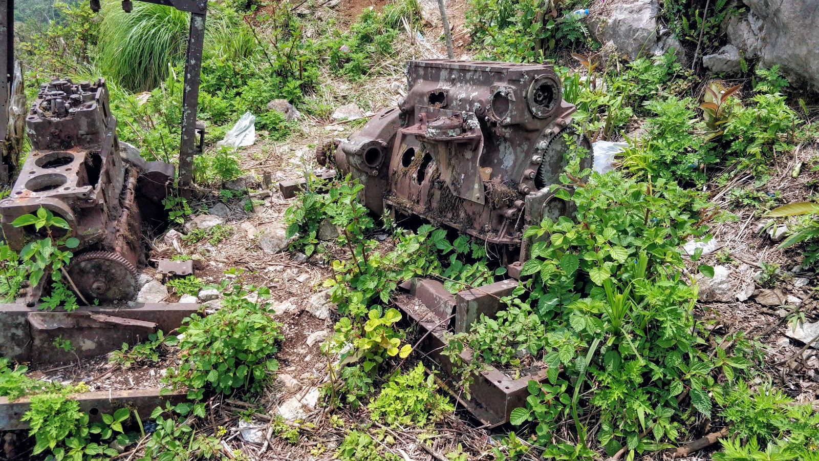
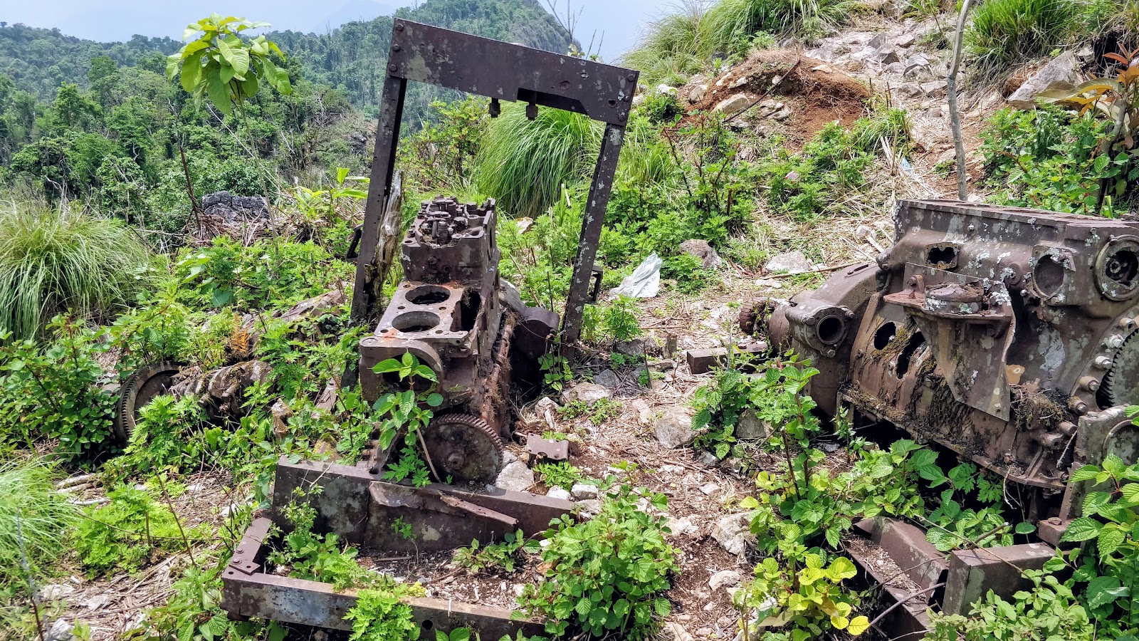
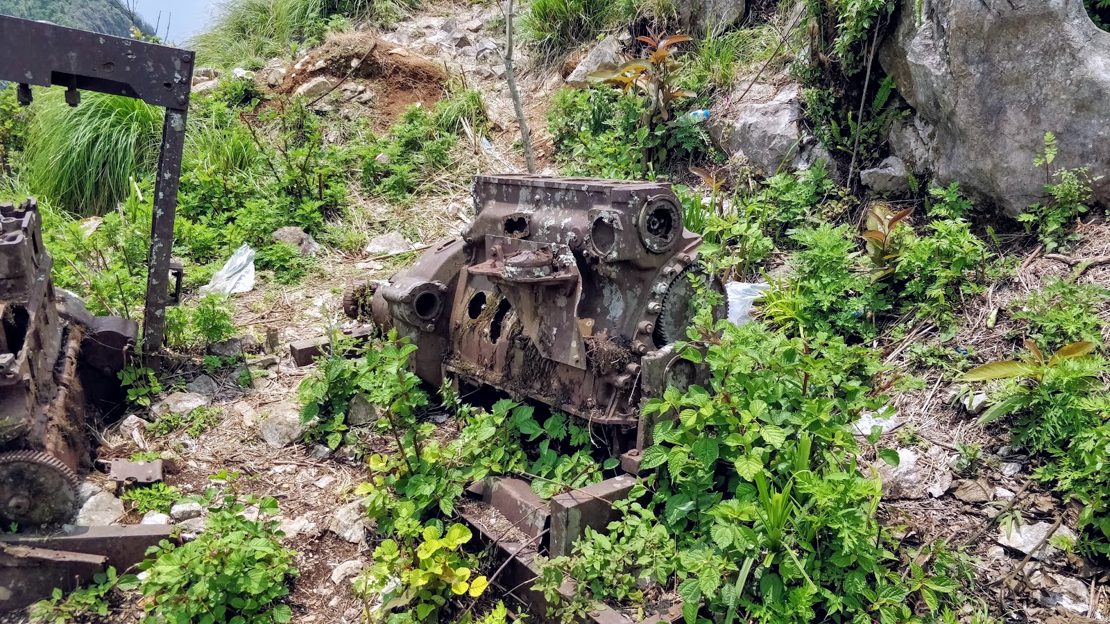
I'm purposely not going to recount any of the facts about Lima Site 85 but will admit a certain "schoolboy fascination" (props to JB) with the site and the circumstances surrounding it.
From https://en.wikipedia.org/wiki/Lima_Site_85
Lima Site 85 (LS-85 alphanumeric code of the phonetic 1st letter used to conceal this covert operation[3]) was a clandestine, military installation located in the Royal Kingdom of Laos guarded by the Hmong "Secret Army", the Central Intelligence Agency, and the United States Air Force used for Vietnam War covert operations against communist targets in ostensibly neutral Laos under attack by the Vietnam People's Army.
There is a ton of LS85 stuff to Google.
DISCLAIMER: These are my opinions. Apologies in advance for not using more precise language and accepted naming conventions, I'm just describing what I saw and did.
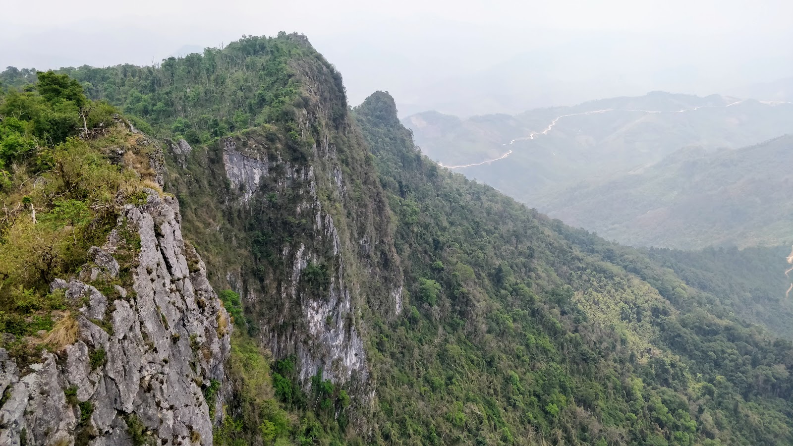
Fog in the mountains - riding in the clouds


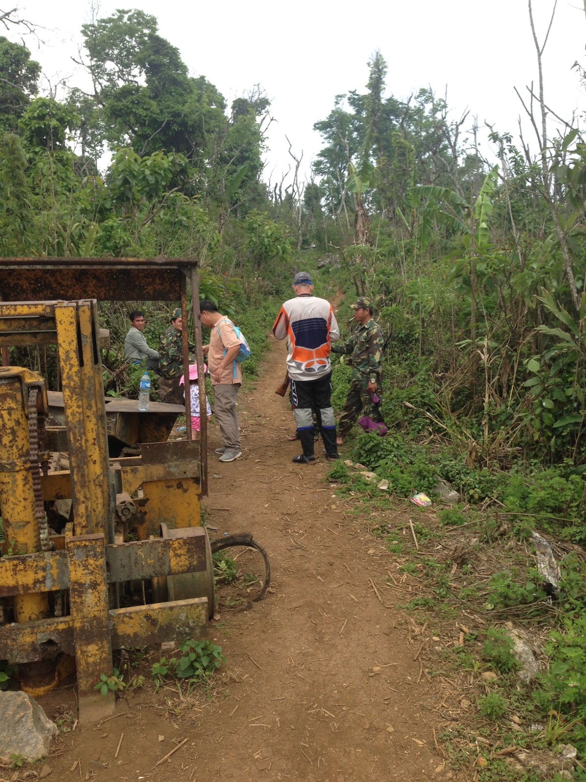
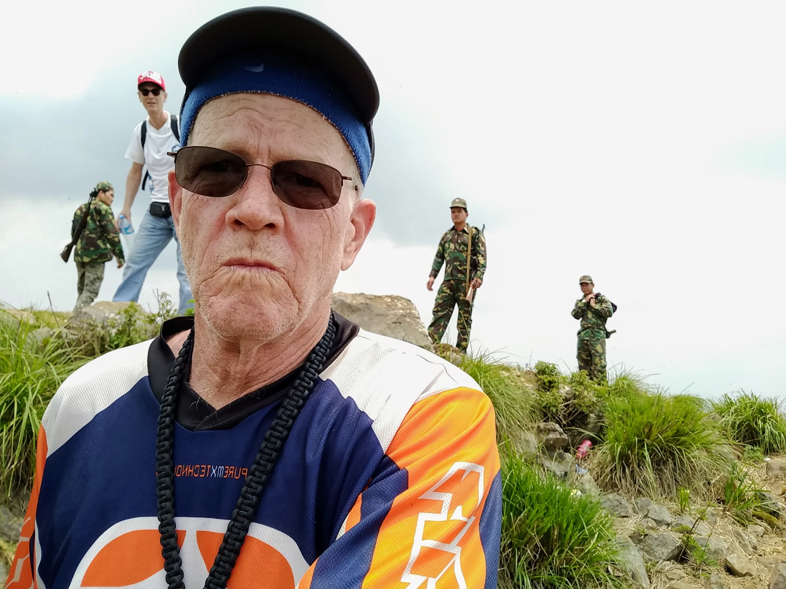
I didn't think I'd be writing a report because I didn't think I'd make it to the base camp. However, I was confident that between my limited language skills and my ability to make people smile, I'd be able to get myself out of whatever trouble I got into. It turns out that I didn't get into any trouble and apparently didn't break any laws or rules since there weren't any signs posted saying stay out or any other indication that the general public wasn't welcome. In fact, I saw some boys collecting firewood on the trail, prior to the Y and also saw evidence of some recent sawmill activity along the trail.
The video I shot and the accompanying narration was intended for my Mom and grand-kids since they wanted to know what I was doing over in Laos.
YouTube playlist of 13 videos here!
I also had no idea at all of what to expect but knew that the GT guys Brian and Chris did a hit and run visit to the base camp last January. I would have been happy to do what they did but ended up hanging out for 20 minutes before being evicted.
We planned on Swiss Danny being my wingman but after careful consideration of his current physical ailments, decided that it would be best for me to go solo. It would have been great to have Danny but alas it was not to be. Moral of the story: if you don't have a good wingman, you better have a good selfie stick.
Saturday, April 30, 2016
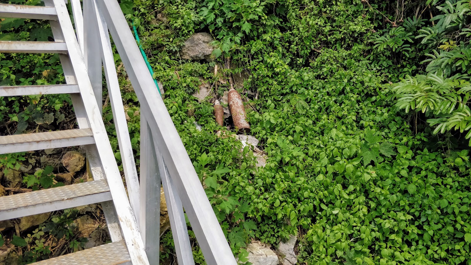
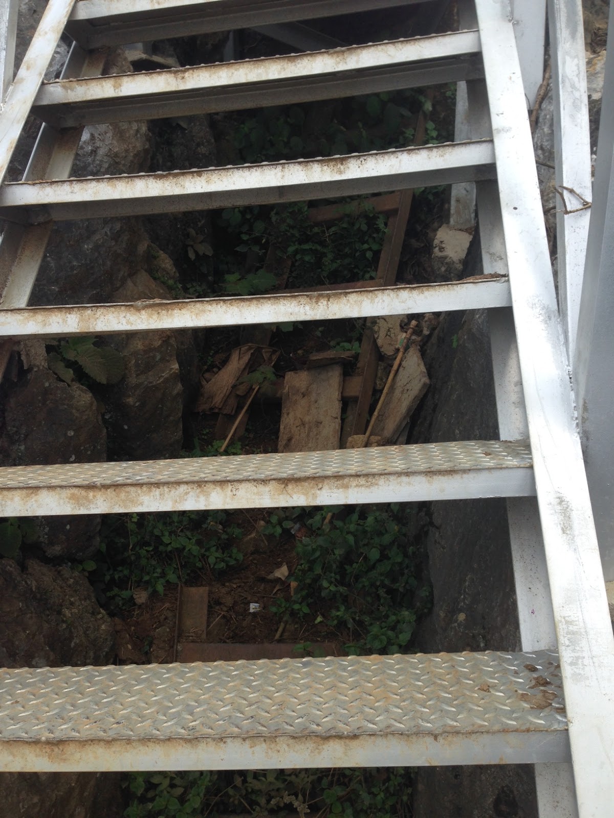
The attached GPS track shows I spent about 20 minutes at the camp. I made a waypoint to show where the pavement starts/ends on the road as well as a waypoint of where I parked the XR for 20 minutes. The POI labelled Ban Phathi on the OSM map is where the base camp itself is. I also dropped a waypoint where the "Y" is that others have taken before. According to Auke, a left turn at the Y (heading north) will take you to where the recent drone footage was launched from. Speaking of drone footage, I probably wouldn't have done this ride if I hadn't seen the footage showing the new building and someone staying there. Also, I think the drone footage is where I first saw the term "ladder" used but I'm not 100% sure what it refers to.
Had breakfast at the farang friendly Dannao Meuang Xam restaurant and was on the road by 8:20 AM.
City center to end of pavement ~ 16 km.
Road to village: ~42 km
Trail (2 track) from village to the base camp: ~7 km
Total: ~65 km
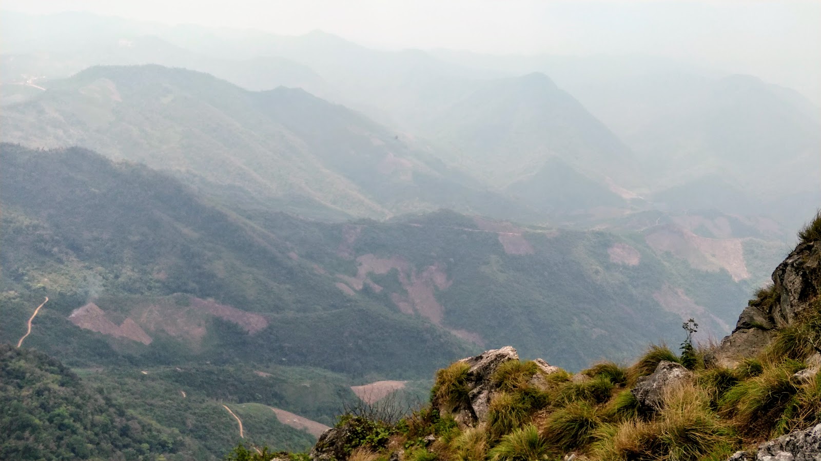
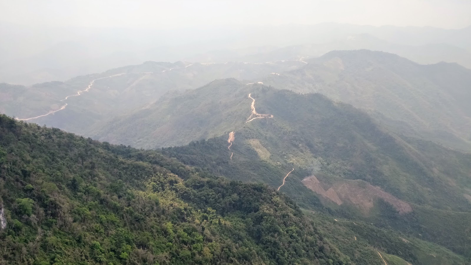
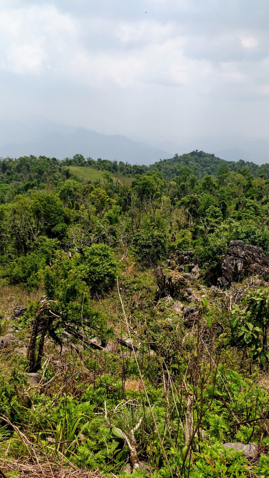
I was pleased that there was as much pavement as there was and even more pleased that the road wasn't all that bad. Only a few wet spots to deal with but this was just the beginning of the rainy season. Still shouldn't be too bad in the wet since the entire road is covered in some kind of crushed rock and fairly well drained. Once again the XR was the right choice as I was able to move at a good pace and take the bumps in stride. Road construction isn't complete but it's good enough to be called a road instead of a dirt track as it is on the OSM map.
Once I was on the last 7 km of trail north of Ban Houayma, I stopped to take off swap glasses and pull my ear plugs out. I didn't know what to expect, if there were any armed checkpoints nor if I would make it to the camp but I wanted these guys to be able to see who I was and I wanted to be able to hear if they were putting a round in the chamber of their AK-47s!
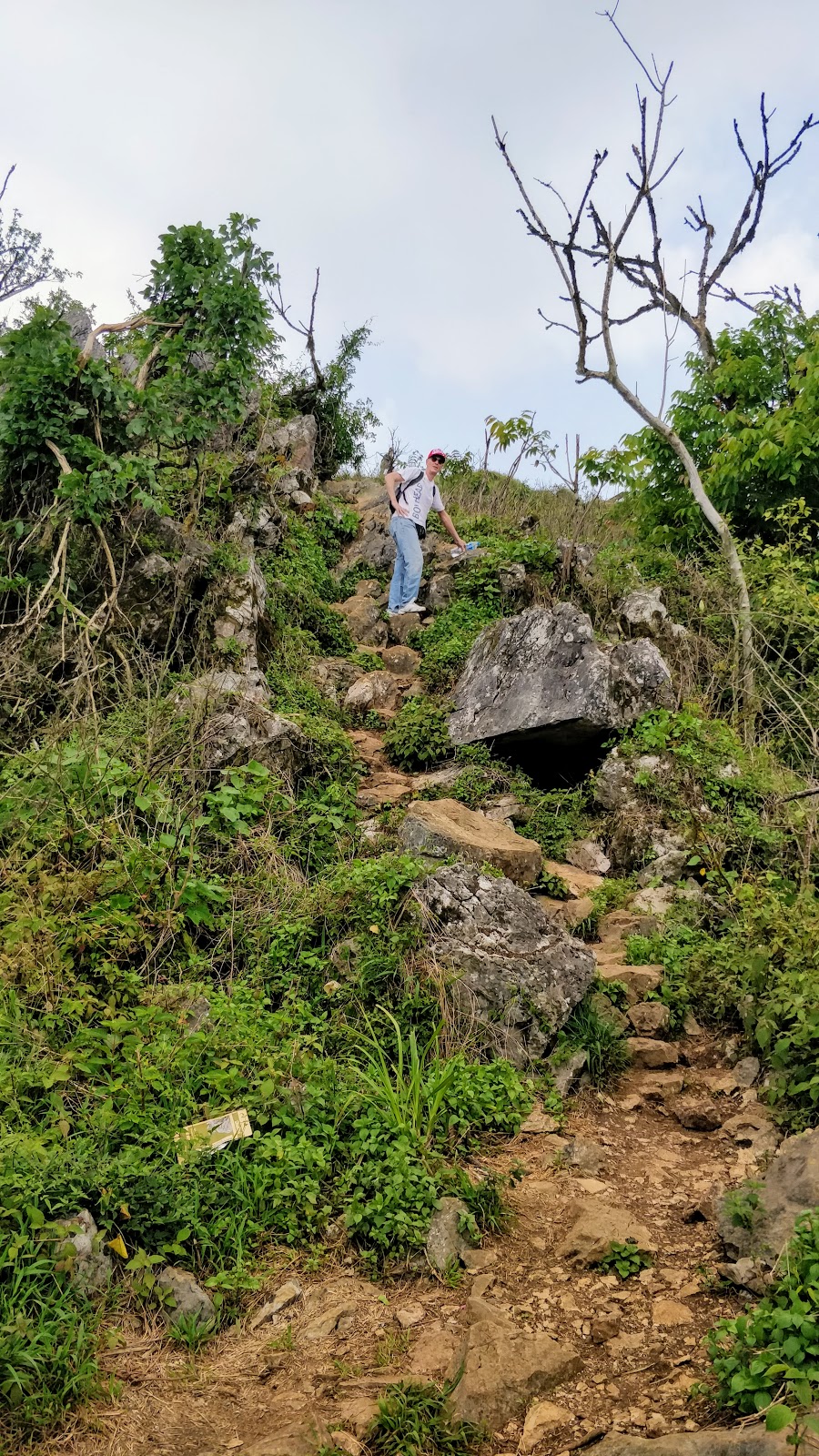
I climbed the last hill in first gear and even then it felt like I came on the camp quickly since I had to keep the revs up to stay in the power band. I'm positive my GS1200 would not have made the final climb and even the good old DRZ-S with the 5 speed gearbox would have required more speed than I would have wanted to use. Having said that the last 1-2 km of trail was in pretty good condition - without any real erosion. Take a look at the gpx to get an idea of how steep it is or see Brian's GT report for an elevation profile.
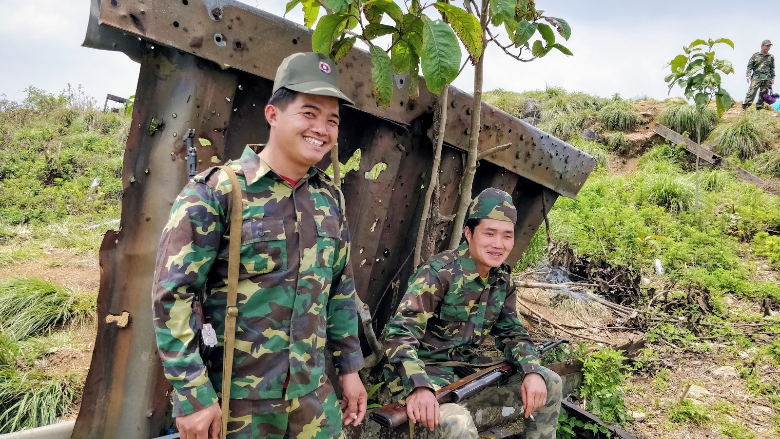
I saw a guy loading his scooter in front of the parking area and rolled up next to him in a friendly manner. I tried to engage him but he was yelling up the hill at the same time he was talking to me. He seemed nervous and preoccupied but never impolite. He didn't give me any indication that I wasn't welcome either. I have a feeling that my choice of helmet decorations made me appear less threatening. After all, it would be hard to shoot someone with a bright red mohawk and a couple of antennas on their helmet, right?
At the same time I could see 2 guys eyeballing me from above. I kept a sharp eye on the hilltop camp the entire time I was there because I don't like bad surprises.
Shortly after my scooter friend left, I noticed that the 2 guys above disappeared. When he left, I rolled the XR to a spot where I'd have a better view of the ladder area.
I took a leak, mixed a bottle of water with some hydration salts before I realized that I didn't have any pictures yet! Using my cell phone I took a series of photos and videos to document my visit.
I didn't hear much other than some rattling corrugated steel flapping in the wind.
Cattle crossing
About 1 or 2 km below the camp there is a closed bamboo cattle guard that has a well reinforced ride-thru for bikes. Nice touch I thought, it makes for a quick getaway.
Pig pen, cows?
There is a small, empty livestock corral next to a steel roofed open sided mini barn. I originally thought it was a pig sty but it makes more sense to think they kept cattle there at one time. There wasn't any cow poop at the camp or one the trail to it so there haven't been any cows around in a while.
There were 9 scooters parked under the roof, ten counting the one that just left. That fact made it feel even weirder that no one has come out to great me at all. I yelled out my best "Sabai Dee" in a submissive manner and waved as well but was ignored.
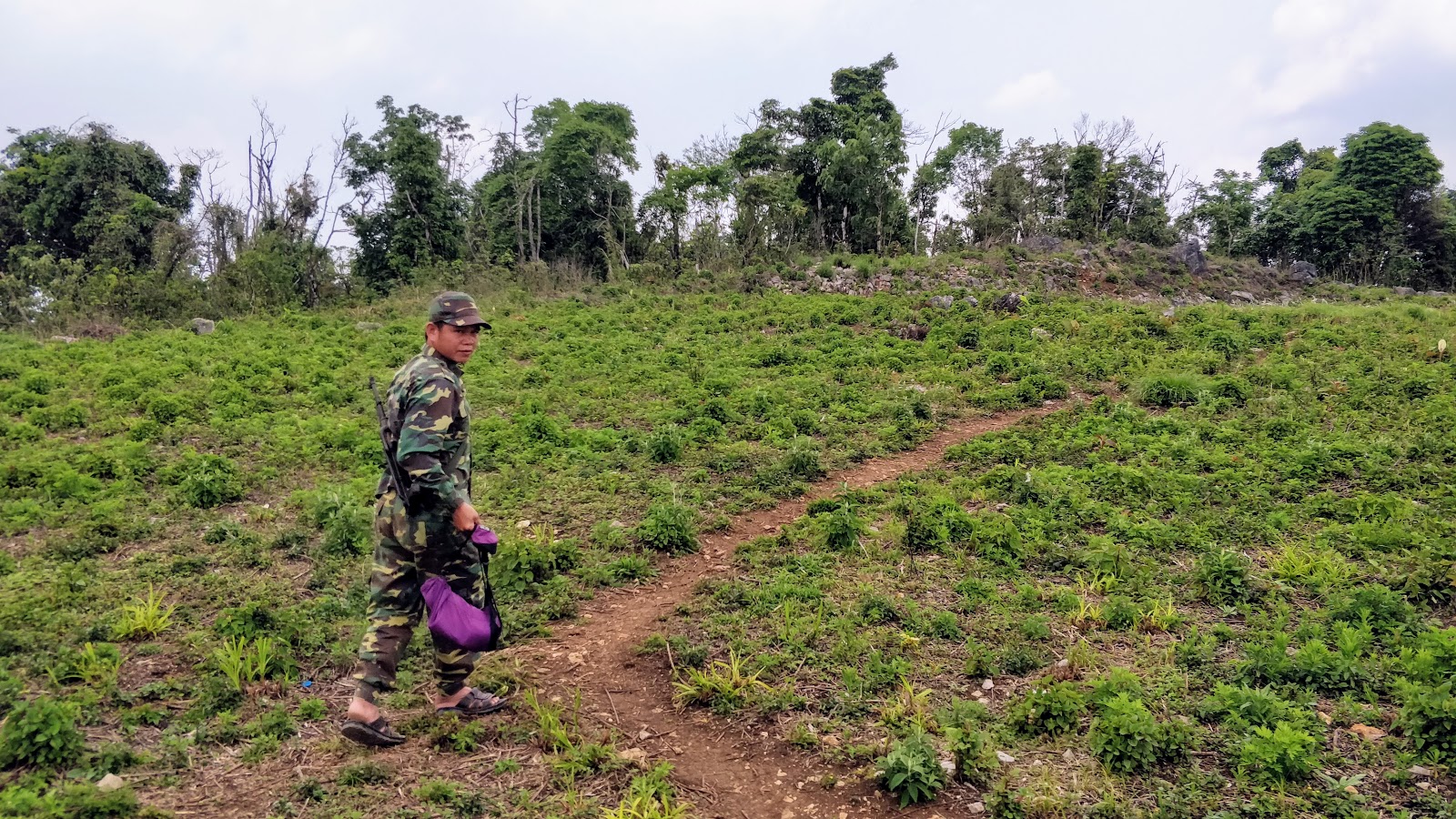
The next person I would hear from would be the "big boss" when he came to the edge of the hill to cuss me out in Laos. I call him the big boss because he was older than everyone else and was wearing some kind of khaki quasi uniform. He made a gesture with his hand and I copied it saying "Go?" He replied "You go!" Once that happened, I fiddled with my camera, keys, gloves and buttpack for a bit and he started yelling "You go!" at me again which prompted me to play stupid, wai him and ask again, "I go?"
I put my helmet on and did my chicken imitation in hopes of lightening the mood. The big boss wasn't impressed but one of the young guys watching said something and laughed out loud. I'm guessing that he was suffering from a hangover and needed 20 minutes to get up and do something the unwanted visitor?
It felt like it was time to go so I started the mighty XR and started rolling down the hill. All of a sudden I noticed a well-used walking trail veering off to the left and realized that's got to be the path I will use to visit the summit next trip. I killed and stopped the XR at the head of the walking trail, looked up to the big boss, and made a motion for me to ride the trail. In his best (only?) English, the big boss told me "You go!" for the last time today.
I rolled down the hill with an incredible adrenaline high and a grin that lasted all the way back to a cold beer Laos at the hotel.
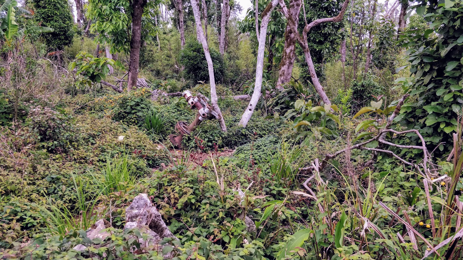
Army or ???
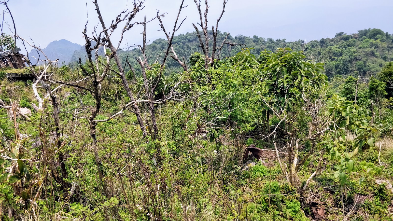
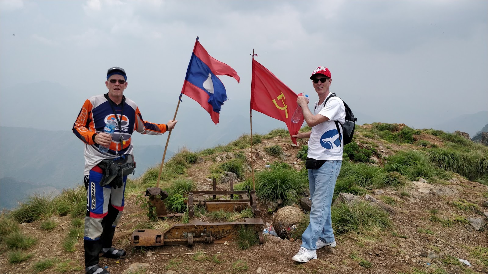
I'm not sure if it's correct to call the place I visited an Army camp or not because it didn't feel 100% Army to me. This was my first visit to a Laos Army camp and I used to seeing a flag flying and/or at least a few guys in some kind of uniform.
Electricity
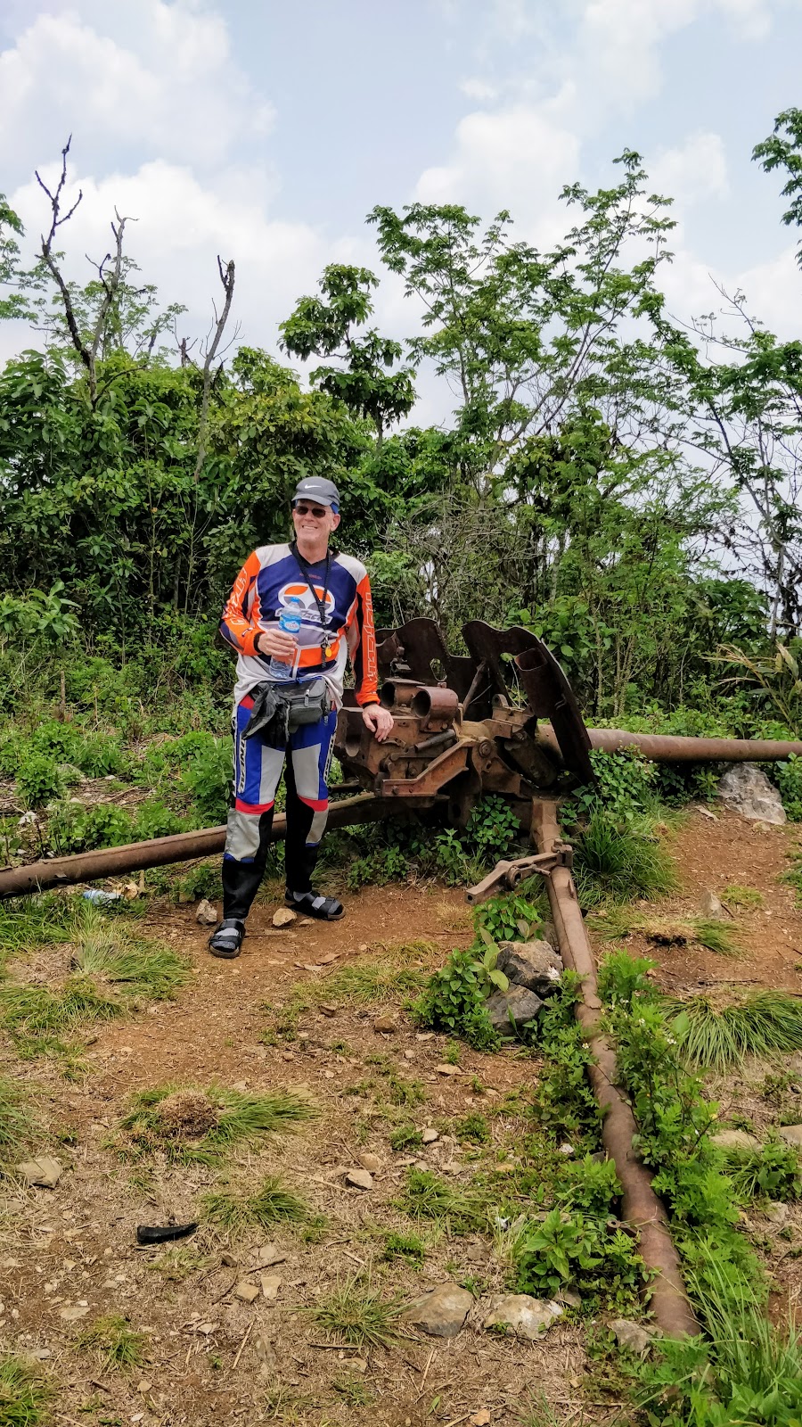
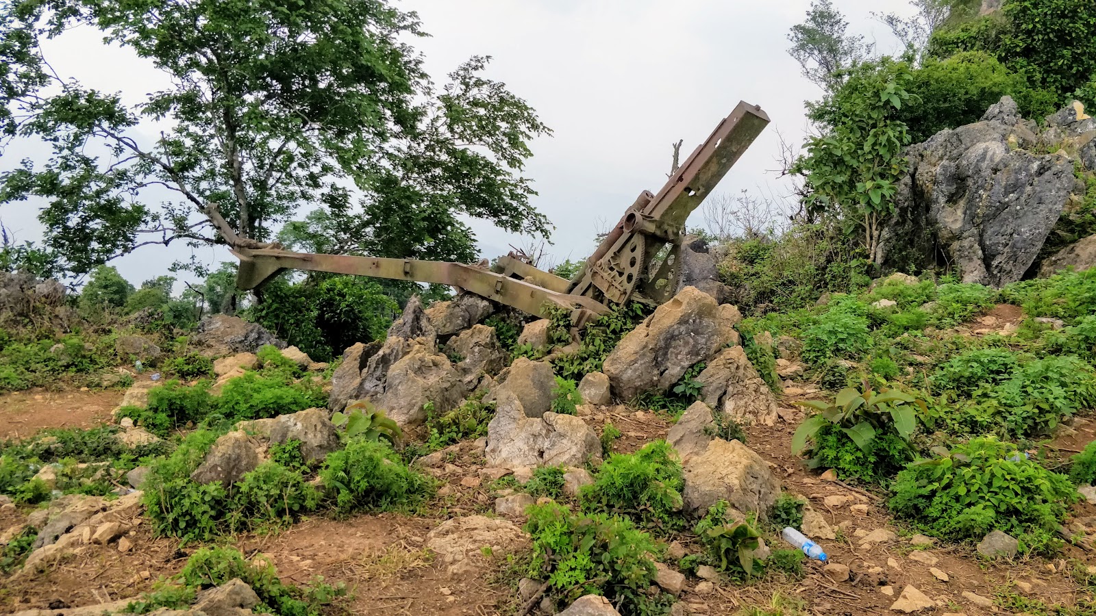
You'll see a lonely electricity pole at the army camp in one of my videos. I saw a lot of new and ongoing electrical construction along most of the road.
Mr. Red Pants/shorts
Full res pix of Mr. Red Pants/shorts
In the drone footage, you'll see someone walking out of the "new building" near the "ladder." I also saw someone wearing red pants/shorts walk out from the building and stand at the edge looking down at me with their hands on their hips. You will have to dl my original photos and zoom in to see Mr. Red shorts. Apologies for my cell phone photos, digital zoom sucks no matter what camera you have.
Shining building
In one of the red pants photos you can also see something shining brightly on the RH side of the new building. I'm guessing that it was a piece of corrugated steel flapping in the wind.
Cell coverage?!?!?

Just before I was chased away, I remembered to look at my phone to see if I had coverage. I was amazed to see 2/4 bars and Edge service for data with my Laotel SIM. Chances are that the guys in the camp have better coverage and I'm sure the guy in red pants had coverage too.
I thought about staying in XamNeua to visit the caves but looking at the rain forecast and considering my advanced age, I decided to move on. Besides, there wouldn't be many other things on my Laos to do list that would beat what I just did other than riding a wheelie down the airstrip at LS20. I don't do wheelies so it felt right to go out on a high note.
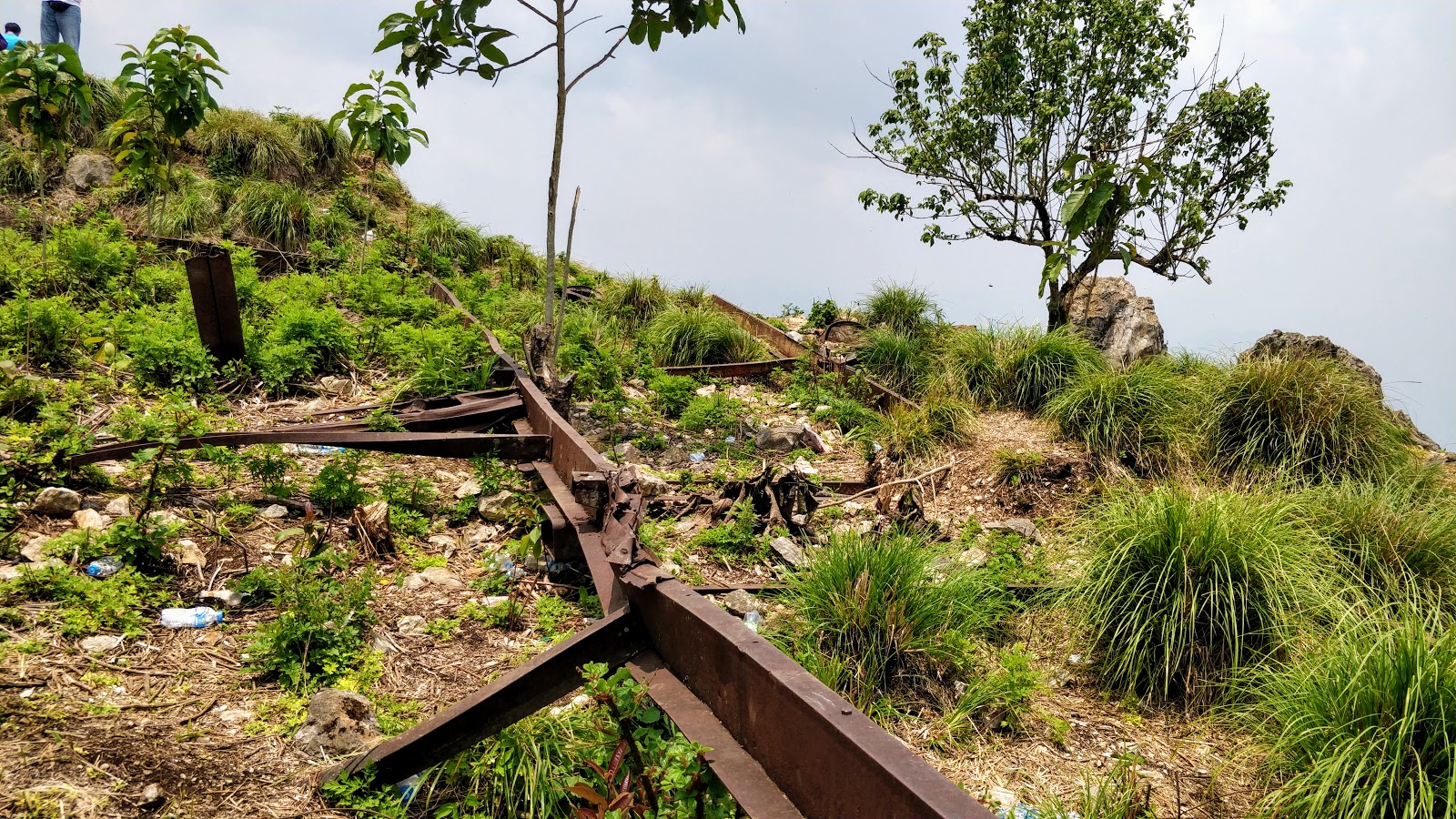
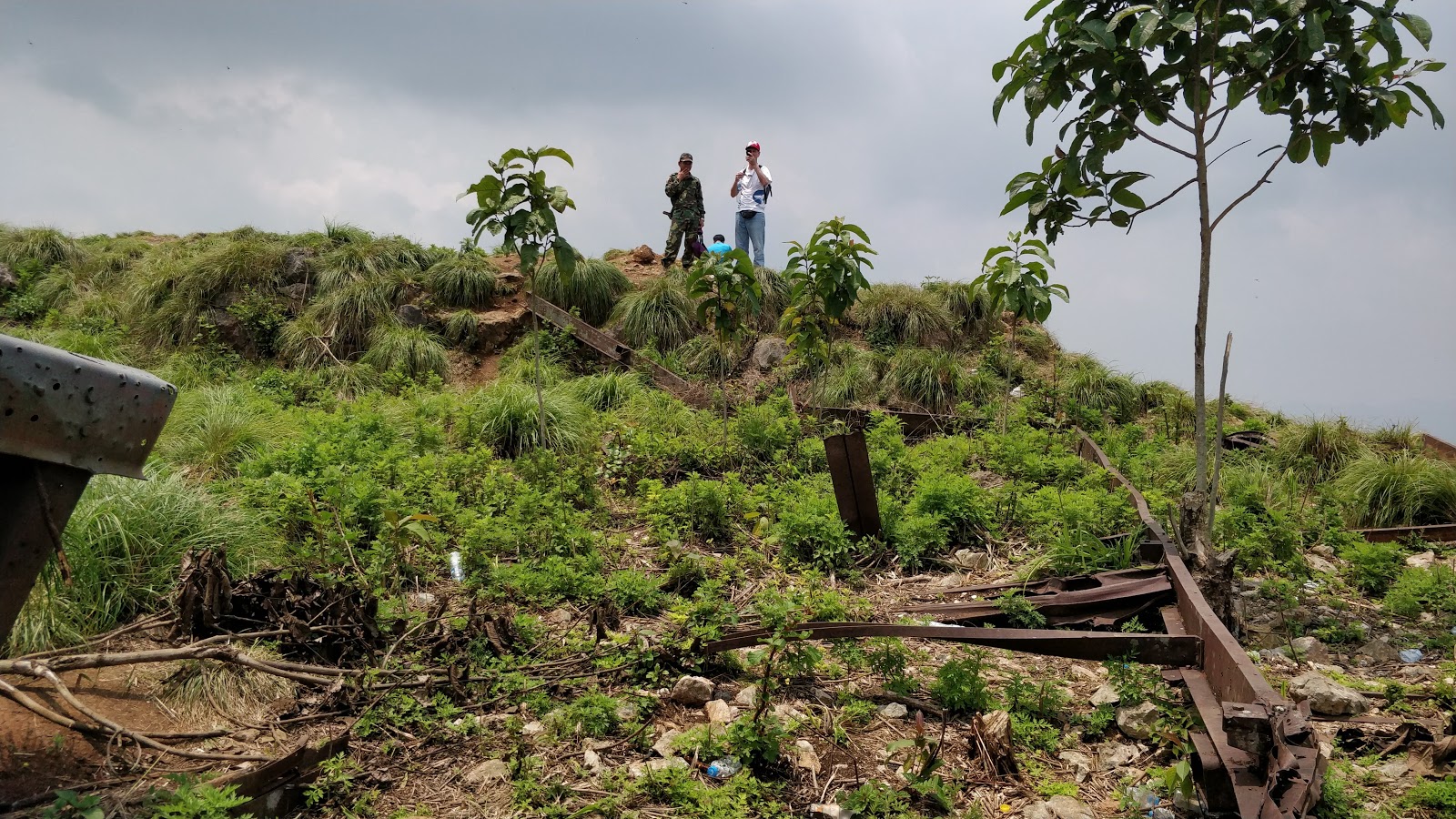
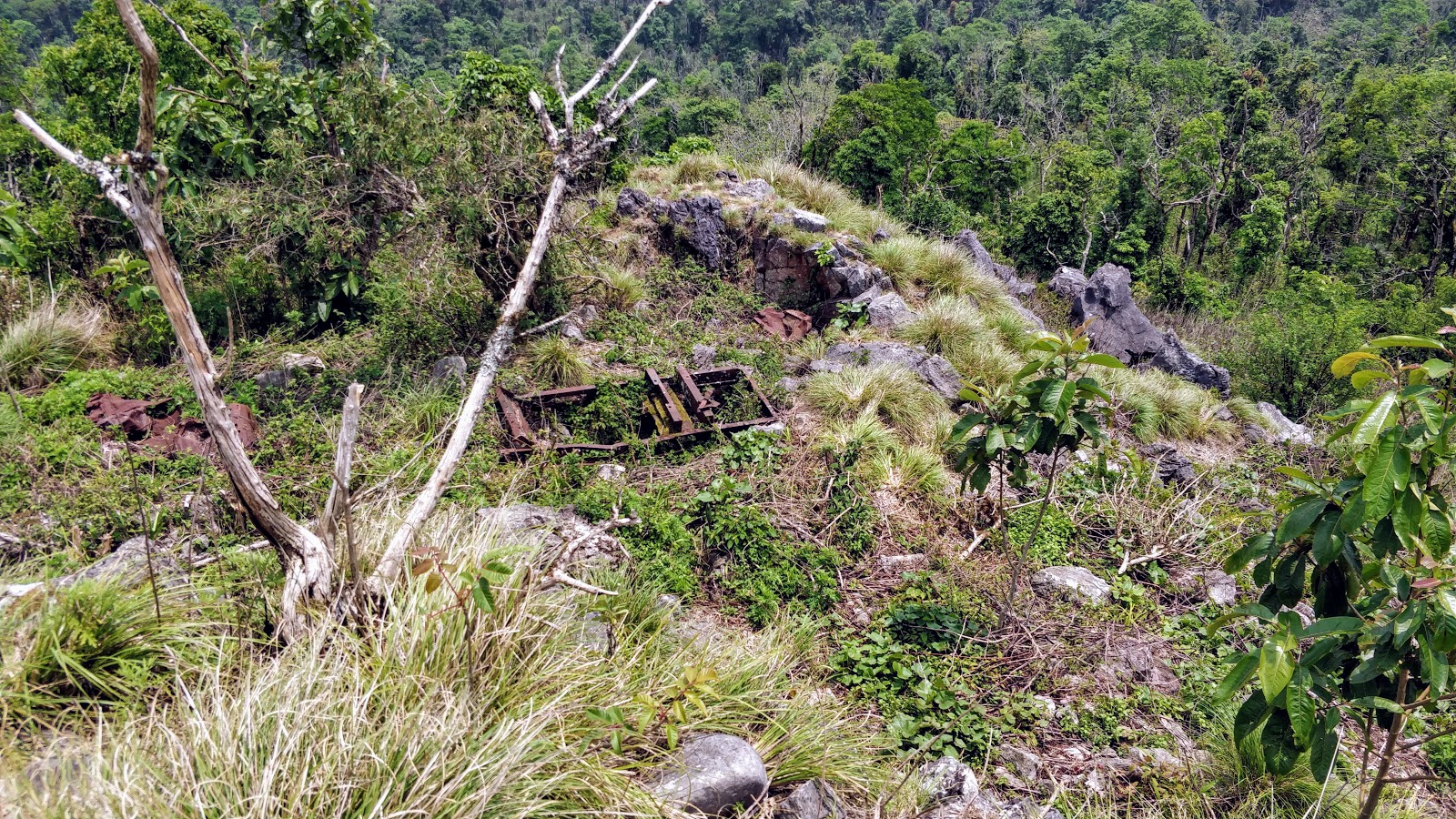
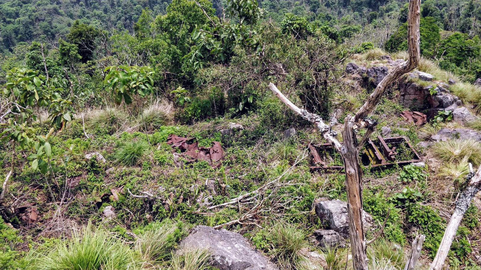
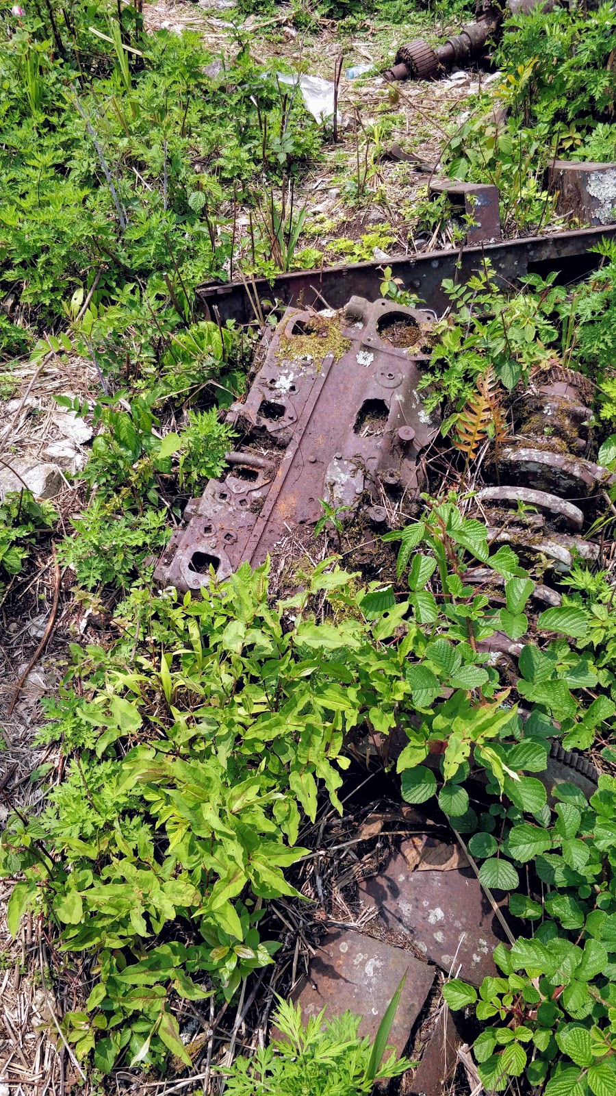
I had a chance meetup with Auke in Phonsavan and ate dinner with him and his TLC brotherhood colleagues. We talked about the unusual status of this "army camp" since it didn't have any flag flying. Auke's been to far more Laos army camps than me and says he can't remember seeing one without a flag. What is also puzzling is the reason for the new building and why there are people staying there. That brings me to my next goal which will be to camp overnight in the new building and tour what's left of the TACAN site the next morning.
Here's the .gpx
View attachment LS85BBQ.gpx
BarryBBQ
I'm purposely not going to recount any of the facts about Lima Site 85 but will admit a certain "schoolboy fascination" (props to JB) with the site and the circumstances surrounding it.
From https://en.wikipedia.org/wiki/Lima_Site_85
Lima Site 85 (LS-85 alphanumeric code of the phonetic 1st letter used to conceal this covert operation[3]) was a clandestine, military installation located in the Royal Kingdom of Laos guarded by the Hmong "Secret Army", the Central Intelligence Agency, and the United States Air Force used for Vietnam War covert operations against communist targets in ostensibly neutral Laos under attack by the Vietnam People's Army.
There is a ton of LS85 stuff to Google.
DISCLAIMER: These are my opinions. Apologies in advance for not using more precise language and accepted naming conventions, I'm just describing what I saw and did.
Fog in the mountains - riding in the clouds


I didn't think I'd be writing a report because I didn't think I'd make it to the base camp. However, I was confident that between my limited language skills and my ability to make people smile, I'd be able to get myself out of whatever trouble I got into. It turns out that I didn't get into any trouble and apparently didn't break any laws or rules since there weren't any signs posted saying stay out or any other indication that the general public wasn't welcome. In fact, I saw some boys collecting firewood on the trail, prior to the Y and also saw evidence of some recent sawmill activity along the trail.
The video I shot and the accompanying narration was intended for my Mom and grand-kids since they wanted to know what I was doing over in Laos.
YouTube playlist of 13 videos here!
I also had no idea at all of what to expect but knew that the GT guys Brian and Chris did a hit and run visit to the base camp last January. I would have been happy to do what they did but ended up hanging out for 20 minutes before being evicted.
We planned on Swiss Danny being my wingman but after careful consideration of his current physical ailments, decided that it would be best for me to go solo. It would have been great to have Danny but alas it was not to be. Moral of the story: if you don't have a good wingman, you better have a good selfie stick.
Saturday, April 30, 2016
The attached GPS track shows I spent about 20 minutes at the camp. I made a waypoint to show where the pavement starts/ends on the road as well as a waypoint of where I parked the XR for 20 minutes. The POI labelled Ban Phathi on the OSM map is where the base camp itself is. I also dropped a waypoint where the "Y" is that others have taken before. According to Auke, a left turn at the Y (heading north) will take you to where the recent drone footage was launched from. Speaking of drone footage, I probably wouldn't have done this ride if I hadn't seen the footage showing the new building and someone staying there. Also, I think the drone footage is where I first saw the term "ladder" used but I'm not 100% sure what it refers to.
Had breakfast at the farang friendly Dannao Meuang Xam restaurant and was on the road by 8:20 AM.
City center to end of pavement ~ 16 km.
Road to village: ~42 km
Trail (2 track) from village to the base camp: ~7 km
Total: ~65 km
I was pleased that there was as much pavement as there was and even more pleased that the road wasn't all that bad. Only a few wet spots to deal with but this was just the beginning of the rainy season. Still shouldn't be too bad in the wet since the entire road is covered in some kind of crushed rock and fairly well drained. Once again the XR was the right choice as I was able to move at a good pace and take the bumps in stride. Road construction isn't complete but it's good enough to be called a road instead of a dirt track as it is on the OSM map.
Once I was on the last 7 km of trail north of Ban Houayma, I stopped to take off swap glasses and pull my ear plugs out. I didn't know what to expect, if there were any armed checkpoints nor if I would make it to the camp but I wanted these guys to be able to see who I was and I wanted to be able to hear if they were putting a round in the chamber of their AK-47s!
I climbed the last hill in first gear and even then it felt like I came on the camp quickly since I had to keep the revs up to stay in the power band. I'm positive my GS1200 would not have made the final climb and even the good old DRZ-S with the 5 speed gearbox would have required more speed than I would have wanted to use. Having said that the last 1-2 km of trail was in pretty good condition - without any real erosion. Take a look at the gpx to get an idea of how steep it is or see Brian's GT report for an elevation profile.
I saw a guy loading his scooter in front of the parking area and rolled up next to him in a friendly manner. I tried to engage him but he was yelling up the hill at the same time he was talking to me. He seemed nervous and preoccupied but never impolite. He didn't give me any indication that I wasn't welcome either. I have a feeling that my choice of helmet decorations made me appear less threatening. After all, it would be hard to shoot someone with a bright red mohawk and a couple of antennas on their helmet, right?
At the same time I could see 2 guys eyeballing me from above. I kept a sharp eye on the hilltop camp the entire time I was there because I don't like bad surprises.
Shortly after my scooter friend left, I noticed that the 2 guys above disappeared. When he left, I rolled the XR to a spot where I'd have a better view of the ladder area.
I took a leak, mixed a bottle of water with some hydration salts before I realized that I didn't have any pictures yet! Using my cell phone I took a series of photos and videos to document my visit.
I didn't hear much other than some rattling corrugated steel flapping in the wind.
Cattle crossing
About 1 or 2 km below the camp there is a closed bamboo cattle guard that has a well reinforced ride-thru for bikes. Nice touch I thought, it makes for a quick getaway.
Pig pen, cows?
There is a small, empty livestock corral next to a steel roofed open sided mini barn. I originally thought it was a pig sty but it makes more sense to think they kept cattle there at one time. There wasn't any cow poop at the camp or one the trail to it so there haven't been any cows around in a while.
There were 9 scooters parked under the roof, ten counting the one that just left. That fact made it feel even weirder that no one has come out to great me at all. I yelled out my best "Sabai Dee" in a submissive manner and waved as well but was ignored.
The next person I would hear from would be the "big boss" when he came to the edge of the hill to cuss me out in Laos. I call him the big boss because he was older than everyone else and was wearing some kind of khaki quasi uniform. He made a gesture with his hand and I copied it saying "Go?" He replied "You go!" Once that happened, I fiddled with my camera, keys, gloves and buttpack for a bit and he started yelling "You go!" at me again which prompted me to play stupid, wai him and ask again, "I go?"
I put my helmet on and did my chicken imitation in hopes of lightening the mood. The big boss wasn't impressed but one of the young guys watching said something and laughed out loud. I'm guessing that he was suffering from a hangover and needed 20 minutes to get up and do something the unwanted visitor?
It felt like it was time to go so I started the mighty XR and started rolling down the hill. All of a sudden I noticed a well-used walking trail veering off to the left and realized that's got to be the path I will use to visit the summit next trip. I killed and stopped the XR at the head of the walking trail, looked up to the big boss, and made a motion for me to ride the trail. In his best (only?) English, the big boss told me "You go!" for the last time today.
I rolled down the hill with an incredible adrenaline high and a grin that lasted all the way back to a cold beer Laos at the hotel.
Army or ???
I'm not sure if it's correct to call the place I visited an Army camp or not because it didn't feel 100% Army to me. This was my first visit to a Laos Army camp and I used to seeing a flag flying and/or at least a few guys in some kind of uniform.
Electricity
You'll see a lonely electricity pole at the army camp in one of my videos. I saw a lot of new and ongoing electrical construction along most of the road.
Mr. Red Pants/shorts
Full res pix of Mr. Red Pants/shorts
In the drone footage, you'll see someone walking out of the "new building" near the "ladder." I also saw someone wearing red pants/shorts walk out from the building and stand at the edge looking down at me with their hands on their hips. You will have to dl my original photos and zoom in to see Mr. Red shorts. Apologies for my cell phone photos, digital zoom sucks no matter what camera you have.
Shining building
In one of the red pants photos you can also see something shining brightly on the RH side of the new building. I'm guessing that it was a piece of corrugated steel flapping in the wind.
Cell coverage?!?!?

Just before I was chased away, I remembered to look at my phone to see if I had coverage. I was amazed to see 2/4 bars and Edge service for data with my Laotel SIM. Chances are that the guys in the camp have better coverage and I'm sure the guy in red pants had coverage too.
I thought about staying in XamNeua to visit the caves but looking at the rain forecast and considering my advanced age, I decided to move on. Besides, there wouldn't be many other things on my Laos to do list that would beat what I just did other than riding a wheelie down the airstrip at LS20. I don't do wheelies so it felt right to go out on a high note.
I had a chance meetup with Auke in Phonsavan and ate dinner with him and his TLC brotherhood colleagues. We talked about the unusual status of this "army camp" since it didn't have any flag flying. Auke's been to far more Laos army camps than me and says he can't remember seeing one without a flag. What is also puzzling is the reason for the new building and why there are people staying there. That brings me to my next goal which will be to camp overnight in the new building and tour what's left of the TACAN site the next morning.
Here's the .gpx
View attachment LS85BBQ.gpx
BarryBBQ