Open Cycle Map (OCM) - gone bilingual

I use an iPhone for GPS stuff.

Have been using MotionX GPS ($1.99), which is supposed to load terrain maps in from OCM, but guess it's importing tiles from an old server or tiles that are rendered slightly differently, as the maps it's showing aren't the new bilingual version.

EDIT: I was wrong - MotionX is using the bilingual maps, but I had to delete everything and re-download, rather than just update to get the new maps.

Just testing Gaia GPS ($19.99) and Maps 3D GPS ($3.99) - both use OCM. Gaia looks OK but is a bit expensive, Maps 3D GPS seems like it'll do what I need it to do - and offers the 3D terrain map view as a useful bonus - for a cheaper price. Will try it out....

EDIT 2: Sticking with MotionX. I like the '3D' of Maps 3D, but you can't organise Waypoints and Tracks so well - and it misses out on a few other features.
 
I keep saying.. However unpopular it is with the resident mappers ;) that these collaborative mapping solutions are going to leapfrog the top down design / centralized collection systems.
 
I try and add both an En and Thai script name when editing Open Street Map (OSM) - which OCM uses as source reference. The OSMers here in Thailand are pushing the 'make the Thailand map Thai' (Thai script namings as primary but with latinised En script translations as a featured secondary). Not so good for most of us if only the Thai script name is rendered, but some renderers (eg. OCM) render bilingual details where Editors have supplied the data. This is far more useful for most of us.

A very good source (but not always right) for place names for the north of Thailand (not sure why the rest of Thailand isn't really covered) in Thai script - GeoNames. I've found En and Th names for places on here that aren't on any other maps I've seen - eg. really isolated little hamlets.

Another good mapping tool - if you want to view larger sized areas of smaller scale maps that you could maybe even get printed off - http://openstreetmap.gryph.de/bigmap.html
Eg.
http://openstreetmap.gryph.de/bigma...l=http://tile.openstreetmap.org/!z/!x/!y.png#
http://openstreetmap.gryph.de/bigma...tp://tile.opencyclemap.org/cycle/!z/!x/!y.png
 
I keep saying.. However unpopular it is with the resident mappers ;) that these collaborative mapping solutions are going to leapfrog the top down design / centralized collection systems.

The OSM maps are not unpopular at least not with this resident mapper and I do provide tracks and waypoints for the OSM maps for countries like Cambodia, Myanmar and Vietnam which I am not covering with my own maps.

Not really sure if the OSM maps are going to leapfrog the top down design/centralized systems as these systems are also making improvements over time. On the other hand the OSM mappers are generally ahead with making changes in maps where the official map makers may take a long time before a change in or a new road appears on the map. At the same time there will be areas where the OSM maps may have more details than the official Garmin maps but the opposite is also true where the OSM map shows little while the official maps show quite a bit more.

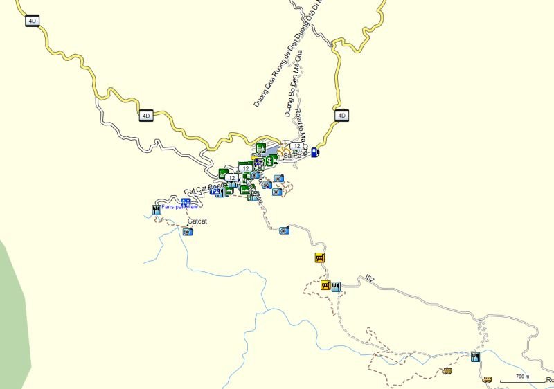
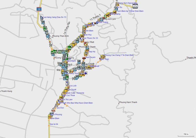
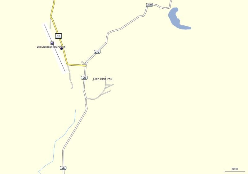
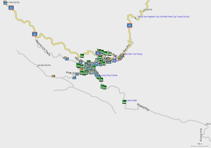
Take for instance Dien Bien Phu in Vietnam where the OSM map shows just a few roads while the official Garmin map shows many more roads as well as Points of Interest. However, for SaPa in Vietnam the OSM map is comparable with the Garmin map.

The Dien Bien Phu maps - top/left Garmin South East Asia and bottom/right the OSM map
SEA DBP.jpg OSM DBP.jpg

The SaPa maps - top/left Garmin South East Asia and bottom/right the OSM map
SEA Sa Pa.jpg OSM Sa Pa.jpg
 
Back
Top Bottom